
1976 Hawai‘i to Tahiti and Back
Before the Voyage:
- Polynesian Voyaging Society Newsletter / April 1974, Volume 1, Number 1: Wa‘a Kaulua ... Double Canoe, by Herb Kawanui Kāne.
- Polynesian Voyaging Society Newsletter / August 1975: A Voyage into Hawai'i's Past, by Ben Finney.
Archival Video and Film (Length: 10 minutes): Hōkūle‘a 1976, including the Arrival in Tahiti and the Arrival back home in Hawai‘i. Posted on YouTube by pcsige.
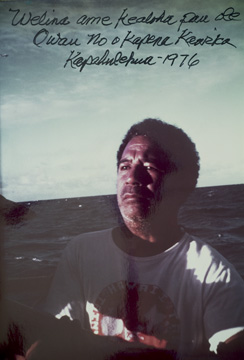
Background on the navigator of Hōkūle‘a, Mau Piailug, from Satawal, in Micronesia From "The Navigators: Pathfinders of the Pacific," posted on YouTube by Documentary Educational Resources.
1976 Hawai‘i to Tahiti and Back
Ben Finney
From “Voyaging into Polynesia’s Past” in From Sea to Space (Palmerston North: Massey University, 1992)
[Note: After the founding of the Voyaging Society and the building of Hōkūle‘a (1973-1975), her first long voyage, from Hawai`i to Tahiti and back, took place in 1976 as part of the Bicentenniel Celebration of American Independence. The voyage “effectively demonstrated how Polynesian canoes and traditional navigational methods were up to the task of planned, long-distance voyaging.”]
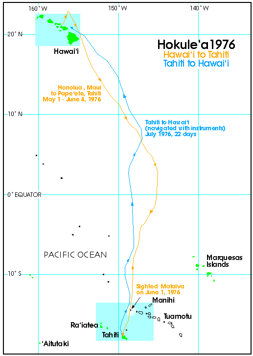
The crossing from Hawai'i to Tahiti presented two main challenges, one in sailing, the other in navigation. The longitude of the Hawaiian island of Maui, our starting point, lies some 500 miles west of the longitude of Tahiti. Since the trade winds along the route generally blow from the northeast above the equator, and from the southeast below it, in order to reach Tahiti, Hokule'a had to sail well enough to windward to make up the 500 miles of longitude and while also fighting the westward moving current that typically accompanies the trades. Our strategy to accomplish this was to sail as hard into the wind as the canoe would point without losing too much speed in order to gain maximum easting in the northeast trades, and then to hold on to as much of that easting as possible when, below the equator, the winds shift to the southeast and would start pushing us to the southwest.
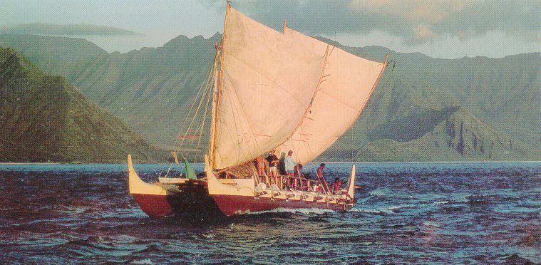
Hōkūle’a, c. 1976. Kamehameha School Archives
The navigational problem was also considerable: how to guide a canoe, without any instruments or other aids, over the open ocean from the Northern to the Southern Hemisphere and, after a month at sea, find the island of Tahiti. Because none of us could with confidence recreate and then precisely apply the methods needed to accomplish this daunting task, and because we knew of no traditional navigators from elsewhere in Polynesia who could do the job, for the voyage we recruited a traditional Micronesian navigator from the Carolinian atoll of Satawal, one of the few Pacific islands where traditional, long-distance navigation is still commonly practised. The strategy of our navigator, Mau Pialug, was to use the rising points of the stars, supplemented by observations of the sun, moon, and ocean swells, as a natural compass to guide the canoe on its course. After mentally keeping track of our progress with a dead reckoning system which visualized the canoe in reference to the changing bearing of archipelagos to one side or the other of our course, Mau planned to make landfall on one of the atolls at the far western edge of the Tuamotu islands, and then make the short crossing from there to Tahiti.
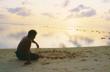
Navigator Pius Mau Piailug on the beach at Satawal, with a star compass in the sand (1983). Steve Thomas Traditional Micronesian Navigation Collection, online at the University of Hawaii at Manoa Library.
The voyage went as planned. Despite a week spent becalmed in the doldrums, and then an encounter just below the equator with headwinds that for a time threatened to drive the canoe to the west of Tahiti, in 30 days at sea, Hokule'a made enough easting against the trades to reach the atoll of Matahiva, the westernmost island of the Tuamotus from where it was easy to sail on to Tahiti. Even when days of solid cloud cover hid from sight the stars, sun and moon, Mau was able to keep the canoe on course and to keep in his mind a picture of the canoe's progress toward Tahiti. And, obligingly, small, white terns skimming over the sea provided Mau with a sign that Matahiva was near before we could actually see this low island.
[Hokule‘a left from Honolua Bay, Maui, on May 1, 1976.
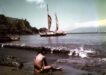
In Honolua Bay, Maui. Photo by Dr. Ben Young
[The crew sighted Matahiva on June 1, 1976. After a day and a half on Matahiva, the canoe sailed on a reach to Tahiti, arriving on June 4, thirty-four days after departing from Maui.]
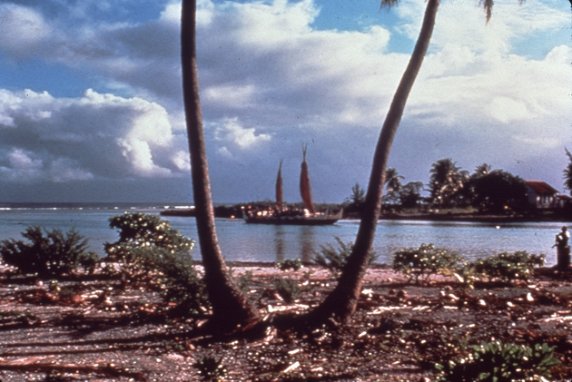
Hokule‘a at Mataiva, 1976
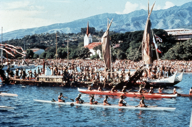
[Nainoa Thompon notes, “At the arrival into Pape'ete Harbor, over half the island was there, more than 17,000 people. The canoe came in and touched the beach. There was an immediate response of excitement by everybody, including the children. So many children got onto the canoe they sank the stern. We were politely trying to get them off the rigging and everywhere else, just for the safety of the canoe.” For video of the arrival, see Keani Reiner’s remembrance of the 1976 voyage to Tahiti on youtube.]
With the canoe sailing freely across strong trade winds, the voyage back to Hawai'i was completed in only 22 days, although unfortunately we were forced to navigate Hokule'a home by modern means as right after arriving in Tahiti Mau had flown back to Micronesia. Nonetheless, the navigational feat of guiding the canoe to Tahiti without instruments, as well as the performance of the canoe over the entire round trip, effectively demonstrated how Polynesian canoes and traditional navigational methods were up to the task of planned, long-distance voyaging, effectively turning the tide against Sharp and his revival of the Lang accidental settlement hypothesis.
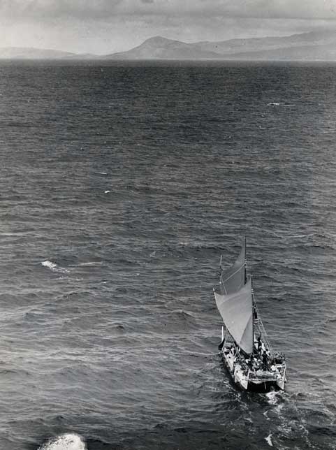
Hokule‘a approaches Oahu and home after its 4,800-mile historic trip to Tahiti and back. Star-Bulletin Archives
[Mau left the canoe after the first voyage from Hawai‘i to Tahiti and before the voyage back because of a conflict between some of the Hawaiian crew members and haole crew members. According to crew member Billy Richards, the conflict stemmed from two very different views of the voyage: for the haole crew members, the voyage was a scientific experiment to learn the techniques by which Polynesians had explored and settled the Pacific; for some of the Hawaiians, the voyage was an highly emotional journey of cultural reawakening. The crew's family and work sacrifices and frustrations in preparing for Hokule`a's first long voyage, and the hardships and inequities during that voyage aggravated the differences. After landfall, both sides vented their frustration and anger, which eventually erupted in physical hostilities on board the canoe.
[For Finney's account of the blows on the canoe and the tensions that led up to it, see Hokule'a: The Way to Tahiti. Since the first voyage, the crew members have reconciled with each other, and crew members and volunteers of all ethnicities have contributed to and are working together to keep alive the voyaging traditions they cherish.]
Crew Members, Hawai‘i-Tahiti: Navigator Mau Piailug, Clifford Ah Mow, Shorty Bertelmann, Ben Finney, Tommy Holmes, Sam Kalalau, Boogie Kalama, Kawika Kapahulehua, Buffalo Keaulana, John Kruse, Dukie Kuahulu, David Lewis, Dave Lyman, Billy Richards, Rodo Williams.
Captain Kawika Kapahulehua. Photo by Dr. Ben Young
Crew Members, Tahiti-Hawai‘i: Snake Ah Hee, Andy Espirito, Kawika Kapahulehua, Mel Kinney, Kainoa Lee, Kimo Lyman, Gordon Pi`ianai`a, Leonard Puputauiki, Penny Rawlins, Keani Reiner, Nainoa Thompson, Maka`ala Yates, Dr. Ben Young.
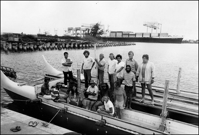
Crew members and friends of the Hokule'a in February 1976, before its first voyage to Tahiti that May: on hull, from left, Tommy Holmes, Abraham "Snake" Ah Hee, Nainoa Thompson, Keani Reiner, Sam Kalalau, Mel Kinney, Penny Rawlins, David Lewis. On central platform: Capt. Kawika Kapahulehua, John Kruse, Kimo Hugho, Billy Richards, Maka'ala Yates, Shorty Bertelmann, Ben Finney, and Vic Fageroos. Honolulu Advertiser Archives.
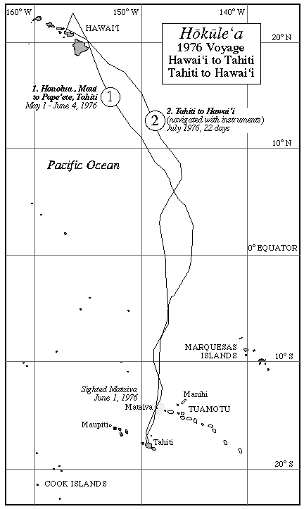
Black and White Map of the 1976 Voyage
Note
Ben Finney's Hokule'a: The Way to Tahiti describes the first voyage to Tahiti. For an account of Mau's navigation from Hawai'i to Tahiti, see David Lewis' We, the Navigators: The Ancient Art of Landfinding in the Pacific, 2nd Edition, pp. 313-336.