 |
|
How the Wayfinder Locates Land (Photo below: An atoll appears as a thin black line on the horizon.)
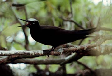
Navigating without instruments is not a precise science. Poor weather and mental lapses on a long voyage adversely affect its accuracy. But the wayfinder need not sail to a destination with pinpoint accuracy to be successful. Instead , the wayfinder in the Pacific tries to hit a "screen" of islands, that is, a group of islands that stretches out on either side of his destination. The longer or wider the screen, the less likely the wayfinder will miss it. Islands in the Pacific are seldom isolated; they are usually found in clusters. The Tuamotu Archipelago stretches 550 miles north to south and 500 miles east to west; the Society Islands stretches 160 miles north to south and 310 miles east to west; the Hawaiian islands extend more than a 1000 miles across the ocean east to west; the major islands form a north-south screen of about 240 miles. Thus while sailing to Tahiti from Hawai'i, the wayfinder can target a 400-mile wide screen of islands between Manihi in the western Tuamotus, and Maupiti in the eastern Society Islands. If the wayfinder can hit any one of the islands in this target screen, he can reorient the canoe after he identifies the island and determines its position in relationship to his destination; if he does not recognize the island and the island is inhabited, he can ask the islanders where he is and if possible, get directions to his destination. While there are open-ocean gaps between islands in a screen, a wayfinder looks for signs to let him know the proximity and direction of land even when he cannot see it. Signs of land include drifting land vegetation; clouds piled up over islands; the loom above an island created by sunlight or moonlight reflecting up from the white sand and smooth water of a lagoon; distinctive patterns of swells created by swells refracting around and / or reflecting off islands; and seabirds such as the manu-o-Ku (fairy tern) and the noio (noddy tern), which go out to sea in the morning to feed on fish and return to land at night to rest. The diurnal flights of such birds are the most useful signs for expanding landfall, since their flights to and from an island gives a fairly specific direction to the wayfinder. As the birds leave an island in the morning, the wayfinder can sail in the direction the birds are coming from to find land; as the birds return to an island in the late afternoon, the wayfinder can follow the birds to land. While a low atoll with trees can be seen at sea from about 7 -10 miles away, observing the daily flight patterns of seabirds can indicate the direction of islands out of sight range. Nainoa Thompson gives the following estimates of ranges of two seabirds that are the most reliable indicators of land: manu-o-Ku (white tern): approximately 120 miles (though this bird may stay out at sea, or fly back to land unseen at night) noio (noddy tern): approximately 40 miles
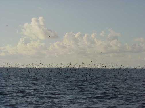
Generally, sighting of large groups of birds is a more reliable sign of a nearby island than sighting one or two stray birds or a small group:
Rangiroa is faintly visible at the horizon in the photo above. Hokule'a was looking for the Tuamotus on the way to Tahiti after having left Rapa Nui and finding Fatu Hiva in the Marquesas. Tahiti lies about 170 miles to the SW of Rangiroa. December 1999. |

