 |
|
Spring 1995: Na 'Ohana Holo Moana
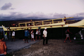
Departure from Hawai'i (Feb. 3-11) Photo right: The Hawaiian Voyaging Canoe Makali'i Ready to be Launched February 3, 1995
February 5, 1995 Makali'i, a third Hawaiian voyaging canoe has been launched at Kawaihae on the Big Island on Saturday, Feb. 4, 1995. The canoe, built by Na Kalaiwa'a (The canoe carvers), will be rigged on Feb. 5. Sea trials will follow. The double-hulled canoe is 54-feet long. Its hulls are fiberglass. The canoe is named after the star cluster known in the west as the Pleiades, whose appearance at the eastern horizon at sunset in the fall marked the beginning of the Makahiki, or harvest festival season in ancient Hawai'i . The builders include Clay Bertelmann, a veteran crew member of Hokule'a and a captain on the 1992 voyage to Tahiti; his older brother Shorty, a navigator of Hokule'a, who will navigate Makali'i; Tiger Espere, a veteran surfer and Hokule'a crew member; Bil ly Richards, a captain from Hokule'a's 1992 voyage and a crew member of the original 1976 voyage to Tahiti. When the canoe is deemed ready, these builders along with Maulili Dickson, Nailima Ahuna, and Chad Paishon, also veteran Hokule'a crew members, wil l sail the canoe to the South Pacific, hopefully in time for gathering of canoes at Ra'iatea on March 18. Meanwhile, Hawai'iloa and Hokule'a are moored at Hilo Harbor. The latest word is that the two canoes will not leave for Huahine before Wednesday morning, Feb. 8. The sail strategy is to hold close to the Northeast tradewinds to gain easting, travel as quickly as possible across the doldrums (an area of light, fickle winds, dead calms, and heavy cloud cover from about 9 degrees N to 3 degrees S latitude, then head south against the Southeast tradewinds. The canoes will be navigated without instruments. Their target screen is a 400-mile wide band of islands from Manihi in the Tuamotu Archipelago (14.4 degrees S, 146 degrees W) and Maupiti in the Society Islands (16 .4 degrees S, 152.25 degrees W). They hope to arrive somewhere upwind, or east of their destination of Huahine. Once in their target screen, the navigators will look for changes in the swell patterns and the flight of land-based birds to find an island t hey can identify, which will give them their exact location. Then they will head for Huahine. Daily reports will give the longitude and latitude of each canoe, based on readings from sealed, on-board satellite transponders. The reports will also give the navigators' estimates of their positions. Their estimated latitude will be based on their esti mates of distance travelled in a north-south direction and on their hand-measurements of stars crossing the meridian. The navigators will give their east-west position in miles east or west of their reference course, a local zero degree longitude line that represents the most efficient route to the destination, given the average wind and current conditions between Hawai' i and Huahine, and the performance capabilities of the canoes. The canoes will not sail exactly on the reference course because wind direction and weather conditions will vary along the way. Cloud cover will prevent the navigators from using celestial bod ies, their most accurate guides to direction. The navigators will estimate the distance the canoes sail from the reference course, and record it in memory so that they will know how far east or west of their destination they are. To plot a reference course on a map, such as Nautical Chart 526 (a large, detailed map of the Pacific Ocean, found at map shops and marine supply stores) use the following points: 1. Cape Kumukahi, the easternmost point on the Big Island of Hawai'i (19 degrees 30 minutes N, 154 degrees 50 minutes west) 2. 9 degrees N, 148 degrees 55 minutes W (on the northern edge of the area of doldrums) 3. 3 degrees N, 147 degrees 40 minutes W (on the southern edge of the area of doldrums) 4. 15 degrees S, 150 degrees W (in the target screen). The navigators' estimated positions will differs from the longitude and latitude determined by the signals sent from the transponders on board the canoes to satellites orbitting overhead. Wayfinding does not produce or record exact physical data; it is a performance art that depends on and tests human intelligence, intuition, memory, and determination to reach one's destination; its theater is the open ocean. February 7, 1995 Yesterday crew members from three Hawaiian voyaging canoes --Hokule'a, Hawai'iloa, and Makali'i-- participated in a departure ceremony for their upcoming voyage to Tahiti and the Marquesas. The ceremony, including traditional chanting and dancing, and sp eeches, was held on the grounds of the Naniloa Hotel on Hilo Bay, with the canoes moored offshore. Hokule'a navigators are Ka'au McKenney and Keahi Omai, on their first long voyage. Their crew includes Sailmaster Nainoa Thompson and master Micronesian navigator Mau Piailug; Harry Ho, Mike Tongg, Ben Tamura, M.D.; Shantell Ching, Junior Coleman, Catheri ne Fuller, Sesario Sewralur (Mau's son); Tava Taupu, and Kamaki Worthington. Hawai'iloa navigators are Bruce Blankenfeld and Chad Baybayan, both veterans of the 1992 voyage. Their crew includes Snake Ah Hee, Kimo Lyman, Dennis Chun, Brad Cooper, Terry Hee, Eugene Kawelo, Reggie Keaunui, Palani Kelly, and Scott Sullivan. Ho'okupu, or gifts, of banana, coconuts, and other plant foods for the voyage were presented. Sailmaster Thompson said that the canoes will leave when the Northeast trade winds reestablish themselves, which could be as early as Wednesday. February 9, 6 a.m. Scheduled Friday departure confirmed by navigator Chad Baybayan. However, the date may change, pending weather. On nights when the dome of heaven is visible, the navigators of Hawai'iloa and Hokule'a will use celestial bodies for direction in guiding the canoes. They have memorized the rising and setting points of over a hundred celestial bodies. Sun The sun travels among the stars on a path called the Ecliptic, marked by the 12 constellations of the zodiac. On Feb. 7, the sun is in Capricorn, rising 15 degrees south of E and setting 15 degrees south of west. Its rising and setting points are moving n orthward each day. By the end of Feb. the sun, in Aquarius, rises 8 degrees south of E, sets 8 degrees south of W. By March, the sun, leaving Aquarius and heading into Pisces, rises 1 degree south of E, sets 1 degree south of W. It will rise due east and set due west on March 21, the day of the spring equinox. Stars The navigators divide the dome of heaven into four quarters, with the following names:
During the voyage south,the North-South Star Line begins to rise in the east at sunset, the Bailer is overhead, and the Great Square is setting WNW, between 14 and 29 degrees north of W. The brightest stars and constellations in the North-South Star Line are:
The North-South Star Line will be setting toward sunrise after its 12-hour transit across the dome of heaven. The Navigator's Triangle follows the North-South Star Line into the sky, rising after midnight. The three stars of the triangle are:
Also in this quarter of the dome of heaven is Lehuakona in Maui's Fishhook (the bright read star Antares in Scorpio), which rises ESE and sets WSW. As the Navigator's Triangle rises in the east, the North-South Star Line is crossing the meridian overhead, and the Bailer, which was overhead at sunset, is setting in the west. The Bailer is a curve of stars formed by:
Inside the curve of the Bailer is the constellation Orion. The belt of Orion rises due east and sets due west. To the south of the Bailer is Ke ali'i kona i ka lewa (The Southern Ruler of the Sky, or Canopus), which rises SE by S and setings SW by S. Planets The planets appear to wander slowly among the stars of the Ecliptic. Rising and setting points of the planets will change over time, but the changes are slow and the planets provide relatively stable clues to direction. During the voyage south:
Moon The moon travels along the Ecliptic, changing its rising and setting points nightly on its 29.5-day cycle from new moon to full moon and back. The new moon rises and sets near the sun on the same side of the sky. The full moon rises and sets on the opposi te side of the sky from the sun. Feb. 7: First Quarter--Rises around noon 17 degrees north of E; sets around midnight 18 degrees north of W. Feb. 15: Full Moon--Rises around sunset 5 degrees north of E; sets around sunrise 3 degrees north of W Feb. 22: Last Quarter--Rises around midnight 19 degrees south of E; sets around noon 19.5 degrees south of W. Mar. 1: New Moon--Rises unseen near the sun around sunrise 3 degrees south of E; sets unseen near the sun around sunset 1 degree south of W. Mar. 9: First Quarter--Rises around noon 19 degrees north of E; sets around midnight 19 degrees north of W. The quarter moons may also be used for navigation when they are high in the dome of heaven. The "cut of the moon"--the line between shadow and light--is oriented north-south, since the moon travels before or behind the sun on an east-west path. February 10, 5:30 a.m. Navigator Chad Baybayan said the departure time has been moved from Friday morning to Friday afternoon or Saturday morning. A storm system is moving over the islands from the west, bringing rain on Friday morning. Once the center of the system moves past the islands, winds will shift to the NW, then N, good wind directions for the canoes to gain easting at the start of their j ourney to the South Pacific. As the system passes, the NE trades should fill back in. February 11, 7 p.m. Hawai'iloa and Hokule'a left Hilo Harbor around 5 p.m. this afternoon. Hawai'iloa was towed out of the harbor by Kama Hele, its escort boat, captained by Alex Jakubenko, who escorted Hokule'a on its 1980 and 1992 voyages to Tahiti; Hokule'a was towed by i ts escort Gershon II, under Steven Kornberg. Also accompanying the canoes is Rizaldar under Randy Wichman of Kaua'i. The third canoe, Makali'i, built in Waimea on the Big Island, is still undergoing sea trials. Winds were northerly, 10-20 knots, gusting higher. A highwind warning was still in effect on Mauna Kea and Mauna Loa. The winds will decrease in strength and shift to the NE tonight. Seas 4-8 feet. The north wind, called Ho'olua, is a cold wind. The open deck and canvas shelters on the canoes will offer little warmth as temperatures drop on the open ocean tonight. The wind chill will compel the voyagers to bundle up. |
 Hokule'a and Hawaiiloa left Honolulu Harbor at 3:45 a.m., Febraury 1,1995 and arrived in Hilo at 11 a.m. (Hawaiiloa) and 6 p.m. (Hokule'a) on February 2. Both canoes were towed all the way around the north side of Moloka'i, Maui, and the Big Island because of the light and variable winds. Seas were two feet and calm, with a huge swell rolling in from the NW. Big surf along the north coast of Moloka'i. Humpback whales were sighted off Moloka'i and the Big Island. The canoes are on schedule for departure so metime after the departure ceremony planned in Hilo on Feb. 6.