 |
|
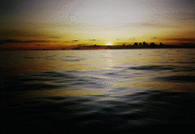
Spring 1995: Na 'Ohana Holo Moana Photo right: The Doldrums Feb. 19, 3:40 p.m.
Hokule'a: 10 degrees 48' N, 149 degrees, 02' W News from Tahiti (from Vetea Hart of the Office Territorial D'Action Culturelle [OTAC]): Te Au o Tonga, the 70-foot Rarotongan voyaging canoe,was carried down to the harbor from the mountains three weeks ago,and will be launched on Saturday, Feb. 25. The canoe will be navigated by Tua Pittman and Pe'ia Tua'ati. The 70-foot Tahiti Nui, a Tahitian voyaging canoe (formerly called Hawaiki Nui), will be launched on Feb. 24, Friday. Both canoes intend to join Hokule'a and Hawai'iloa on the way back to Hawai'i. Feb. 20, 7:10 p.m. Hokule'a and Hawai'iloa made about 170-180 miles in the last 24 hours. Hawai'iloa has picked up some ground and is now within 60 miles of Hokule'a. The two canoes continue to hold their desired heading, sailing parallel to and 50-60 miles east of their SS E reference course. At 8 a.m. this morning thecanoes were at: Hokule'a: 8 degrees 30' N, 148 degrees, 02'W Hokule'a has sailed into the region betweeen 9 - 3 degrees N associated with light winds, doldrum conditions, heavy cloud cover, and thunderstorms. A weather map of the area the canoes have traveled into shows clear skies. The Kona storms passing over Haw ai'i have pushed the easterly trade winds farther south than normal, which could allow for quick passage through these latitudes just north of the equator. Feb. 21, 7:10 p.m. Latest satellite fixes from 6:30 p.m. last night. Hokule'a 5 degrees 45' N, 147 degrees 26' W Hawai'iloa has sailed to within about 35 miles, almost due north of Hokule'a. [Mahalo to Bernie Kilonsky of the UH Manoa Oceanography Dept .for e-mail providing fixes on the canoe twice a day. Data from ARGOS.] Hawai'iloa has moved about twice as far as H okule'a over a twelve hour period. It may be getting better winds; also it is lighter and sails better in light airs such as the canoes are now experiencing in the Intertropical Convergence Zone. Report from morning of Feb. 21: "Don't be surpised if I leave the radio--we're being blasted by a rain squall. Everyone's scrambling to trim the sails and and steer the canoe," said Scott Sullivan, our radio man on Hawai'iloa. Each morning, he's the first person we contact at 7:30 in th e radio room of Peace-sat, a satellite communication station at UH Manoa which provides links to the Pacific Islands. When we contact Hokule'a, the crew is scrambling there, too, working the canoe in a rain squall. Nainoa's too busy to take a call from hi s dad. This weather is typical of the Intertropical Convergence Zone, where the NE and SE tradewind belts meet. Lines of rain squalls with strong winds alternate with periods of light variable winds and calms. Hawai'iloa entered the area last night, about 50 mil es behind Hokule'a. Hokule'a began to slow down over the last twenty-four hours--doing 80-90 miles (rather than 150-180 miles, as in the previous two days). At 8-9 a.m., the canoes are doing 5 knots in the strong winds. An hour later the winds have diminished to around 5-8 knots, and the canoes are sailing 2 knots. At 8 a.m.this morning, Hawai'iloa navigator Bruce Blankenfeld estimates the canoe to be at 7 de grees 3' N and 44 miles east of the reference course. He is close--the canoe is at 7 degrees 13'N and about 80 miles east of the reference course (147 degrees 30' W)--ten miles of latitude and 34 miles of longitude off after about 900 miles of sailing. The system of wayfinding by the stars and swells is definitely accurate enough to guide canoes over the long searoads of the Pacific. On the 1992 voyage back to Hawai'i, Bruce said he saw a path across the waves back home, even when the canoe was forced b y the wind to sail in a direction he did not want to go in. Bruce is navigating along with Chad Baybayan, another veteran of the 1992 voyage. Both are highly knowledgeable and experienced in their art. They take turns resting and sleep about 4 hours a day. Bruce says the fishing has been perfect--they are catching one fish a day, yesterday a mahimahi, "just enough for a meal, no waste." Last night the navigators steered by the rising Mars (ENE), and the stars of the constellation Leo, then later Hokule'a (Arcturus). Leo seems to pull Iwikuamo'o, or the North-South star line into the sky: Na Hiku (the seven stars of the Big Dipper--NE by N), Hokule'a (ENE), Hikianalia (Spica E by S), Me'e (Corvus ESE) and Hanaiakamalama (The Southern Cross SE by E)--a whole curve of navigation stars rising at different times along the eastern horizon. Bruce says the dominant SE swell has diminished, and t he largest swell is now coming from the E. Hawai'iloa has been riding well over the swells and taking on very little water. Hawai'iloa has sailed a slightly more easterly heading than Hokule'a over the past 24 hours. The navigators try to stay east of their reference course so that they will arrive upwind of their destination, in this case Huahine or Tahiti. The two canoes are now at about the same longitude, with Hokule'a about fifty miles ahead. Hokule'a: 6 degrees 26 minutes N; 147 degrees 24' W Weather Analysis, based on data collected by the UH Meteorology department. On Feb. 21, the canoes should have winds from the east at 10-15 knots. Satellite photos show clouds over or near the canoes. [The rain squalls!] But they do not have the character istics of severe rainstorms [No great danger to the canoes]. Temp: 78-84 degrees, today and tomorrow. Forescast: more of the same for tomorrow. [Dan Schowerer, Meteorology Student at the UH]. News from Aotearoa: Hector Busby, canoe builder and leader of the Maori voyaging canoe revival, says his canoe Te Aurere, will be shipped to Pape'ete, Tahiti, next Tuesday (Feb. 28, HST). The crew will fly to Tahiti in early March to join the canoe and sa il with the fleet to Ra'iatea, Taha'a, Tahiti, Nukuhiva, and Hawai'i. Feb. 23, 3:30 a.m.--12 days out At 7 a.m., Feb. 22, Hawai'iloa was only 10.8 miles from Hokule'a, though still out of sight: Hokule'a: 5 degrees 5 ' N, 147 degrees 17' W Hawai'iloa made about 140 miles to Hokuelea's 90 in the previous 24 hours. Hawai'iloa's navigators estimated the canoe to be at 5 degrees 30'N, 44.5 miles east of the reference course. Hokule'a was in the middle of another rain squall, so communication wa s difficult, with heavy static on the radio. Hokule'a's navigators' estimate: 4 degrees, 48' N, Miles East: ? [Couldn't make out what Keahi was saying on radio.] Hawai'iloa was not in the rain squall yet; they have been experiencing better weather. Hokule 'a has gone to a 2 watch system (two teams alternating 6 hours on, 6 hours off), used when weather is bad so more crew members (6 rather than 4) are available for working the canoe. Chad Baybayan (Hawai'iloa reported better than average conditions so far in the Intertropical Convergence Zone. Heavy cloud cover the night of Feb. 21, but enough patchy clearing to steer by celestial bodies. The planets were visible: Mars rising in the e vening ENE and setting in the early morning WNW; Jupiter rising ESE after midnight; Venus rising E by S in the early morning. Hokupa'a, the North Star, was also visible, about 4-5 degrees above the horizon and directly astern as the canoes headed south. T he moon was helpful. The departure was timed so the navigators could use the moon in the ITCZ, both for direction (rising and setting south of E last night) and to light up the swells at night. The dominant swell was coming from slightly behind the canoe (from ENE), allowing the canoe to surf forward. The latest readings from 6 p.m. last night: Hokule'a: 4 degrees 13'N, 147 degrees 14' W Hokule'a made about 100 miles in the previous 24 hours; Hawai'iloa about 110 miles. Hawai'iloa is making less easting and is about 21 miles to the NW of Hokule'a. The canoes are less than 100 miles from the southern edge of the intertropical convergence z one (around 3 degrees N). This trip through the zone has been remarkably fast; navigation conditions, particularly for Hawai'iloa, remarkably good. Winds variable, but mainly easterly, up to 10-20 knots. Chad remembers, however, that in 1992 on the voyage south, southerly winds at the southern end of the ITCZ forced the canoes to tack east. Weather Analysis for Feb. 22 [Dan Showerer]: Good sailing with east winds at 15-20 knots. The winds may shift more southeasterly as the canoes move toward the Equator. This could impede their progress. Rain could occur at any time. [Satellite photos show a long band of clouds running along the equator. Easterly to southeasterly winds are normal in the SE trade wind belt south of the equator.] Hawai'iloa reported to the Wai'anae students that the manauea (seaweed) looks dead. Scott thinks the problem was not enough aeration in the bucket. They may leave the contents of the bucket in the doldrums. No fish yesterday. Scott speculated that the canoes were moving too slowly (1-3 knots in 5-8 knot easterly winds at the time) to catch fish by trolling. Best fishing (from experience on previous voyages) seems to be when the canoe is moving at 6-7 knots. Dinner: clam chowder and rice. Kimo Lyman, watch captain on Hawai'iloa, requested that we buy packaged saimin that is cooked in a pot, rather than "Cup of Noodle" saimin, which comes in styrofoam cups for individual servings: "We are saving all our garbage until the canoe reaches land because we don't want to dump anything in the ocean. The empty styrofoam cups are taking up too much space in the garbage bag on the canoe." Feb. 24, 4:45 a.m.--13th day at sea Both canoes reported they were out of the area of doldrums yesterday morning. The skies were blue, with fair weather cumulus clouds overhead. Winds were easterly at 15 knots, and the canoes were sailing at 4-5 knots. This was the quickest sail through the area of doldrums for Hokule'a, which is on its fifth voyage south. At 7:30 p.m. Feb. 23, they were at: Hokule'a: 1 degree 57' N, 147 degrees 52'W Both canoes have crossed the reference course and are now west of it. Ka'au on Hokule'a estimated 7 miles W yesterday morning. As of last evening, Hokule'a was 10 miles west of the reference course. Hawai'iloa was 20 miles west. They were about 25 miles a part. Both canoes sailed about 120 miles yesterday. Weather analysis: Yesterday, winds were from the east from 10-20 knots. Tempatures in the 80's and will steadily increase as the canoes get closer to the equator. On the weather map, rain clouds moved a couple of degrees north of the canoes as the day pro gressed, so they had good weather. Forecast: Rain at any time due to the location near the equator. Winds will be 10-15 knots out of the east south east. [Dan Schowerer] With winds out of the ESE, the canoes should be able to hold a course due south. However, their course on the satellite track shows that they are heading S by W. This track would take them to the west of their target of Tahiti/Huahine. The crews are catching fish again. One aku on Hawai'iloa; one aku and one ono on Hokule'a. The Hokule'a count is now 23 fish, about two per day on average, since leaving Hilo. Hokule'a crew member Cathy Fuller reported that the six kalo huli (taro cuttings used for planting) and 4 pia (arrowroot) tubers gathered and packeted by the students of Ka Papa Honua o Keawanui (Kamehameha Schools Alternative Education Program at Moloka' i High School) are still alive. Kalo was the main staple in traditional times for Hawaiians. The report on the Hokule'a Plant Project explains how the project was put together: Masashi "Cowboy" Otsuka, kupuna on Moloka'i and well known mahi'ai o kalo (taro farmer) suggested sending three varieties of kalo: 'api'i, found abundantly in Waipi'o Valley on the Big Island; hearty under different conditions; piali'i, because it produce s much more poi than most varieties; and mana lauloa, found abundantly in the drier areas of Hawai'i (Kona, Keaukaha, etc.), very hearty. Students prepared the gourd to hold the kalo cuttings: The gourd (14" x 20") was sanded and rubbed with kukui nut oil to make the surface resistant to saltwater and rainwater. Penny Martin and Mel Paoa, two Moloka'i residents who have sailed on the canoes , suggested a net be made from sennit to carry the container, secure the top; and so the gourd could be hung, thus avoiding contact with water running over the deck or in the hulls due to wave action. Mike Wada, program counselor, made the net. Students g athered moss and coconut husk for packing. Kupuna Otsuka instructed students to squeeze the moss and husk to remove excess water. The coconut husk was placed at the bottom of the gourd; then some moss; then the kalo cuttings; then more moss and coconut hu sk. Students of Keawanui: Jamie Aki, Anthony Burrows, Michelle Horcajo, Steven Kaholoa'a, Shannon Puaoi, Edmund Lima III, Blaine Isabel, Anthony Naki, Mason Nakihei, Sean Young, Amie Lalim, Georgette Stevens, Daniel Gonzalez, Obrien Muller. The Staff: Rose Mo reno, Site Manager; Mike Wada, Counseling Specialist; Nick Akana, Teacher/Counselor; G. Keoki Schnackenberg, Teacher/Counselor; Paula Friel, Teacher; Carmen Augustiro, Clerk; Doug Kingsley, Maintenance. Medical report from Dr. Ben Tamura: Amazed at how difficult the voyage is on the body. Always cold, wet, and hungry. Original settlers of Hawai'i must have been very fit to make their voyages. The crew of Hokule'a is in good condition, mainly because they prepared well and were in good health when they left Hawai'i. Canoe can be a healthy environment if hygiene is maintained and the men on board "aim properly." The awapuhi (ginger root) remedy for seasickness seems to be working well. Dr. Tamura is taking the capsules of awapuhi himself, and "This is the first time I haven't gotten seasick". Four other crew members are participating in the experiment: 2 taking awapuhi and 2 taking placebos of cornmeal. The Experiment was designed Nova Suenaga, senior at K amehameha Schools. Feb. 25, 3:15 a.m.--14th day at sea Hokule'a was 3 miles south of the equator at 7 p.m. last night; Hawai'iloa was still ten miles north and about 35 miles to the west of Hokule'a. Hokule'a: 00 degrees 03' S, 148 degrees 04' W Hokule'a, on a course due south, is again east of its reference course; Hawai'iloa has also taken on a more southerly direction and is tracking back towards the reference course. The canoes are on parallel courses and made about 130-140 miles over the las t twenty-four hours. Nainoa Thompson, sailmaster on Hokule'a, reported that the canoe has picked up speed in 15-20 knot easterly winds and are doing about 7 knots. At this pace the canoes could be in the latitude of the Society islands--17 degrees S--in about 6.5 days. The tw o canoes are over half way to their target of Huahine/Tahiti about 1000 miles to the south. A.M. report: Scott, radio man on Hawai'iloa, said that so far, this trip has been the best sailing he's ever done on the canoes. The wind is brisk, the seas relatively flat, with a small SE swell and a smaller easterly swell. The crew is catching fish aga in--yesterday an aku and a spearfish. Kimo Lyman, watch captain, aboard Hawai'iloa reported that the crew had not touched the helm in the last twenty-four hours. They steered the canoe by adjusting the weight on board and trimming the sails. He noted that the difference between Hawai'iloa and Hokule'a was that Hawai'iloa tended to run down wind, while Hokule'a tended to turn into the wind. Lyman reported that last night, a pod of nai'a (dolphins) visited the canoe for about forty minutes. The playful mammals leaped and splashed around the canoe, darting past and circling around beneath a full sky of stars. They left phosphorescent trails in the water, appearing like small torpedoes or ghostly dancers as they streaked past the canoe. The crew watched in awe. After midnight, the waning quarter moon rose south of E, big and orange, like the grin of a Cheshire cat. Scott said it seemed to be symbolic of the good fortune the canoes have experienced so far on the voyage. In the clear night sky, the 10 p.m.-2 a.m. watch steered by Na Hiku ("The Seven [Stars]" or the Big Dipper) rising NE by E; Lehuakona ("Red flower of the southern sky" or Antares), the bright red star of Manaiakalani (Maui's Fishhook, or Scorpio) rising ESE; and Hanaiakamalama ("Cared for by the m oon," or the Southern Cross; the cut of the quarter moon, or the line between light and shadow, is oriented north-south, with the southern end pointing toward the Southern Cross, which points due south). Hokupa'a, the North Star, a couple of degrees above the horizon now, was no longer visible through the atmosphere of the earth. This star drops toward the horizon as the canoes sail south, one degree down for each degree of latitude south. At the equator it is at the horizon. Catherine Fuller of Hokule'a predicted the canoes would be crossing the equator today (Feb. 24). In response to a question by 4th graders in Tanya Wills class at Kilohana School on Moloka'i, Kimo Lyman said the crew has not had to ration water so far; in fact, they had gathered 20 gallons of rainwater and taken freshwater baths in the rain squalls in the Intertropical Convergence Zone. Weather Analysis: The canoes are between a low trough and a high ridge. The back edge of the trough runs through (140W, 10N) and (145 W, 0). The upper level winds show subsidence aloft. This means good weather for the next 24 hours. The satellilte picture shows light stratus clouds moving east to west with the winds. These clouds should not produce any serious rainstorms. The surface level maps show east winds at 10-20 knots. This is atypical of equatorial weather. The forescast looks like clearing and go od winds out of the east for the next couple of degrees south (120 miles). A high pressure cell over Tahiti and tradewinds from the ESE at 10 knots are waiting fo the canoes in the southern hemisphere [Bernie Kilonsky]. |
 Hokule'a and Hawai'iloa continue their quick pace south, making about 150-170 miles SSE yesterday, parallel and to the east of to their reference course. Hokule'a is still making better progress close hauled to the wind; Hawai'iloa is behind, about 70 mil es to the NW. At 8 a.m. thismorning: