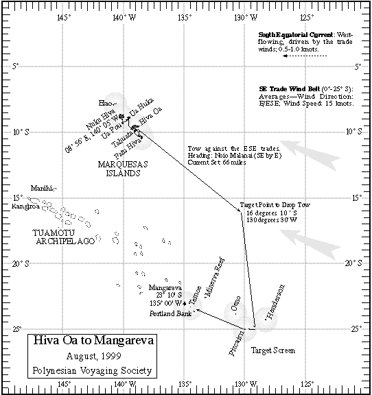
Hiva Oa to Mangareva
Report on 08/28/99, A.M.
Received at 1:25 p.m.:LAND....LAND.....LAND. At approximately 1 pm HST, the navigators Catherine Fuller, Moana Doi, and Aldon Kim sighted the small atoll of Te Moe some 20 miles off the starboard bow. A very small spec on the horizon, Te Moe was exactly where the navigators though it would be. In the next few hours, they will be looking for Mangareva another 30 miles northwest of Te Moe.
Navigators' Estimated Position at 6 am, 08/28/99: 22 deg 58 m S, 56 miles along the reference course line in the last 12 hours(gps-23deg 36m S,133deg 52m W)
Heading last 24hrs: Komohana (under sail) then at 6 p.m. turned 'Akau (under tow)
Current Heading @ 6am: Noio (under sail)
Miles in last 24 hrs: 120
Strategy: Hokule'a has started its search pattern; looking for signs of land to the northwest. The navigators believe to southeast of Mangareva.
Strategy Next 24hrs: Search for land heading Noio Ho'olua
Winds: continues to blow steady from the North
Swells: southwest swell @ 6ft, north swell from wind @ 2ft
Clouds: cumulus mostly, few upper level cirrus and altocirrus
Changes in last 24 hrs: not much has changed, wind decreasing slowly
Next 24 hrs: wind will build slowly from the east
Steering at night by Ka Lupe o Ka Welo (pegasus), Pira'etea (Deneb), Mintaka (Orion's Belt)
Latitude star: Poloahilani (Shedir) @ 11deg at the meridan
Land Signs: Manu o Ku (white tern) from northwest.
Sources of Information: Moana Doi, Cat Fuller and Chad Baybayan.
Prepared by Kamaki Worthington on Kamahele.
For more information on the leg to Mangareva,
go to the Hiva Oa to Mangareva Page.
For more information on the quest for Rapa Nui, go to the PVS Homepage.