Saturday, July 10, 1999 (8:30 a.m.)
Canoe Departed Hilo p.m. June 15, 1999,
As of Sunrise Today Hokule'a was at Sea: 24.5 days
Actual Position (From GPS unit on board escort boat).
July 9, 4:45 p.m.: 08 degrees 30.65 minutes S, 142 degrees 40.26 minutes W
July 10, 7:46 a.m.: 07 degrees 37.02 minues S, 142 degrees 02.49 minutes W
Navigator's Estimate (from Bruce Blankenfeld, Navigator, and Pi'ikea Miller, Apprentice Navigator on "Hokule'a."):
July 9, Sunset: 9 degrees 9 minutes S, west of the Marquesas
July 10, Sunrise: 8 degrees 24 minutes S, west of Marquesas
Hokule'a was heading Manu/Noio Ko'olau (NE/NE by E), at 5 .5 knots this morning. They have been on this tack since yesterday afternoon. The canoe is about 78 miles WNW of Eiao, the island at the Northwest corner of the Marquesan Archipelago. Eiao is about 2000 feet high, a little lower than the island of Lana'i; on a clear day, it can be seen within 44 miles.
The navigators were watching a stationary cloud on the horizon to the ESE, wondering if this was a sign of land, but they did not sight any flocks of land-based seabirds this morning at sunrise flying in that direction.
Winds are from 'Aina Malanai (ESE) at 15 -20 knots. Two swells, one from ESE (6-8 ft.) and one from the E (10-12 ft.).
Strategy: The navigators will continue heading Manu/Noio Ko'olau (NE/NE by E) for another six hours, and then reevaluated their position. They intend to re-evaluate their position every six hours and tack accordingly.
Latitude: Kochab and Pherkad
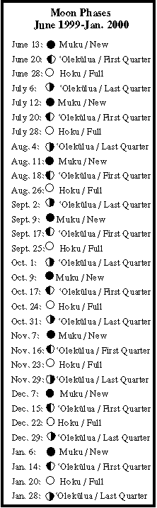
Stars. Moon: Kaloakupau (the 26th moon phase) rising after midnight.
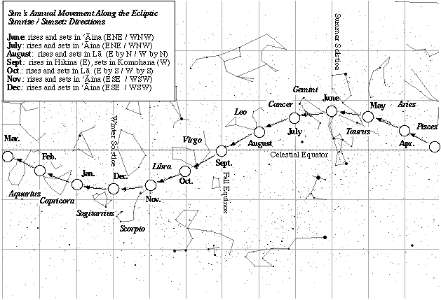
Daytime navigation: Sun: sunrise and sunset (ENE/WNW); Kaloakupau (the 26th moon moon phase) setting in the afternoon.
Fishing report: Caught a 7 lb. aku and a 20 lb, ono this morning.
Sea Life: Boobies. One manu-o-ku this morning.