Saturday, June 26, 1999 (8:30 a.m.)
Actual Position (From GPS unit on board escort boat).
June 25, Sunset (5:50 p.m.): 07 degrees, 45.44 minutes N, 144 degrees, 27.28 minutes W
June 26, Sunrise (5:35 a.m.): 07 degrees 35.55 minutes N, 144 degrees 05.26 minutes W.
Radio Report from Pi'ikea Miller, Apprentice Navigator on "Hokule'a."
No. of Days at Sea: 11
Hokule'a was back in the doldrums this morning. With winds 5-10 knots from the ESE, the canoe was making 2 knots, heading hema (S).
Yesterday afternoon at about 3 p.m., a big squall hit the canoe. The crew took advantage of the fresh water to take showers and gather about 20 gallons of rainwater.
The sky was intermittently clear last night, as the navigators steered by the Navigator's Triangle (altair, vega, and deneb) rising in the early evening; the Venus, Spica, Mars, and the Moon setting; Hokupa'a due north.
The crew closed the sails at about 3 a.m. last night, as the canoe was making no progress in the light airs. They opened the sails again this morning after sunrise, when the winds picked up a little.
Position (Navigator's Estimate):
June 25, Sunset: 6 degrees 20 minutes north; 33 mi. E of reference line
June 26, Sunrise: 6 degrees 03 minutes north; 42 mi. E of reference line
Strategy and Heading (with current set): try to hold the course line of nalani malanai (SE by S). (the ESE winds are pushing the canoe south instead.)
Speed: 2 knots
Navigation
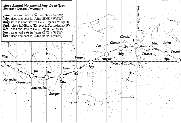
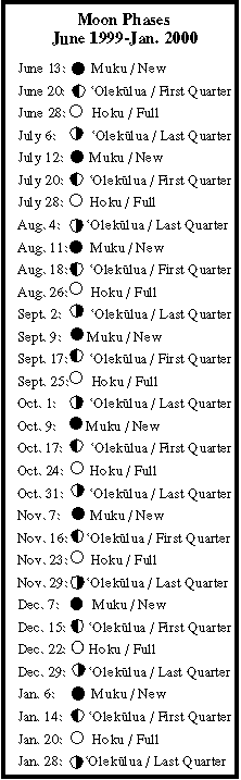
Daytime navigation: sunrise and sunset (ENE/WNW); 12-day old moon rising in the afternoon; three swells: SSW and S 2-3 feet; E.
Nightime navigation: (see above)
Latitude: Hokupa'a
How Non-Instrument Navigation is Done Sun's Position on the Ecliptic Moon Phases (June 1999-January 2000) Rising Points of 21 Brightest Stars Latitude Stars
Fishing report: No strikes.
Sea Life: terns, one dark and one light-colored, were following the canoe. (perhaps these birds are from the Line Islands to the west.)