Wednesday, June 23, 1999 (8:30 a.m.)
Actual Position (From GPS unit on board escort boat).
NA
Radio Report from Pi'ikea Miller, Apprentice Navigator on "Hokule'a."
No. of Days at Sea: 8
Winds are diminishing. ENE 10-15 knots. Clear skies and drier air. The navigators feel that based on their dead reckoning and latitude measurements, Hokule'a should be approaching the Intertropical Convergence Zone, but no sign yet of heavy clouds associated with the ITCZ.
Two spouts sighted in the distance...whales, though too far to identify what kind of whales. Navigator Blankenfeld says whales are signs of good luck. A pile of birds fishing in the distance...too far to identify what kind of birds.
Crew spirits are good: 4 musicians, 1 massage therapist, and 10 comedians on board.
The Navigators are resassessing their position, and feel they may be farther east of their reference course than they thought because earlier they had factored in too much current drift to the west.
Position (Navigator's Estimate):
Sunrise, June 23--8 degrees 46' N; 41 mi. E of reference line, 911 from Hilo
Heading (with current set) and Strategy: maintain manu malanai (SE) heading as long as the trade winds hold.
Speed: 4-5 knots
Navigation
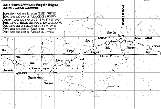
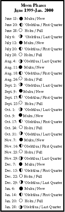
Daytime navigation: the two trade wind swells (ENE, ESE); sunrise and sunset (ENE/WNW), 10 days old moon rising in the early afternoon.
Nightime navigation: alto stratus, clearing in early morning. navigating by Venus setting and vega and deneb rising. later, hokule'a (arcturus) and the moon setting, jupiter and saturn rising.
Latitude: latitude estimate based on altitude of Hokupa'a (Polaris).
How Non-Instrument Navigation is Done Sun's Position on the Ecliptic Moon Phases (June 1999-January 2000) Rising Points of 21 Brightest Stars Latitude Stars
Fishing report: No strikes.
Sea Life: whales, birds (unidentified)