Tuesday, June 22, 1999 (8:30 a.m.)
Actual Position (From GPS unit on board escort boat).
Sunrise: 5:25: 11.53.70 N 146.28.38W
Radio Report from Pi'ikea Miller, Apprentice Navigator on "Hokule'a."
No. of Days at Sea: 7
The navigators corrected their estimated latitude to 10 degrees N at sunrise, based on a good measurement of the altitude of Hokupa'a, the North Star, with Alkaid parallel to Hokupa'a (i.e. when the the North Star is close to the height of the North Celestial Pole). They decided they have been overestimating their speed and distance traveled.
After a day of cloudly, squally weather, choppy seas, and gusty winds, the sky cleared last night at about 9 p.m. Weather today is sunny, with winds ENE at 15 knots.
The back sail was reefed last night to take pressure off the rig.
Position (Navigator's Estimate):
Sunset, June 21--10 degrees15 ' N; 30 mi. E of reference line
Sunrise, June 22--10 degrees N; 31 mi. E of reference line, 850 from Hilo
Heading: manu malanai (SE)
Speed: 5-6 knots
Navigation
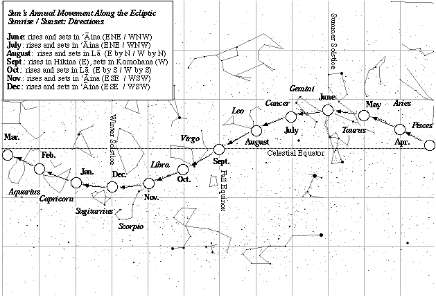
Daytime navigation: the two trade wind swells (ENE, ESE); sunrise and sunset (ENE, WNW), 9 days old moon rising in the early afternoon.
Nightime navigation: clear skies last night. navigating by Venus setting and vega and deneb rising. later, hokule'a (arcturus) and the moon setting, jupiter and saturn rising.
Latitude: latitude estimates based on altitude of Hokupa'a (Polaris).
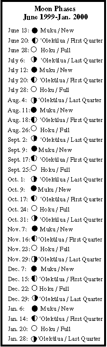
How Non-Instrument Navigation is Done Sun's Position on the Ecliptic Moon Phases (June 1999-January 2000) Rising Points of 21 Brightest Stars Latitude Stars
Fishing report: No strikes.
Sea Life: 'A (Boobies), shearwaters, ko'ae kea (white-tailed tropic birds)