Hiva Oa to Mangareva
Report on 08/17/99, A.M.
Sources of Information: Moana Doi, Cat Fuller and Chad Baybayan.
Prepared by: Nalani Wilson on Hokule'a; Kamaki Worthington on Kamahele.
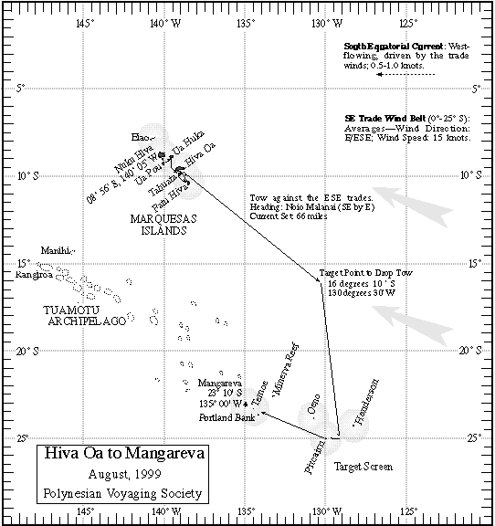
Navigators' Estimated Position at 6 pm, 08/16/99: 12 deg 30 m S, 22 miles west of the new reference course line. (Actual Position from GPS: 12 deg 45m S, 135 deg 39 m W)
Navigators' Estimated Position at 6am, 08/17/99: 12deg 58m S, 12 miles W of the new reference course line. (Actual Position from GPS: 13 deg 11 m S, 134 deg 39 m W)
Last 24 hours:
Heading 'Aina Malanai (ESE) @ 4kts (under tow); est. miles travelled 48 miles in 12hrs
Wind La Malanai (E by S) @ 8-10kts
Swells from La Malanai (E by S), 2-4ft; second swell from Manu Malanai (SE). @ 2ft
Strato cumulus cloud cover @ 25%
Wind picked up a little and changed direction, more easterly
Steering stars: Hokule'a, Cassiopeia, Jupiter, Saturn, Mars
Moon (Kukolu / 5 days old, waxing).
Latitude Star: Shedir in Cassiopeia at 19 degrees above the horizon @ meridian.
The crew yesterday scrub deck and canvas, pumped hulls as the weather was very calm. The crew is experiencing a stomach virus going around, putting 2 people a day down for 24 hrs. Some still have fever from land and a report of staph infection. Nothing serious...the normal winter cold season on the canoe.
No fish today, although a malolo (flying fish) flew into Chad's sleeping bag last night!!
Sealife: Koa'e kea (white-tailed tropic bird), booby, malolo; no marine mammals
For more information on the leg to Mangareva, go to the Hiva Oa to Mangareva Page.
For more information on the quest for Rapa Nui, go to the PVS Homepage.