Monday, June 21, 1999 (8:30 a.m.):
Actual Position (From GPS on board escort boat): Will be added when available, perhaps later today.
Radio Report from Pi'ikea Miller, Assistant Navigator on "Hokule'a."
Hokule'a's crew woke up this morning to a solid wall of clouds to the SE. As of 8:00 a.m., the sky was 100 % cloud covered, with high grey-white stratus clouds above cumulus clouds. The wind has been holding at ENE, 10-20 knots, becoming gustier. Air temparature is warming and humidity is increasing as the canoe heads toward equatorial waters. Everyone's hair and clothing is damp, but good spirits continue.
Position (Navigator's Estimate):
Sunset, June 20--11 degrees 46' N; 23 mi. E of reference line; 590 miles along the reference course from Hilo
Sunrise, June 21--11 degrees N; 23 mi. E of reference line; 656 miles along the reference course from Hilo
Heading: manu malanai (SE)
Navigation
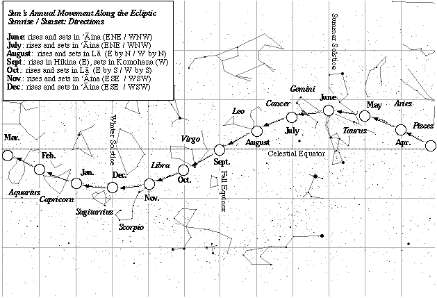
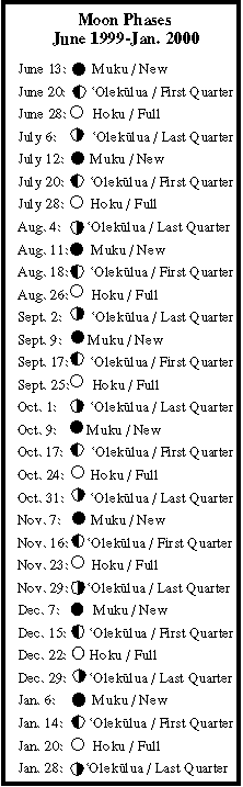
Daytime navigation: the two trade wind swells (ENE, ESE); sunrise and sunset (due east and west), quarter moon rising in the early afternoon.
Nightime navigation: clear skies last night. navigating by Venus setting and vega and deneb rising. later, hokule'a (arcturus) and the moon setting, jupiter and saturn rising.
Latitude: latitude estimates based on altitude of Hokupa'a (Polaris); southern meridian has been cloudy.
How Non-Instrument Navigation is Done Sun's Position on the Ecliptic Moon Phases (June 1999-January 2000) Rising Points of 21 Brightest Stars Latitude Stars
Fishing report: No strikes. Malolo (flying fish) landing on deck at night.