
Estimating Position
Estimating Position East or West of the Reference Course
The reference course which runs between the point of departure and the destination (see "Course Strategy") serves as a local 0 degree longitude line against which the wayfinder can keep track of his east-west position. During the voyage, the wind will either allow the canoe to sail along the reference course, or what is more likely, the wind will push the canoe off the reference course. Thus the canoe is either on the course line (0), or a certain number of miles to the east or west of it. When the wind pushes the canoe off the reference course, the wayfinder must keep track of how far off he is.
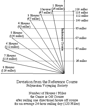
Nainoa Thompson keeps track of deviation from the reference course in units called houses. If the canoe goes one sailing day in a direction one house to the west of the direction of the reference course, the canoe is one house to the west of the reference course; if, on the next day, the canoe goes one sailing day in a direction three houses to the east of the reference course, it would be two house to the east of the reference course. The houses east or west of the reference course are distances (not to be confused with directional houses) and can be translated into miles using a trigonometric formula for right triangles, given the distance of one leg (one sailing day = 120 miles) and one angle (one house = 11.25 degrees):
If the wayfinder loses track of his position in relationship to his reference course (e.g., during a prolonged storm or in prolonged cloudy conditions), he is lost; he can determine his north-south position (latitude) through observations of the stars, but he can't determine know how far east or west he is along that latitude. He remains lost until some landfall (or seamark) allows him to determine his location and reorient himself. When lost, the wayfinder can look for land by tacking back and forth across an area where he thinks his destination or some other island might be located.
Estimating Latitude
Latitude-Height of Stars Crossing the Meridian
Latitude is the distance on the earth's surface from the equator. It is given in degrees north or south of the equator (One degree of latitude equals 60 nautical miles; each degree contains sixty minutes; one latitude minute equals one nautical mile.)
One strategy of locating an island without navigational instruments is called lattitude sailing. It involves sailing to the latitude of an island, preferrably upwind, then searching for the island along that latitude. For this strategy to work, the navigator must be able to tell when he is at the latitude of the island. The navigator can make a rough estimate from his dead reckoning, but there are more precise methods to determine latitude without instruments.
The North Star / Hokupa'a
North of the equator, the altitude of the relatively fixed star Hokupa'a (Polaris, the North Star) is approximately equal to the latitude of the observer. (Hokupa'a is actually 44' from the celestial north pole and inscribes a 1.5° circle around it.)
- At the equator (0 ° latitude), Hokupa'a is about at the horizon (0 ° altitude);
- at 10 ° N latitude, Hokupa'a is about 10 ° above the horizon;
- at 20 ° N latitude-within the latitudes of Hawai'i-Hokupa'a is about 20 ° above the horizon, and so on.
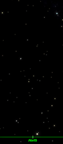
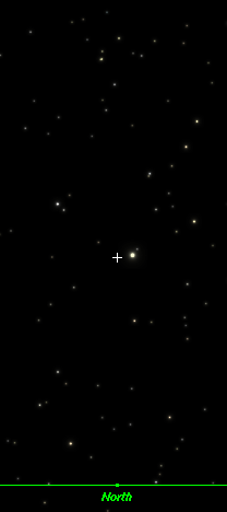
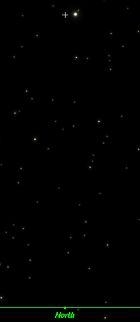
Hokupa‘a at the equator 0° / at 10° N / at 20° N
The altitude of the star can be measured using the hand stretched out in front of the eyes, with shoulders squared. Different configurations of the hand (e.g., a fist, a span, two fingers, three fingers, etc.) can be calibrated to distances (degrees) in the sky.
Meridian Pairs
Stars crossing the meridian can also be used to estimate latitude. At given latitudes, a star crosses the meridian at a certain altitude. If the navigator knows the altitude of the meridian crossing of a star at a particular latitude, and he can tell when the star is crossing the meridian, he can estimate his latitude by measuring the altitude with his hand.
To know when a star is crossing the meridian, the navigator uses meridian pairs--stars which cross the meridian togther. When the pair is perpendicular to the horizon, the stars are crossing the meridian. (The meridian is an imaginary line on the celestial sphere passing through the north and south celestial poles and the zenith, the point directly above the observer's head. The closer a star is to the horizon, the more accurately its altitude can be measured without instruments. However, stars that cross the meridian too close to the horizon, 1-3 ° from it, often cannot be seen because of clouds, sea spray, etc.)
At the equator, the altitude of a star as it crosses the meridian is equal to 90 ° minus the star's declination. (The declination of a star gives the position of a star on the celestial sphere, measured in degrees away from the celestial equator, an imaginary circle that passes through due east and due west. A star on the celestial equator has a declination of 0°; a star 30° north of the celestial equator has a declination of 30°, and so on. The declinations of stars are published in astronomical handbooks. For the declination of stars used in Hawaiian navigation, see Hawaiian Star Lines.)
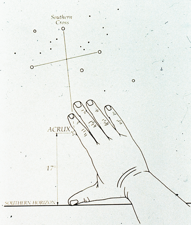
The Southern Cross / Hanaiakamalama: One meridian pair is the top and bottom stars in the Southern Cross, Kaulia (Gacrux) and Ka Mole Honua (Acrux).
At the equator, Kaulia (Gacrux) crosses the meridian 33° above the horizon due south: 90° - 57° (dec. of Kaulia) = 33°; and Ka Mole Honua (Acrux) crosses the meridian 27° above the horizon due south (90 ° - 63 ° (dec. of Kaulia) = 27°).

As the observer moves north of the equator, these two stars will cross the meridian at lower and lower altitudes above the south celestial pole; the observer can substact his latitude from the altitude of the star crossing the meridian at the equator to get the altitude at which the star crosses the meridian at his new latitude.
At 10 ° N, Kaulia (Gacrux) crosses the meridian 23 ° above the horizon due south: 33 ° - 10 ° (lat. N of the equator) = 23 °.
At 10 ° N, Ka Mole Honua (Acrux) crosses the meridian 17 ° above the horizon due south: 27 ° - 10 ° (lat. N of the equator) = 17 °.
As the observer moves south of the equator, the two stars in the Southern Cross would cross the meridian at a higher and higher altitude; the observer adds his latitude south of the equator to the altitude of the star crossing the meridian at the equator to get the altitude at which the star crosses the meridian at his new latitude.
At 10 ° S, Kaulia will be 43° high as it crosses the meridian (33° + 10° [lat. S of equator] = 43°; Ka Mole Honua will be 37° high (27° + 10 ° [lat. S of equator] = 37°).
At 21 ° N (about mid-latitude of Hawai'i), Kaulia (Gacrux) crosses the meridian at 12 ° above the horizon: 33° - 21° = 12°; Ka Mole Honua (Acrux) crosses the meridian 6 ° above the horizon due south (27° - 21° = 6°):
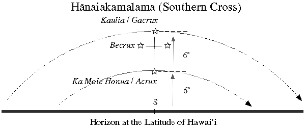
That the distance between Ka Mole Honua and the horizon, and Kaulia and Ka Mole Honua are equidistant (both equal to 6°) is an additional visual clue that the navigator is at the latitude of Hawai'i:
As the sun passes through the zodiac over the course of the year, the stars in the portion of the sky in which the sun is located are not visible. So those stars would not be available for determining latitude at that time of the year. The navigator uses meridian pairs that are visible after sunset and before dawn at the time of the voyage.
Voyages are planned for times of the year when the weather and winds are optimum and also when certain meridian pairs are visible. For example, when sailing to Hawai'i from the South Pacific, the navigator wants to have the Southern Cross crossing the meridian in the night sky for determining when the canoe has reached the latitude of Hawai'i.
Numerous meridian pairs were used during the voyage to Rapanui (1999-2000).
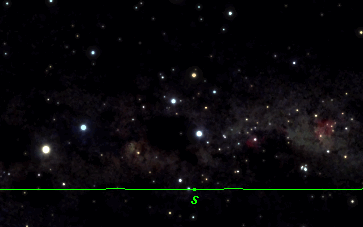
The Southern Cross was visible crossing the meridian in the predawn sky as Hokule'a returned to Hawai'i in February, 2000.
Latitude-Rising and Setting Pairs
Pairs of stars that rise or set at the same time can also be clues to latitude. Pairs rise and set together only at specific latitudes. For example, when 'A'a (Sirius) and Nana-hope (Pollux) set together, the observer is at the latitude of Tahiti, or 17° S:
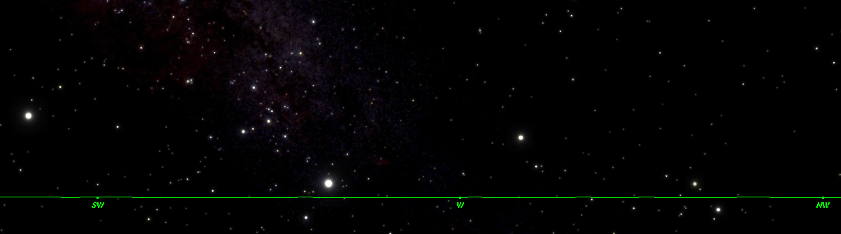
Looking west in Papeete, Tahiti, 'A'a (Sirius), the brightest star, sets between W and SW. Between W and NW, Na Mahoe (The Twins) are setting, the first of the pairs, Nana-mua (Castor), is already below the horizon; Nana-hope (Pollux) approaches the horizon line at the same time as ‘A‘a. Between 'A'a and Nana-hope the star Puana (Procyon) will set a little later, as will the bright star to the SW, Ke Ali‘i Kona i ka Lewa (Canopus).
At a more northern location (e.g. at the equator) 'A'a sets earlier than Nana-hope (Pollux); at a more southern location (e.g. Auckland), Na Mahoe sets earlier 'A'a.
Three setting pairs in Hawai‘i the following:
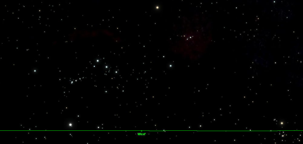
1. Puana (Rigel) the bright star in Ka Hei-Hei (Orion) to the left of west, sets with Kapuahi (Aldebaran, the red star on the horizon to the right of west, near the side of the chart.)
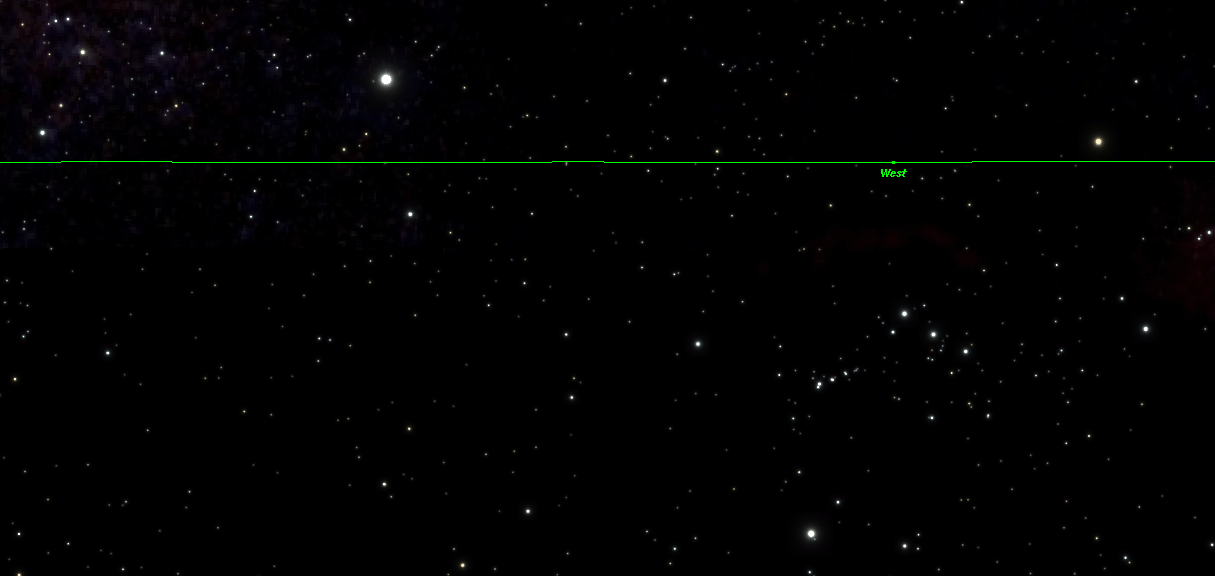
2. After Puana (Rigel) has set, Adara (in the constellation Canis Major), the dim star on the horizon near the left side of the chart, sets together with Kauluakoko (Betelguese, in Orion) the dim bright star to the north of west near the on the right side of the chart. The bright star between the two is 'A'a (Sirius, also in Canis Major).
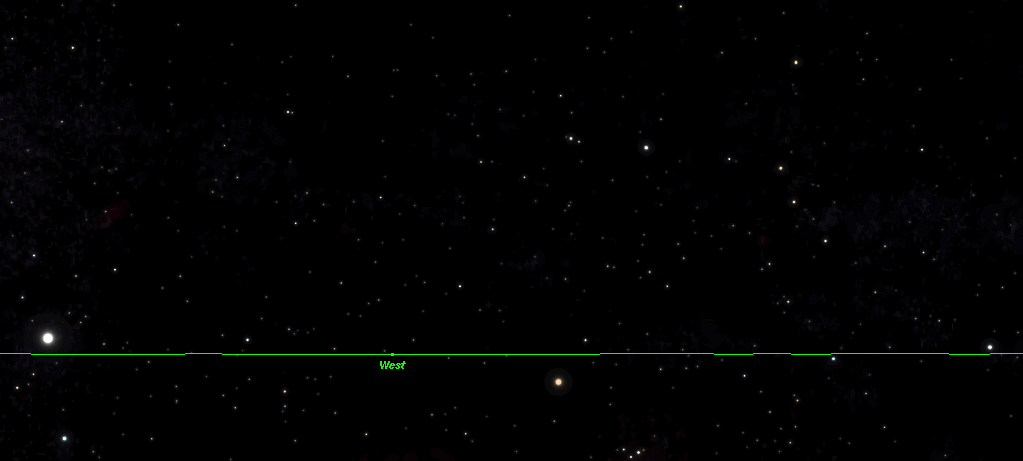
3. ‘A‘a (Sirius), the bright star on the horizon near the left side of the chart, sets together with Alnath (Beta Tauri), the dim star on the horizon at the right side. The bright star just beneath the horizon to the right of West is Kauluakoko (Betelguese), which has just set.
Zenith Stars
At a given latitude, only certain stars will pass through the zenith, the imaginary point in the sky directly overhead. The most conspicuous (i.e. brightest) of these stars is called the zenith star of that latitude. The zenith star of Hawai'i is Hokule'a (Arcturus); the zenith star of Tahiti is 'A'a (Sirius). The declination of the zenith star is equal to the latitude it is associated with. Thus the declination of Hokule'a (Arcturus) is 19 ° N; the latitude of South Point on the Big Island of Hawai'i is about 19 ° N; the declination of 'A'a (Sirius) is 17 ° S; the latitude of Tahiti is 17 ° S.
If the navigator knows the zenith stars of different latitudes, he can tell what latitude he is at by observing what star passes directly overhead at night. However, while the observer can make a rough estimate, it is difficult to tell when a star is passing directly overhead on a canoe that is pitching, rolling, or corkscrewing along. The observation is not as precise for determining altitude as the other methods: (1) measuring altitude of Hokupa'a north of the equator; (2) measuring the altitude of stars as they cross the meridian; or (3) watching for pairs of stars that rise or set together.