
Voyage to Rapanui
Journal, Tahiti to Hawai‘i, February 5-27, 2000
Sam Low
Photos by Sam Low on Hokule‘a and Makanani Attwood on Kamahele
Kinohi loa
This is just the kinohi loa – the beginning - of a long voyage of words. It is dedicated to my aumakua and my kupuna and especially to my father, to Clorinda, to Pinky and Laura.
My father's ashes were laid in deep swirling pools of water in the Atlantic more than 35 years ago – blood of Hawaii nurtured by blood of New England – joined in the moana that knows no boundaries. I am two spirits – of the anuanu land, the cold place and the nopu, the hot – of the ohana of my mother and father. Their love for joins these two worlds. May this work which we take on – from the valley of Niu to the sand plains of Martha's Vineyard – strengthen that union. Aloha.
Sam Low
Departure
In the harbor - ice like pancakes. On the ship - decks rimed with salt stirred by yesterday's wind. Sloops and schooners – moored in ice - wear mustaches. Sleeping.
A longshoreman exits a building, windows sheathed in condensed warmth. “Ain't seen it like this for a long time. It's the wind chill – forty below.” Pigeons huddle on the building's roof.
Seagulls squat on lily pads of ice. The air is still. A plume of smoke rises like a white pine tree. The ship glides through slush. I slide away from one island home – to another.
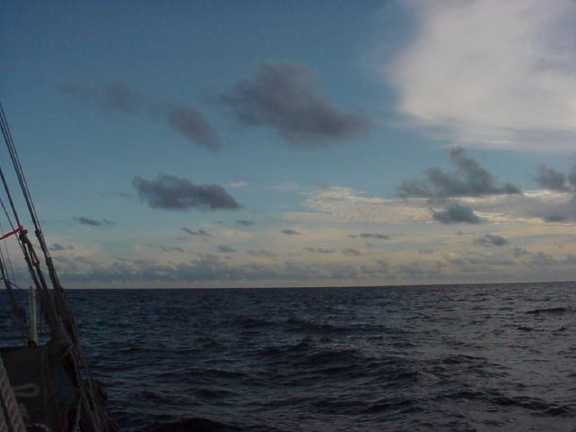
A faint sun. Sky joins sea in a dull crease – a deeper band of gray – as if at the ocean's extremity the atmosphere was bent upon itself like a piece of tin. The island, receding, is dark. Then lighter. Then gone.
Blessing
The heiau browed the hill, gift of many ancient hands, strong with mana like bleached bone wrapped in tapa. The knowledge came with a price, was a gift encumbered with duty. Our navigator accepted the gift with ha'aha'a – humility. He would soon stand upon the smooth planks of the canoe – the leader of yet another seeking, accompanied by his aumakua and his ohana, his comrades entrusted to each other, sliding through danger. But first this. Alone. The request for pomaika'i – blessing – and for alaka'ina – guidance – and for koa – courage. Ancestral mana throbbed from the stones of the heiau into the soles of his feet. He stood there beneath the heiau's hooded eyes – waiting to enter.
Crews
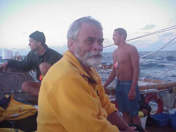
Hokule'a: Snake Ah Hee, Chad Baybayan, Pomaikalani Bertelmann, Bruce Blankenfeld, Shantell Ching, Sam Low, Joey Mallot, Kahualaulani Mick, Ka'iulani Murphy, Kau'i Pelekane, "Tava" Teikihe'epo Taupu, Nainoa Thompson, Mike Tongg, Dr. Patrice Ming-Lei Tim Sing, Kona Woolsey. (Total: 15.)
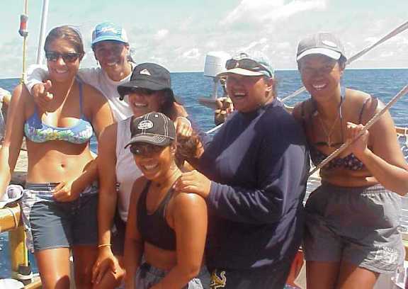
Six Canoe Sisters (The most ever on a single Hokule'a crew): Kona Woolsey, Kau'i Pelekane, Ka'iulani Murphy, Dr. Patrice Ming-Lei Tim Sing, Pomaikalani Bertelmann, and Shantell Ching
Kama Hele: Alex and Elsa Jakubenko, Makanani Atwood (Hawai'i), Eric Deane (Tahiti), Mate Hoatua (Tahiti), Richard Konn (Tahiti), and Teikinui Tamarii (Tahiti). About the Escort Boat Kama Hele and its Owners, Alex and Elsa Jakubenko.
Click here for Sam’s Portraits of the Homebound Crew.
Tautira: Hokule'a's Home in Tahiti
I first visited Pape'ete in 1966 when it was a somnolent seaside town with a few yachts tied to the quay along the main street. There were low buildings along the street and a famous bar, called Quinns, which had a rough reputation. Today, few places are left from that earlier time. There are the grand avenues where the old French Colonial buildings still stand and the Hotel Royal Pape'ete which was once the best but is now overshadowed by many new ones on the city's outskirts. Office buildings rise above boutiques and restaurants. The bars are fancy in the French manner, which means expensive and with an "I could care less" attitude which passes for an island weltzschmertz.
The Banyan trees that I remember still cast pools of shade along the park beside the main street and locals with tattoos still sit under them watching life pass and talking in a mix of Tahitian and French. The popping of motor scooters is familiar but it's now drowned by the roar of big diesel tourist busses and Mercedes trucks and the street is clouded with fumes. Pape'ete has become a place that, if you know better, you leave as soon as possible.
Hokule'a's home port in Tahitian waters is the village of Tautira, an hour's drive on a road that winds through a landscape of utilitarian architecture - burgeoning strip malls, gas stations, lotissemonts - a French-Polynesian version of suburban sprawl. Following the road, the hubbub of uncontrolled development subsides. The air clears of fumes. Mountain peaks jostle toward the shore - presenting waterfalls and vistas into deep valleys. In Tautira, the road ends.
Robert Louis Stevenson visited Tautira in 1888 on a cruise through the South Seas . "One November night in the village of Tautira ," he wrote to a friend, "we sat at the high table in the hall of assembly, hearing the natives sing. It was dark in the hall, and very warm; though at times the land wind blew a little shrewdly through the chinks, and at times, through the larger openings, we could see the moonlight on the lawn... You are to conceive us, therefore, in strange circumstances and very pleasing; in a strange land and climate, the most beautiful on earth; surrounded by a foreign race that all travelers have agreed to be the most engaging... We came forth again at last, in a cloudy moonlight, on the forest lawn which is the street of Tautira. The Pacific roared outside upon the reef. Here and there one of the scattered palm-built lodges shone out under the shadow of the wood, the lamplight bursting through the crannies of the wall."
Tautira has changed since then, of course. The "palm-built lodges" are long gone, replaced by neat bungalows of wood or cinderblock with metal roofs. But the mountains of the Vaitepiha Valley still rise above the village and the Pacific still roars upon the reef and the swells still make a solid white line on an azure gin-clear sea. In the lagoon it is calm. There are stands of tall coconut palm along the shore along with ironwood, milo, mango and ulu trees with leaves that open like human hands, yellow in the palm, dark green at the finger tips. Small fishing skiffs are parked in many lawns. There is a public water tap by the Mairie - the Mayor's office - and many village women come here to wash their clothes; hanging them out to dry in the yard - pareos of many colors and designs. Driving into the village, the valley opens wide, revealing peaks deep inside, masked in cloud. The slopes are light green with ferns. Mango trees stand above the ferns and lower down are hala trees in groves. Tautira remains, as Stevenson wrote more than a hundred years ago, "a strange land and climate, the most beautiful on earth."
Nainoa Thompson first visited Tautira in 1976 as a crewmember aboard Hokule'a. There he met Puaniho Tauotaha, one of the village elders - a fisherman, canoe paddler, and canoe carver - a man of immense physical and spiritual strength.
"You could be in the canoe house," Nainoa remembers, "and there was laughter and singing and people talking but when Puaniho got up to speak there was complete silence. I didn't know what he was saying but it felt like an oration. And if he wasn't doing that he never said anything. When he coached the canoe paddlers he hardly said a word. He was an extremely quiet man. Very religious, very disciplined. He was the edge of the old times."
After her famous maiden voyage to Tahiti, Hokule'a sailed from village to village along the coast. Wherever she stopped, the crew was hosted like visiting royalty. Nainoa had yet to sail aboard the canoe on a long voyage and although he had prepared for the return trip he was nervous and he was embarrassed by the attention.
"We would prance into these parties and sit down and they would feed us food and beer all night as if we were very special people - which we were not," he remembers. "We sailed into Tautira, the last stop in Tahiti , and we anchored and I had just had enough. I told Kawika, the captain, 'I will stay aboard the canoe.' The current was strong. We had two anchors and the bottom was coral and they were not going to hold well so I was worried. 'We are so close to leaving,' I thought, 'what if the anchors drag and we damage the canoe?'"
Kawika agreed that Nainoa could stay aboard while the rest of the crew went to the party in the village. That afternoon, Nainoa enjoyed the solitude. The canoe bobbed serenely at her anchorage. The sun began to settle over the nearby mountains.
"Finally, the sun went down behind Tahiti Nui," Nainoa remembers, "and I saw this little girl, maybe four or five years old, on the beach. She had a flower in her ear and she was waving to me to come on shore. She just kept on waving. So I went on shore and she grabbed me with hands so small that she could hold just two of my fingers. She took me by the hand and led me down the road and into a simple house with a dirt floor. They had put in some picnic tables and they had the whole crew in there and they were feeding them shrimp and steak and all kinds of food. Somebody would stand behind you and if your beer glass got half empty they would fill it up. Puaniho came in. He was the stroker for the old time canoe paddlers. He sat down. He had powerful eyes. He was poor in material things but he was a very strong and powerful man. He couldn't speak English and I couldn't speak French or Tahitian. We sat there and we spent the evening with him. It was just overwhelming how much the people of the village give when they had so little to give. They didn't have a floor in their house, much less beer and steak to share. I felt awkward. Here was this Hawaiian group who really didn't know a damn thing about sailing and they were treating us as if we were special people."
"We sailed back to Pape'ete and we were staying in a hostel," Nainoa continues. "Two days before we left I was sleeping in my room and about four o'clock in the morning I woke up. Puaniho's wife was pulling me by my toes and waving to me to go outside. So I got my clothes on and we went outside. She couldn't speak any English and so she just signaled to get in her truck. We drove all the way back to Tautira, early in the morning, as the sun came up. We went to every house, every house, and we stopped and they filled that truck up with food. By the time we drove back to Pape'ete I was sitting on a mound of food - banana, taro, mango, uru - everything. There was no verbal communication. Puaniho drove right up to the canoe. He knew exactly what he was going to do. They put all the food aboard and then he drove off."
"Somehow Puaniho knew that I was nervous about the trip. I was even considering not going. The next day he came back and he had carved a wooden cross, a necklace, and he gave it to me. That was when I knew that I had to go."
When Nainoa returned to Hawai'i aboard Hokule'a in 1976, he told his grandmother, Clorinda Lucas, and his parents, Pinky and Laura Thompson about Puaniho and the hospitality the crew had received in Tautira.
"I told that story to my grandmother and to my mom and dad and you can imagine what that meant to them. They knew that I was afraid - that I felt that I was not prepared. And these Tahitians knew what to do to care for me and the crew by giving us what they could - their food and their aloha."
In 1977, Nainoa invited Tautira's Maire Nui Canoe Club to Hawai'i to compete in the Moloka'i Race. About fifty people arrived. Pinky and Laura moved out of their home in the Niu Valley as did Nainoa and his sister Lita and her husband Bruce Blankenfeld. They converted the Hui Nalu canoe shed into a dormitory with bunk beds on loan from the National Guard. For a month Nainoa and his family hosted their Tahitian guests. It was the beginning of many such exchanges between the people of Hawaii and Tautira.
Maire Nui won the race. "All the other crews were competing for second place," Nainoa remembers. They returned twice more, winning each time, and retired the famous Outrigger Canoe Club cup which now sits in the house of Sane Matehau Salmon - Hokule'a's host whenever she visits Tautira.
"If you understand how anxious my parents and grandmother were during the 1976 voyage, you can understand how grateful they were for the hospitality shown to us by the people of Tautira. And you can understand how they would move out of their house and give it to them and feed them for a month. That's why Sane says 'This we will never forget and this is why we will always take care of you when you visit Tahiti .' And then you can also understand why Hokule'a has to come back to Tautira whenever we come to Tahiti ."
"For me, Tautira is not just a beautiful physical place. It's a symbol for the kinds of values that are important," Nainoa says. "I learned from the people of Tautira that there are other ways to measure wealth besides the things that you accumulate. The people of Tautira are extremely happy when they see that we are happy. When they give to you they feel rich themselves. That is what Tautira is all about.”
Thursday, January 27, 2000
It's simmering in the flat skirt of land beneath Tautira's towering peaks. Crevices etched in the peaks by rainy season waterfalls are dry. The lagoon is a mirror and the surf is a light scrim lining the reef. Puffy cumulus clouds crenellate the horizon as cirrus and mare's tails glide almost imperceptibly overhead. There's not a breath of wind.
In the morning, we receive flu shots from doctor Ming-Lei Tim Sing and Kaui Pelekane, a nurse at Queen's Hospital in Honolulu .
Chad Baybayan presides at our first meeting as a crew.
“Have all the halyards been checked for wear and replaces where necessary?” he asks Kamaki Worthington, a crew member on the voyage to Rapa Nui who remained in Tahiti to care for the canoe.
“The halyards are done,” Kamaki says, “and the sails are tied on and ready. The number twenty-nine is on the fore mast and the thirty-two is on the mizzen.”
“How about the radios?”
“The handhelds work fine and we tested the transponders and the single sideband.”
The transponder is a radio transmitter that sends a signal to Honolulu via satellite where it is decoded at the University of Hawaii to provide a record of Hokule'a's track across the ocean.
“Good work,” says Chad .
“Mike and Kahua will check out the radios today,” he continues, assigning each of us our tasks, “and call PSAT this morning.”
“Ka'iulani and I will make sure the water is loaded aboard.”
“Sam, you inventory the documentation gear.”
“Bruce and Snake, you check the fishing equipment. Pomai and Terry will check the galley, and Bruce – can you make a list of the fresh food we'll have to take aboard?”
Whenever Hokule'a arrives in Tautira, her crew is fed and housed by the villagers, with assignments arranged by Sane Matehau, mayor for the last 23 years and a prosperous building contractor. Sane appears to be in his early fifties. He is a physically strong man, barrel-chested, with a round open face that is often creased with pleasure. He wears his hair in a modified brush cut. His girth is ample. He is a man who naturally commands attention. Sane has six brothers and three sisters - a huge family that has become our ‘ohana in Tautira.
Our Tautira Hosts
- Edmon and Lurline – Shantell, Sam and Pomai
- Vaihirua – Maka
- Tepe'a and Toimata – Bruce
- Ota and Terrevarua – Tava, Kamaki and Chad
- Sikke and Linda Matehau - Mailing and Kona
- Franco and Laiza Toofa – Kaui Pelekane
- Jaqueline and Sabu – Marco
- Sylvain and Lydia Atchong – Terry
- Mereille and Manuia Marutaata – Ka'iulani
- Maeva and Patrice Taerea – Nainoa and Pinky
- Rosedine and Gerrard Mana - Joey
Friday, January 28
We continue to prepare for sea. During the morning crew meeting, Nainoa asks us to have the canoe ready to depart on three hours notice beginning tomorrow. The wind has been light and northerly but if it shifts back to trades from the southeast, we must be ready to take advantage of it.
“Our main problem is to get north beyond the Tuamotus,” he tells us, "and that's about 240 miles. So if the wind shifts we've got to go."
The Tuamotus screen our course to Hawaii . Sometimes called "the dangerous islands," they are low coral atolls - difficult to see during the day and almost impossible to see at night - although Master Navigator Mau Piailug can smell their coconut palms many miles at sea. The islands are a blessing for canoes sailing from Hawaii to Tahiti because they provide a 405 mile long "safety net" across the canoe's path - a large area of land and bird signs that extends the geography of landfall. But sailing back to Hawai'i they're a barrier to the open ocean which must be passed before a navigator can breathe freely.
With the wind on our beam - from the east - we can sail through the Tuamotus quickly, but when it's from the north, as it is today, we must tack - extending the time we are among the low coral atolls - and the danger.
As we wait for favorable winds, hundreds of chores are completed - life jackets, harnesses and flashlights are distributed to the crew; strobe lights, and man overboard gear is checked; electrical equipment - radios, satellite transponders, solar panels and batteries – is tested; galley gear is loaded aboard.
Tomorrow the vigil begins. The navigators will scan the skies for signs of easterly winds while we await the word to depart. Our duffel bags are packed.
January 27 - Meeting at the Mayor's Office "The Old Men of Tautira"
You could imagine a meeting like this in a thatch-roofed canoe house hundreds of years ago with the visitors' double-hull voyaging canoe drawn up on the beach outside. But this meeting is held in the white-washed conference room of Tautira's mayor - Sane Matehau - and the date is January 27th, the year 2000. Only the feeling is ancient - a sharing of stories by friends from distant islands, a bonding together of a wide-spread `ohana.
Outside the conference room, the setting sun colors clouds over nearby mountains and a cool wind washes ashore over the reef. Inside, we are seated in a circle with representatives of Tautira's community, including Kahu from the Protestant, Catholic and Mormon churches. Sane has called the gathering to celebrate the 25 th anniversary of the joining of Tautira's people with the people of Hawai`i .
The first to speak is Tutaha Salmon. For a Tahitian, he appears almost delicate, yet his bearing is dignified, suggesting confidence. His graying hair indicates he may be in his seventies. Tutaha was once the mayor of Tautira – a position now held by Sane - his son-in-law. He is now the governor of a large Tahitiian district including Tautira and three other towns: Faaone, Taravao and Pueu.
"It's an honor that whenever Hokule`a sails to Tahiti she lands here in Tautira," Tutaha tells us. "How many times have you come? I cannot count them. But what's important is that you are now our family - our brothers and sisters."
Following protocol that is ancient, Tutaha then speaks of his elders. The enfolding story of Hokule`a's relationship with Tautira began with "the old men" - a six-man canoe team who paddled their way into the history books
"Our dream of cultural exchange was born twenty-five years ago. In those days the man I remember first is Puaniho. He has now passed on but he showed us the way. He was a quiet man, but powerful. There was Mate Hoatua the steersman on the canoe from Haleolono to Waikiki . He steered the whole way, without relief. Henere, Tevae, Nanua and Vahirua paddled the canoe. We called them "the old men" because their minimum age was fifty. This is our time to remember them and to tie that rope tight to the mast."
"The old men" of Tautira's Maire Nui canoe club first traveled to Hawai`i in 1975 to compete in the Moloka`i race. Pinky Thompson next rose to speak in response to Tutaha's welcome.
"I want you to know that we feel at home ever since you took a strange looking Hawaiian youth into your homes 25 years ago, my son Nainoa. You recognized immediately that he was a stranger in a land that was strange to him and you malama-ed [took care of] him."
Nainoa came to Tautira in 19[76] as a member of Hokule`a's crew. He recognized immediately that the "old men" of Maire nui paddled differently than any team in Hawai`i.
"They were so smooth," Nainoa recalls, "their movements were fluid, no lost energy, and their canoe seemed to leap forward - faster than anything I had every seen.”
He wanted to learn from them and in 1977 he got the chance. In that year's Moloka`i race, Nainoa's team from Hui Nalu lined up next to "the old men."
"They were twice our age, and we were a pretty strong crew but they left us in their wake, paddling easily."
In that same year, Nainoa traveled to Marina del Rey to serve on a motor boat escorting Maire Nui in the Race to Newport Beach , California.
"They finished the race, took a shower, and were drinking a beer before the second place canoe arrived. They beat them by an hour and 4 minutes."
Nainoa invited Maire Nui to stay in Niu Valley when they came to Hawai`i in 1978 for the Moloka`i race and again in 1979 when they won the koa division for the third consecutive time – retiring the famous Outrigger Canoe Club cup to an exhibit case at Sane Matehau's home in Tautira. Over the years, visits by Maire Nui to Hawai`i and by Hawaiians to Tahiti continued. Puaniho built a Koa canoe for Hui Nalu and later another famous Tautira canoe builder flew to Kona to build six Koa canoes - helping to inspire a renewal in traditional canoe building that thrives today.
Nainoa, Bruce, Pinky and their Hui Nalu colleagues studied the Tahitian way of paddling and became champions themselves. Pinky remembered those moments in his presentation at the Mayor's office.
"You helped us become champion paddlers, but you did much more than that. You helped us to return pride to our Polynesian people by restoring our native craft of canoe building and paddling."
"'The old men' taught us what it means to be champs,” Nainoa added. “It's not about outward appearance. It's about what happens inside. They didn't talk much because they knew that the mana comes from within. They didn't think of themselves representing just a club - they represented all their people.”
Friday, January 28 – Crew Briefing
“We're on three hour call to set sail,” Nainoa tells us at this morning's crew briefing. “Our first problem will be to get to the Tuamotus, 240 miles to the northeast. The crew is made up of new sailors and expert sailors. It's designed that way. Bruce and Chad are in overall charge of safety and of educating the new crew. They will stand six-hour watches each – six on and six off. They will hot bunk with each other, share the same puka, because when one is sleeping the other will be on watch. Tava, Snake and Mike will be watch captains. Shantell will navigate and so she will be up most of the time. Ka'iulani and Kahualaulani will assist her so they will stand 6 hour watches, on and off. Pomai will cook, so she'll not stand a watch. The rest of you will be on watch for 4 hours, then have 8 hours off.”
On one of the long tables at Sane's house, where we eat every morning and evening, Nainoa spreads a map of the Pacific. He traces his finger along a red line drawn on the map from Tahiti to the Big Island .
“This is our course line. It's been drawn like this ever since 1980. Makatea, here, and Rangiroa and Tikihau, here, will be stepping-stones as we head north. Once we clear the Tuamotus we will sail on long tacks, hopefully one single tack, to this point 275 miles west of the Big Island , where we will turn to sail downwind, probably to Hilo . With the new sails we have now we should be able to sail efficiently. I think it will take about 22 days.”
“Our problem now is the weather. Normal trade winds, from the east or southeast, are ideal. Hokule'a can point six houses into the wind, so we can sail north or northeast. But the forecasts are now calling for winds from the north and in those conditions here's what happens.”
Nainoa takes two pencils and joins them together at the ends, the lead tips pointing outward. He arranges them in a fan with the included angle equal to six houses - 67 and a half degrees – the angle that Hokule'a can make when sailing into the wind. He lays the pencils up against the chart with the right hand pencil heading north, into the wind, and the left hand one – our course in a northerly wind – pointing off to the northwest.
“If the wind forces us to sail off to the northwest, we'll end up in Satawal.”
“The weather pattern in the Pacific at this time of the year extends over an area 5000 miles long. Since December, the Pacific (mid Pacific?) has been a convective factory of rising air. There's a large high-pressure system to the east. In the winter, the high-pressure systems move, but now they stall and another has formed to the west. In between the two systems there's a depression – a trough that extends south of Tahiti and to the west across the Pacific. It's a doldrum condition caused by two stationary air masses. A whole Pacific-wide system. That trough (which causes the north winds?) extends for a long, long way. If we set out now and sail to the northwest, we'll never get out of it. That system may be here for a long time. We're stuck.”
“There's a hurricane to the north of New Zealand , 2000 miles away, but there's no real chance that it will come up here. The hurricane is a refrigerator. It sucks out warm winds so it might allow the trades to reestablish themselves. If that happens we might get a single day of good sailing weather. But don't count on it.”
“So we have a big challenge. We have light winds but they're blowing from the direction we want to go – right in our face. To get out of here, we may have to tow. No one likes to tow, but we may have no other choice. Our voyage has a larger intent – we sail to serve our community – and we have to be back in time to get the canoe ready for her birthday at Kualoa on March 12 th . We cannot wait beyond the 5 th of February to leave, even if we have to tow. About 240 miles north of Manihi we can get into good trade winds.
Nainoa pauses, for a moment, allowing this to sink in.
“Okay, Chad and Bruce, you are in charge of seeing that the canoe is ready and conducting safety drills. But remember; be careful of the heat. You can easily dehydrate.”
(Check all of the above weather analysis with Nainoa)
Saturday, January 29 - Weather Watch
The ocean remains unsullied. Parapets of cumulus cloud are stalled around the horizon. There's a breath, and no more than that, of wind - but it's out of the north, so getting to the Tuamotus will be an ordeal of constant tacking into headwinds.
The high-pressure(?) ridge containing light unstable winds continues to dominate our weather system. We want the ridge to move but it's blocked by a zone of low pressure to the south, which pulls the wind toward it, creating northerlies. This morning Nainoa speaks with Bernie Kilonsky at the University of Hawai`i . The low may finally move south, Bernie tells him, allowing the high pressure ridge to move with it. If so, the light and variable northerlies should be replaced by easterly trades. We may see some change on Sunday and certainly by Monday. And, if Bernie is right, the trades should fill back in by Tuesday.
"Ok," says Nainoa, "we stay on alert to go within three hours notice - but if Bernie is correct we'll probably not leave until Tuesday."
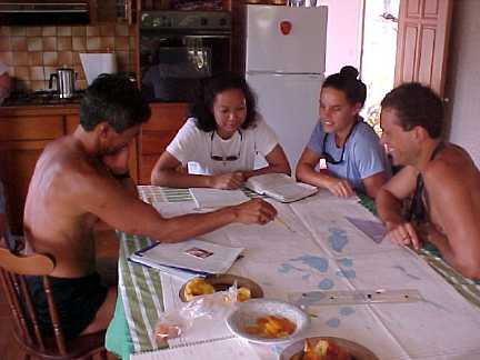
In the meantime, Nainoa and Shantell Ching join with student navigators Kahualaulani Mick and Ka`iulani Murphy to lay out their course line to Hawai`i and discuss alternative routes depending on changeable wind and weather conditions. Bending over the kitchen table in Nainoa's house, they first consider the effect of the current.
"The longer you're in the current the more its effect will be," Nainoa explains, reviewing basic knowledge, "so the amount of offset will depend on your speed. The slower you go - the more the offset."
The offset is also affected by the angle that the canoe makes to the current. Assuming the canoe's speed to be five knots, for example, with an easterly current of half a knot, a heading of Manu (NE) will produce an offset to the west of four degrees. Increasing the canoe's angle to the current increases the offset. If she heads Nalani (NE by N) the offset is five degrees, while a course to the north (Akau) means an offset of six degrees. This kind of effect becomes great over long distances. Consider the passage from Rangiroa to the doldrums, about 1100 miles. At a speed of 5 knots, a half knot easterly current will set the canoe to the west 12 miles a day or 108 miles during the nine day voyage.
The navigators memorize current effects like these as a set of general principles which can be easily modified mentally as conditions change. If they sail north at 5 knots and the current is from the east at half a knot - the westerly offset is 12 miles each day. Change the canoes speed by 50% to 2.5 knots and the daily offset will be twice as much - or 24 miles – because the canoe will take twice as long to cover the same distance.
"We always try to eliminate having to do math in our heads," Nainoa explains, "it can cause serious brain damage."
For now, the navigators concentrate on the "first stage" of the voyage home - from Tahiti to just north of Rangiroa - when the canoe will enter the open ocean and begin "stage two" to the doldrums. During the first stage, Makatea - about 124 miles to the north - will be a stepping stone, a chance for Shantell and her colleagues to test the accuracy of their navigation. They consider when to depart Tautira in order to arrive at Makatea with sufficient time to explore the island.
They decide to leave at 11 am . They will have no celestial bodies to steer by so they must guide the canoe by "back sighting" on Tautira's mountain peaks. Shantell figures they will be able to use the 4,500' high mountains for about 60 miles on a clear day and maybe 30 on a humid day - like today.
"That means that if we sail at five knots we can use our back sight for about 6 hours," she says, "or until 5 p.m. By 3 p.m. the sun will be low enough on the horizon to steer by so we can check our course to Makatea and modify it if necessary."
When they reach Makatea, the navigators must decide when to set out for the difficult pass between the low coral atoll of Tikehau and Rangiroa which leads out into the open ocean. Kahualaulani runs his finger over the eastern side of Tikihau's fringing reef.
"These black marks are coconut trees," he says "and we should be able to see them maybe ten miles at sea - during the day. At night, forget about it. We might be right on top of the reef before we see it."
"The distance from Makatea to Tikehau is 40 miles," says Shantell "and we want to be no closer than 10 miles at sunrise, so when should we leave?"
"If we can average five knots then we should leave about midnight ," says Ka`iulani, "which should get us to a point about ten miles off the reef at about 6 a.m. "
And so it goes - the three navigators bend over their charts, discuss strategy, and make notes in their logbooks. From time to time, Nainoa joins them, asking questions - probing their readiness.
"I may be asking a lot of questions of you guys now," he says, "but at sea I'm going to back off. We'll meet at sunrise and sunset and talk about where you think you are and what course we should steer, but I will only step in if you're about to make a mistake that will jeopardize our safety."
The navigators' meeting breaks up at about noon but they will meet again at sunset to watch the stars rise over Tautira's peaks and establish their "back sight." The rest of us wait impatiently to board the canoe and leave - but for them the voyage has already begun.
Sunday, January 30
For the crews of Kamahele and Hokule`a, including new arrival Nalani Wilson, today was mainly one of rest. The weather continues unchanged - hot, humid with little wind - although it was cooler last night. At 4 a.m. this morning Ota, Sabu, Papa Vaihiroa and Tepea began preparing the imu for what may be our last big feast in Tautira before departing. At one p.m. , we gathered at Sane's to pule, then dig into roast pork, fish, taro, breadfruit and all the traditional dressings - a grand Tahitian feast. And singing, lots of singing.
January 31, Monday - Wind Watch
At 5:30 a.m. Shantell and Pomai Bertelmann stand at the end of the jetty leading into Tautira's harbor. They see the dark outline of mountain peaks descend to the sea - punctuated by upthrusting coconut palms at the shore. They see an upturned scimitar of moon, pale against the brightening sky, and the bright spot that is Venus. More importantly, they see a broken rope of compressed ropy cumulus clouds trailing away to sea from the mountains' dark slopes.
"There's wind out there," Shantell says, "and it looks like light trades. The clouds are dispersed on the horizon which means the wind is light, it's not strong enough to push them together, but it's there alright."
Ripples flit across the surface of the lagoon - fanning away from the beach - the result of wind funneling through deep valleys behind Tautira.
"That's a local wind," Pomai says, "which is apparently from the south, but it's not significant."
Cars and bicyclists begin to move through the village. A group of children, bearing baguettes, walk by. The sun rises orange behind the low scudding clouds and the clouds lighten and pick up the sun's orange glow. High cirrus clouds are brush strokes of yellow and white.
After breakfast, we meet aboard Hokule`a where Nainoa , Chad and Bruce assign each of us watches and duties while underway. The canoe is moored in the sheltered lagoon. There's no breeze and it's already extremely hot. Snake, Mike and Tava - the three Watch Captains - take us through drills. We open and close the sails and practice bending different jibs on the forestay. We rig a larger mizzen sail in anticipation of light winds. As a final drill, and without warning, Bruce yells "man overboard" which elicits a scurry to pull in the sails, douse the jib, deploy the man overboard pole and make radio contact with the imaginary escort boat ghosting in our wake.
"Good job," is Bruce's comment.
By 2 p.m. , the low ropy cumulus clouds have morphed into puffy ragged shapes - an N.C. Weyeth sky - with exuberant parapets of cloud marching briskly from east to west. Palm fronds clack together in the freshening breeze. Nainoa spreads the word - if the winds continue to build, we may depart tomorrow morning.
In the afternoon, Shantell and the student navigators gather with Nainoa. They discuss the weather. “When you look at the clouds and see that the bases are all at the same level over the horizon, then you can predict that there is wind out there.” says Nainoa. “If you see high clouds with a lot of vertical development, the winds are slowing down. But you can be fooled. During a hot day like this morning, the land heats up and the cool air over the water tends to flow toward the land – a convection effect – and that makes it appear that there may be strong trade winds. But if the wind comes out of the valleys at night, you know that it's not trades.”
“This morning it looked like we might have light trades,” says Shantell, “but in the afternoon when I was at Sane's the clouds started to get more vertical.”
“And wisps of cirrus,” says Nainoa. “When rain squalls develop vertically the rain pulls down the moisture and leaves cirrus behind. The wind regime is still very light. We have to wait until tomorrow to see what develops.”
“The trip to Rapa Nui required that I be able to focus and to use my instinct much more than my intellect,” Nainoa says. “We sailed on even when there were no stars. We were pushing every inch of the way to stay ahead of a front behind us. That was a trip that I knew my intellect would not get us through, so for this voyage I'm paying more attention to the other side.”
The navigators focus on the upcoming voyage to Makatea. (Check this) “Makatea is 65 degrees from Tautira,” says Shantell, “ so if you factor in 5 degrees of lee drift and 5 degrees of current at 5 knots (the current or speed of canoe?) we want to point the canoe one house upwind of the current. We want to steer Nalani.”
“What is the estimated time of departure out of Tautira to get to Makatea based on a canoe speed of three knots?” Nainoa asks. “Keep in mind that we can see about 21 miles on a light wind day because there's no salt in the air.”
“At one a.m. on Wednesday,” says Shantell.
“So we would be at Makatea at 6 p.m. , that's ugly.”
“How long would it take if we can sail at 4 knots?”
“Thirty-one hours.”
“So when do we leave?”
“ Eleven a.m. ” (I don't think this is right. If takes 41 hours at 3 knots and 31 hours at 4 knots, the difference in time to leave is 10 hours, so 6pm minus 10 hours = 9AM?)
“Yes, so we need a wind that will allow us to sail at about 4 knots. If our speed parameter is 4 knots, we won't leave tomorrow. Let's shoot for Wednesday and better winds.”
“If we want to stop ten miles short of Tikihau at night, do we wait at Makatea or de we leave and wait at Rangiroa?” Kahualaulani asks.
“If the winds are from the east we go and wait at Rangiroa. If they are behind us – no. The wind will tend to blow us onto the islands.”
“Tikihau is hard to see,” says Shantell. “When we went there in '95, it took me a long time before I could see the trees.”
“I want to sail home,” says Nainoa at the close of the meeting, “because only through sailing can we learn. It's the relationship between us and the canoe and nature that I want, so I'm opposed to towing because that allows us to artificially set our speed and we don't learn.”
At the end of the day, we fan out to our homes to wash clothes, write in our journals and prepare for departure. Shantell Ching lays out her star charts on the long dining table at Sane's house and immerses herself once again in the intricate details of navigating Hokule`a home.
Tuesday, February 1 - No Wind
At 5 a.m. , when the village first begins to stir, the lagoon is calm. Palm fronds are motionless. The air is still. It appears that yesterday's cloud messengers and their rumor of trade winds was a ruse. Last night, downpours cleaned the sky, opening a view to brilliant stars - Orion (ka heihei o na keiki), Taurus (kapuahi) and the Pleiades (makali'i) - a virtual explosion of tiny, blinking points of light. This morning it is, once again, much too tranquil for our tastes.
At last night's navigator's meeting, Nainoa discussed the French weather predictions, courtesy of Guy Raoul – our meteorological guru in Mangareva. Today - winds ESE at ten knots; tomorrow - ESE at 5 knots, Thursday - ESE at 10 knots and Friday - variable. The direction of the wind is favorable but its velocity is not. In ten knots of wind, the canoe - heavily loaded as she will be at the beginning our voyage – can make maybe three knots. In a five knot zephyr, she will bob and rock – almost stalled. We decide to wait for the weather pattern to reveal itself. But deadlines are approaching - Hokule`a's March 12th birthday celebration at Kualoa, for example. Nainoa's guesses that if the winds do not become favorable by Saturday, we will be forced to depart Tautira under tow. To prepare for that, and be ready to leave on short notice, Alex and Elsa Jakubenko will depart Mo'orea, where they've been visiting with their family, to arrive here tomorrow aboard Kama Hele.
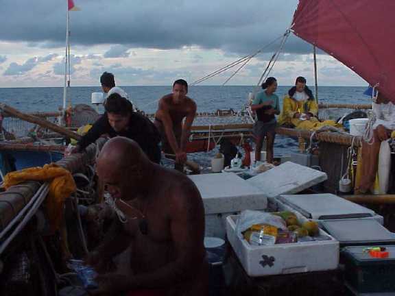
Today, the crew gathers at the canoe to load fresh produce. Over the rail, gifts from the people of Tautiura, come bananas, mango, limes, coconuts, vi (a mango-like fruit), grapefruits... We stow onions and ginger in netting along the port and starboard navigators' platforms. Pomaika`i Bertelmann and Dr. Ming-Lei Tim Sing check out the galley - a two burner propane stove in a fiberglass box on deck - and inventory basic staples.
Ming and Pomai at the galley
Mike Tongg briefs us on radio procedures.
Mike
Joey Mallot, Kaui Pelekane, Kona Woolsey and Snake Ah Hee lash spare booms along the port and starboard catwalks.
At six thirty p.m. we meet aboard the canoe. Nainoa tells us we may depart tomorrow if the wind shifts, but more likely on Thursday. The latest weather reports from both French and American meteorologists agree that the wind north of Rangiroa, beginning on Saturday, is likely to be 20 knots out of the east - reason enough, he explains, to leave on Thursday even if at the end of Kama Hele's towline. A Thursday departure will also give the navigators some moonlight when we reach the vicinity of Hawaii so they may see the nighttime horizon and more easily judge a star's altitude - the key to latitude.
“If we wait here too long,” says Nainoa, “the moon will be too small to see the horizon. We want to be in the latitude of Hawaii on the 25 th when the moon will be up at 11:30 .”
And when we reach three degrees north - the usual address of the Intertropical Convergence Zone (the doldrums) - the moon should be full, a guide to direction even under heavily occluded skies.
"But right now there is no convergence zone," Nainoa tell us, “because the low to the South is pulling the southeast trades around more to the east.”
The convergence zone is usually marked by the meeting of two massive wind belts--the NE and SE trades--in a broad zone near the planet's belt tine--the equator. But partially because of the effect of the low to the south--pulling the winds down to it--there is virtually no convergence. To the north of Rangiroa we should encounter steady easterly winds to power us all the way to Hawaiian landfall.
Wednesday, February 02, 2000
Dogs sleeping in the shade of their houses, pant rhythmically. Even at complete rest, under the tents that shade Hokule`a's decks, sweat sheens the skin of her crew and darkens their tee shirts. Chad runs an abbreviated meeting--explaining that we plan to raise anchor tomorrow morning and move to a pier near to Tautira's school where prior to departure, we will invite the children aboard and, later perhaps, the families who have so generously hosted us. At the conclusion of simple departure ceremonies we will set out for home--given, of course, that all these plans ultimately depend on the weather and other variables not under human control.
At nine a.m., precisely on schedule, Kama Hele glides through the entrance to Tautira's fringing reef and drops anchor a few hundred yards from Hokule`a. Maka welcomes her with warbling blasts from his pu. With Kama Hele's arrival it seems like now, finally, all is ready for our departure.
Thursday, Feb. 3 Sunrise/Tautira
The white "bread truck" threads its way through the streets of Tautira, honking its horn. Women emerge from trim bungalow or ranch-style houses, cross lawns rimmed by hibiscus, and take delivery of slim baguettes-the Tahitian breakfast staple. There are puddles in potholes where roads are dirt-evidence of another early morning downpour. At the thin strand of the beach near Tautira's man-made boat harbor Nainoa, Bruce, Chad and Shantell gather once again to study the clouds at sunset. "What do you see, Shantell?" Nainoa asks after another group has had time to assess the evidence of weather presented by the brightening skyline.
"The clouds are towering," she says, "so the wind is light."
"What direction?" Nainoa asks.
"If you face North I can see the clouds moving," she says, "so the direction is probably northeast."
"Right, but slow, yeah?"
"Yes," Shantell agrees.
The light northeast winds will make it difficult for the canoe to make any progress toward Makatea--her first landfall after Tahiti. The navigators huddle to discuss the situation. The rising sun disappears behind a dark smudge of cloud and sends spears of light down to meet the rippled water of the lagoon. A fishing boat exits the harbor and picks up speed, heading east.
"I feel the pressure of our schedule to return to Hawaii," Nainoa says, "but the wind is light, we might not be able to make it to Makatea. We should think of what is best for the experience of the young navigators and the canoe. My instinct-from having watched the changes since Sunday-is that the wind will continue to get better. "Mau always taught me that you don't decide when to go, the weather tells you when you go, so I think we wait."
So we will not depart today for Hawaii but neither will we be idle. Hokule'a and Kamahele will weigh anchor to move over to a place near Tautira's school for an educational session and then set sail for a few hours to provide a Bishop Museum/Olelo film crew an opportunity to gather video material for an educational program. Then, in the afternoon, canoe and escort will return to their moorings to await a favorable wind shift. We are disappointed not to be on our way but, at the same time, glad for the opportunity to spend one more day with our Tahitian families.
Feb. 4, 2000--Lessons in Navigation
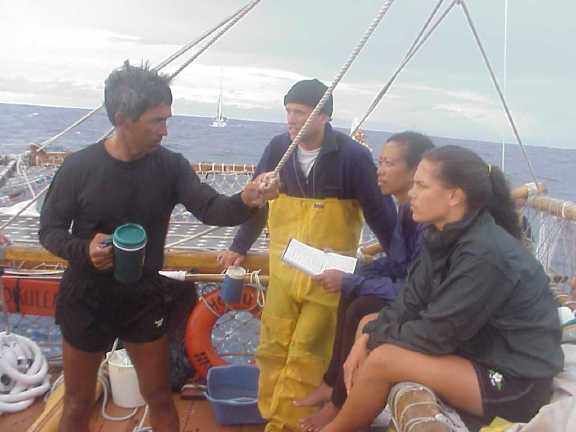
For the last week, Hokule`a's student navigators--Shantell Ching (the principal navigator) and Ka`iulani Murphy and Kahualaulani Mick (apprentice navigators)--have been meeting with Nainoa at his house in Tautira village. The meetings are designed to be collegial but the distance between the teacher and the students, even though they are the best of friends, is often apparent.
Nainoa, Shantell, Ka'iulani, and Kahualaulani Plotting the Course to Hawai'i
Much of the teaching comes in general principles presented by Nainoa through questions--like this one: "Suppose you think that you are 9 degrees South by your dead reckoning and you measure Kochab cross the meridian 6 degrees above the horizon--where are you?"
The students knew that a meridian altitude of 6 degrees translates to a latitude of 10 degrees South and they understand that Nainoa is asking them which method of determining their position should take precedence--dead reckoning or star sights? Are they at 9 degrees South as determined by their dead reckoning or 10 degrees South as determined by the altitude of Kochab?
There is a long silence--eventually Nainoa breaks it.
"When you get a good star measurement I'd trust it. Start your dead reckoning from the point indicated by the stars--in this case 10 degrees South."
"Here's another question," Nainoa says "Can you use Kochab as a latitude star even if it does not cross the meridian?"
Normally, the altitude of a star is taken when it does cross the meridian when it reaches its highest or lowest point as it circles the celestial poles to estimate the latitude at which the canoe is at. Unfortunately, during the first few weeks of our voyage, Kochab, a latitude star, will cross the meridian at its highest point after the sun has risen so it cannot be observed at that time. On February 5th, for example, Kochab's meridian crossing is at 6 a.m. or 0600 as sailors like to say it.
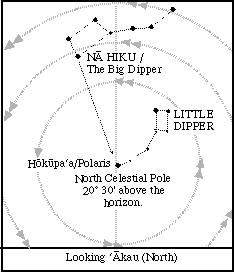
The Little Dipper, with Kochab as it brightest star, circles Hokupa‘a, the North Star in Hawai‘i. Kochab crosses above and below Hokupa‘a. On the way to Hawai‘i from Tahiti, with Hokupea‘a below the horizon, Kochab crosses the meridian at its highest point and is visible just above the horizon (and higher and higher each night as the canoe sails north, a clue to latitude.
Using a computer program that replicates the motion of the stars across the night sky as well as during long sessions with Will Kyselka in Bishop Museum's Planetarium--Nainoa watched Kochab cross the meridian time and time again. In this way he repeated the process used by ancient navigators--years of patient observation--but he was able, with the use of modern technology, to speed it up. He carefully measured the altitude of Kochab at meridian crossing and an hour before it crossed the meridian and found that the difference in altitude was only a quarter of a degree. "And that's not measurable with the naked eye," Nainoa says, "so yeah, you can easily use Kochab at 5 a.m. to get latitude."
Next, Nainoa steps through a series of more simple problems. When, for example, is it best to hold navigational meetings at sea to assess our position? At sunrise and sunset because without clocks these are easily observable times of the day.
What to do if sailing into the wind and inexperienced helmsmen are having trouble steering an accurate course? Trim the sails and move weight around on the canoe so she steers herself.
How to determine the amount of leeway of steering error due the force of the wind on Hokule`a's sails? Watch the angle that the canoe's wake makes with her hulls.
How far away can you see landfall? It depends on the height of the island and, of course, the visibility. (A high island like the Big Island of Hawai'i--13,789 ft. high--can be seen from over 100 miles away; an atoll, on which the highest points are the top of coconut trees, can be seen from 8-10 miles away.)
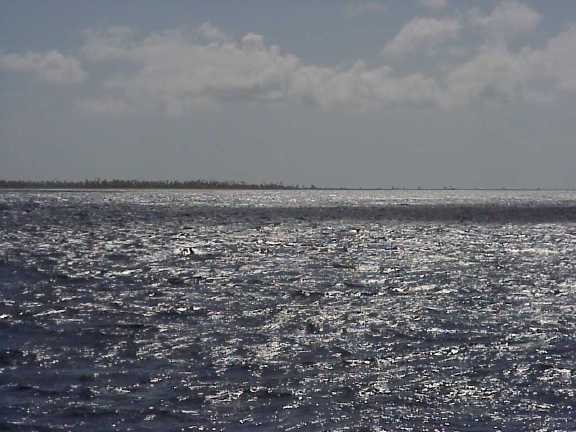
Tikehau atoll
How can vog be helpful in finding the Big Island? If you see it, you are downwind of the island.
What is the overall current effect in the doldrums? None, because the currents are too variable to predict.
Nainoa's probing questions and his presentation of various scenarios are often accompanied by stories--a sharing of mistakes he has made with the obvious intent of indicating that navigation is, after all, a process of learning in which there is much trial and many errors. Take the case of sighting the Big Island at the end of the 1995 voyage, for example: "We were making our approach at night," Nainoa says, "and I was pretty confident that we were getting close but all I could see ahead were layers of light pink shading to purple then black. We couldn't see the island because of all the vog. Snake saw something glowing ahead. A fishing boat? We couldn't tell. It was a moment of panic. All of a sudden Snake said, "Hey, I think it's the volcano." It will be like that, you go through moments of panic and even hallucination combined with moments of intense insight."
The training sessions between navigator and students usually last for an hour or two after which the navigators either study together or by themselves to memorize the stars or various "formulas" for determining leeway, or current set, or go over their mental maps of the course to Hawai`i.
"Don't forget that this should really be fun," Nainoa told them at the close to one meeting this week. "Don't lose your excitement and your instinctual sense of knowing by too much studying. You have each other--remember that. I look forward to seeing you huddling together trying to figure things out. And don't worry. I won't let you do anything foolish but I also promise you, that I will let you do this trip--as much as possible--on your own."
Feb. 6, 2000 / Dawn--A Squally First Day at Sea
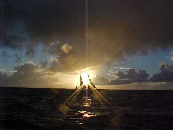
The winds, having been on vacation from Tahitian waters for almost two month, returned--with fireworks.
Yesterday after an emotional farewell ceremony, Hokule'a raised anchor early in the afternoon and passed through the reef at 2 p.m.
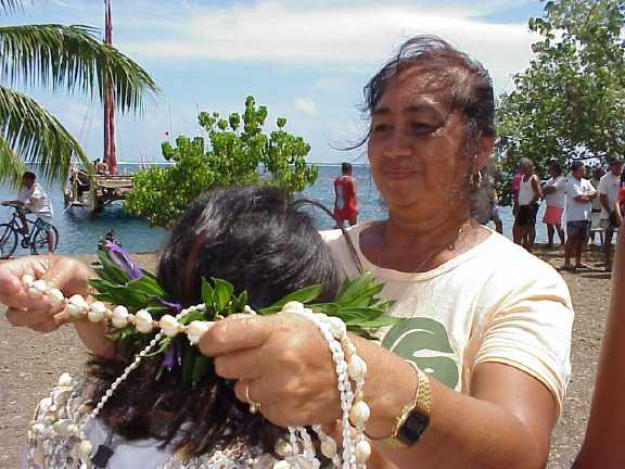
Tereraura says goodbye to expedition doctor Ming-Lei
While we were still close to the island, the winds were gentle--5-10 knots. As we released the tow line and were raising our sails, a bolt of lighting struck through the clouds at a low peak over Tautira. A few seconds later we were all jolted by a sharp crash of thunder and some crew members reported feeling an eletrical charge in their hands while they were coiling the halyards.
As Tahiti begins to drop lower on the horizon, the wind accelerates and swells pucker the ocean, passing under the canoe. Hokule'a leans against her lee hull and plunges forward--her responses slowed by the heavy load she is carrying.
All around the darkening horizon, too far away to hear thunder, lighting illuminates tight knots of clouds--squalls moving from east to west in the trade wind flow.
Nainoa divides the crew in half--five hours on watch and five hours off, to allow the maximum number of people on watch--a standard procedure in squally weather. The crew has to close up the sails when a squall approaches to prevent wind damage to the rig or the canoe.
First day out on our way home to Hawaii. Hokule'a is being steered by Nainoa who is showing Ka'iulani and Shantell some of the nuances of steering in variable winds ranging from 10-20 knots.
Squalls assemble to the east and rush toward us. We take in sail and roll in the troughs of waves, opening our sails again when the squalls has passed. The night is moonless and dark, concealing approaching squalls. We have to listen for them, watch carefully when the horizon is momentarily illuminated by lightning.
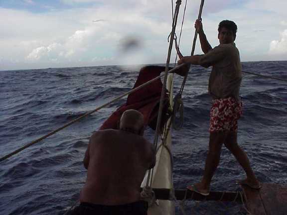
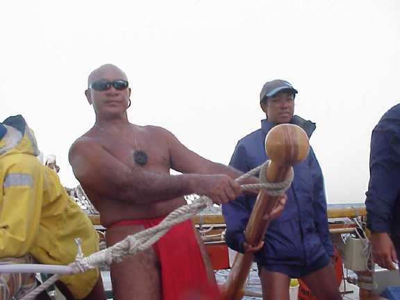
In the afternoon and evening the wind increases to 20 knots from the E-SE gusting from 40-45 knots with occassional squalls. The crew is forced to take in sail and heave-to about ten times on the first day at sea. Here Tava and Bruce change out a light wind to a heavy wind jib.
A little before midnight, Nainoa orders all sails brailed up and the jib taken down. A few moments later, we are shaken by 40-50 knot gusts driving rain and horizontal strata of water across Hokule'a's deck. A few waves crash aboard. Hokule'a shakes them off.
One such squall hits in the evening watch, another in the morning. By sunset the crew has been forced to close sails at least a dozen time. "If we hadn't closed the sails in time when the big squalls came through, we would be in some difficulty," says Nainoa.
At dawn, Shantell and Ka'iulani meet with Nainoa to report on the navgation: 72 miles from Tahiti. 52 miles to Makatea. "We should see Makatea in about 8 hours. After that, perhaps Mataiva." Nainoa reponds: "We have to be careful about approaching Mataiva. We can't see it at night, so figure your sail plan accordingly."
It's been an uncomfortable first night at sea. But everyone on the crew is doing well, working together wonderfully. We are looking forward to better weather today as we sail toward Makatea, a raised atoll between Tahiti and Rangiroa.
Feb. 7, 2000; 2 days since departure
At 4 a.m. comes the order to get under way--we had stopped sailing for six hours last night to wait for enough light to see our way through the dangerous low atolls of the Tuamotus. And what a night! We watched Orion pursue the Pleiades almost directly over the mast, as the Southern Cross arced upright and the Scorpion rose from the sea.
"I think the islands are right there," Nainoa says to Shantell this morning, gesturing toward the horizon where a rosy haze of clouds rises thousands of feet into the sky. "The eastern swell is gone. Something is blocking it. It must be the Tuamotus --Rangiroa is 40 miles wide."
We are reaching the end of the first leg of the trip--from Tautira to the Tuamotus. It has allowed the three student navigators to test their skills. If they can find their way through the Tuamotus, they can begin the next leg north to the doldrum zone with more confidence.
Yesterday the wind settled down out of the east and blew steadily at 10-15 knots. The squalls have disappeared.
We hoped to see Makatea in the late afternoon on Sunday, but the winds forced us to the west, so we passed the island unseen below the horizon. Not being able to sight Makatea as a stepping stone makes the navigation less certain. "But it's a good lesson," Nainoa reminds the three student navigators. "You often can't steer an ideal course, so you have to make changes in your mind all the time."
At the sunset navigator's meeting last night, Nainoa posed three questions to his students: "How many miles from Tahiti were we at 6 p.m. today? What is our latitude? Where are the Tuamotus and what is your plan for approaching them?" Earlier Nainoa, Bruce, and Chad concluded we were 30 plus miles west of Makatea and on a course and heading to intersect Mataiva during the night. "There is no moon and a little salt in the air, so it'll be difficult to see Matativa, even though there are plenty of trees on it. We should probably heave to around 11 p.m. tonight and wait for six hours, then set sail and go through the Tuamotus during the day."
Shantell, Ka'iulani, and Kahualaulani, calculate that between sunrise to sunset, we sailed 124 miles toward Na Leo Ko'olau (NNE). Makatea lies 124 miles from Tautira in about the same direction, so the canoe should be at the same latitude--15 degrees 50 minutes S. The winds pushed the canoe off the reference course to the west--32 miles west, they calculate. "So we are about 50-55 miles from Mataiva," Shantell reports to Nainoa. "Good, your dead reckoning position and mine are about the same, but I think we are about 49 miles from Mataiva." They agree that we should sail 25 more miles and heave to, then wait till just before sunrise to sail through the Tuamotus.
During the evening the wind shifts, and we sail NE, Manu Ko'olau, so this morning we sight Tikehau rather than Mataiva, and keep sailing. Before noon the atoll sinks into the ocean behind us and we trim our sails for the long voyage across an empty sea to Hawai'i.
Sighting Tikehau at dawn
Feb. 8, 2000; 3 days since departure / Calm Seas
A double rainbow frames Shantell, Kahualaulani, and Ka'iulani as they sit on the port navigator's platform considering Hokule`a's progress from sunset to sunrise, behind them Kamahele gleams, stark white sails and hull, against the towering cumulus clouds that ring the horizon. The clouds rise to about 10,000 feet and bend away with the impulse of a eastward moving upper air stream to form a swirling parasol above the escort boat.
"How did we do?" Nainoa asked Shantell at the morning navigators' meeting.
"We went an average of 5 knots for the 12 hours, heading haka."
In response to this report from his navigator Nainoa simply smiles and nods his head.
A slight adjustment was made yesterday when we departed Tikehau. The reference course, the imaginary geographic line along which the east-west position is plotted, was altered to begin at Tikehau --25 miles to the west of its former beginning point at Rangiroa. "This means that we have to keep those 25 miles in mind as we approach Hawai`i," Shantell explains, "and remember that our cushion for sighting land has been reduced from 275 to 250 miles."
The cushion Shantell speaks about is the distance to the east from the Big Island to where Hokule`a's reference course intersects the latitude of Hawai`i--the point where the navigators will turn the canoe west to begin their search for the Hawaiian islands.
"We always approach the islands from the east because it is relatively easy to determine our latitude and because it's much easier to search with a northeast tradewinds behinds us then tacking into them," Nainoa explains.
So the end game strategy goes like this: Hokule`a sails northeast from Tahiti across parallels of latitudes from that of Tautira, 17 degrees 44 minutes south, to that of the center of the Hawaiian islands, 20 degrees 30 minutes north. Using the stars, it's relatively easy to judge latitude to within a degree or so--about 60 miles --so the navigators guide Hokule`a to a rendezvous with 20 degrees 30 minutes north latitude and then turn west to begin their search. But if their dead reckoning is in error and they are already west of Hawaii, they would be searching empty ocean. Next stop Japan. Hence "the cushion." By steering from Tahiti toward a point 275 miles to the east of Hawai`I, the navigators provide a large margin for error in their ability to reckon longitude (their position east and west of the islands) by dead reckoning.
Yesterday we encountered the remnants of an upper level disturbance that occasionally descended to the surface, bringing squalls--one of them long enough for the crew on watch to take fresh water baths.
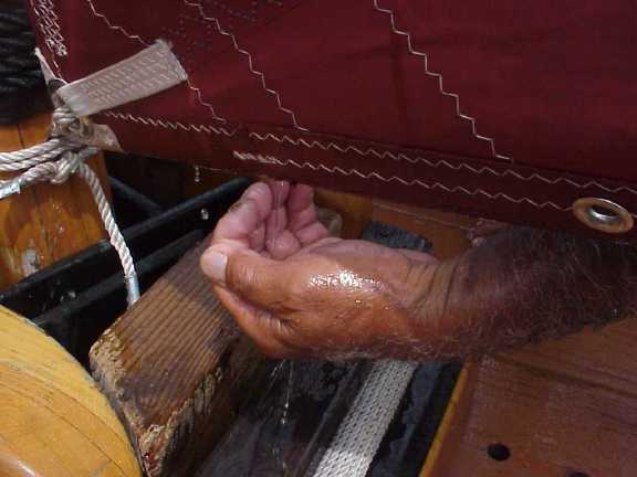
Life-giving Water of Kane: Tava gathers a handful of precious fresh water from a passing squall
The mid-day sun was hot, forcing the crew to seek shelter in shade pools cast by Hokule`a's sails. The tradewinds are now clearly established and we are moving along at a steady 5 knots.
Snake napping in the shade
Yesterday evening was another beauty, the horizon smudged with low clouds illuminated by an occasional flicker of lightning and the sky dome clear except for wisps of fast moving clouds.
"It's so beautiful out here tonight," Bruce says to the crew on watch, "and it's really difficult for me to explain it to my friends back home. You've just got to experience it to believe it."
The moon is a tiny upturned sliver, in a phase the navigators call hoaka, the second day since it was new and the sky was absent its sheen. With the moon almost aft our port beam, we steer northward toward Capella's pointers. The Milky Way is a glowing ribbon overhead which is matched by phosphorescent sparkles in our wake stirring up hundreds of darting squid. We are on a beam reach and a steady easterly wind and under these conditions Hokule`a will wander when asked to steer herself, so the giant center steering sweep is constantly manned. Kau`i relieves Tava on the sweep and aligns Hokule`a with the setting moon on our port beam. The sweep is angled to port by a simple device--a rope tied from its terminal knob to the safety railing along the deck. Kau`i partially sits on the sweep and partially leans against it applying weight to lift the blade from the water. Standing up she allows it to lower into our wake and steer us off the wind. Her motion becomes a kind of graceful dance. In choppy seas, the paddle undulates harshly--kicking back against the body of the steersperson; in relatively calm seas, its motion is gentle.
Wednesday, February 09, 2000--Light Winds
Yesterday (Tuesday, Feb. 8) we woke up to what seemed to be solid East winds accompanied by typical tradewind cumulus and we sailed well, working North for half a day.
Sunrise, Feb. 8
"In the afternoon we saw a large towering cumulus to the North," says Nainoa, "which indicated a probable breakdown in the trades."
Later in the afternoon squalls started to come through with a lot of rain but little wind. We had three squalls before sunset. After each of them there would be either no wind or a little wind but from the North so we would move for a time and then stall in our tracks, a pattern that Nainoa calls "jump sailing."
The pattern continued into the evening and morning of today, Wednesday--and at about 11 a.m. we remained virtually stalled in very light winds.
Shortly after sunrise a crew meeting was held aboard the canoe. Shantell presented today's navigation report: "We were at 10 degrees, 51 minutes S at sunrise," she says, "at about 10.5 miles W of our course line which is pretty much right on it. Everyone is doing a really good job of steering and in spite of the setbacks from the squalls we are doing very well."
At noon, Nainoa orders the largest sail possible bent on for the mizzen to take advantage of what little wind there is and we fix awnings over our decks to protect us from the blasting heat of this almost windless day.
Kona and Kau'i help put on a bigger sail for light wind conditions.
Thursday, February 10, 2000--Slow Going
Ua hala ka `ino, ua kau ka malie ("The storm has passed, calmness is here.")
It may begin with a rustling of the wind and then a fluky quality to it. The wind becomes restless--haunting. Then it begins to pulse. At night there might be a thickening in the darkness, a blotting of stars, then a dark line and, beneath it, a froth of white. The squall, approaching, seems to fan out--send out scouts first, then deploy its main body in a flanking maneuver, or it may rush ahead as if to harmlessly cross our bow then stop and lurk allowing us to sail up to it. Now the squall moves toward us, gathering mass, swelling, rising higher, pumping itself up and becoming something altogether more sinister than a mere thickening of the night, a thing, what to call it? A monstrous dark blob out there with malevolent intent.
Rain may proceed the wind which finally arrives accompanied at first by a deep whooshing sound--still distant--and then a moaning and the thumping of rain on Hokule`a's decks and the higher pitch of the rain as it strikes our canvas half-tents.
Way before all that has happened Nainoa will have climbed onto the Navigator's platform or ascended to the safety rail, standing with one hand on the rigging, examining the squall's intent. After a time, depending on the signs he detects, he will give the order to stand by the sails. The crew will disperse to their stations--three forward to take in the jib, four to the mizzen, which is the largest sail and so the one taken in first. One crewmember is at the sheet to loosen it; another at the clew to carry the sail forward as a third hauls down on the railing lines to pull the sail tight against the mast. The sheet is always paid out slowly to keep the clew from flapping in the wind and striking one of the crew.
We have experienced a range of squalls on our voyage--from the violent one on the first day with blasting winds accompanied by rapid bursts of lightning all around the horizon to Tuesday's downpour in almost still air. In the first squall the rain crossed the deck horizontally, in the second it was almost vertical.
"You have to watch the squalls carefully," Nainoa says, "if you see one coming to starboard, for example, you want to sail up to the last minute to let it go astern if possible because if it crosses in front of you it blocks your passage. A squall can create a kind of vacuum behind it in which there may be no wind for hours at a time. But, on the other hand, you don't want to wait too long because then the squall will hit you and it can do damage to our rig or endanger the crew. The first principle aboard this canoe is safety."
So far this voyage has been an interesting lesson in weather for everyone on board. We have experienced the gambit, from constant squalls (ten in a single day) to torrid days in which the sails hang limp and useless and the sun--in this windless world--is hot enough to be almost dangerous. It is as if we have sailed into some misplaced doldrums zone or into the aptly named "Horse Latitudes" at 40 degrees N or S where a constant high pressure area creates listless winds and the horses--carried aboard the ships of, for example, the Spanish Conquistadors--began to die of thirst.
From his office at the University of Hawai`i Bernie Kilonsky has a unique view of our situation--from space, using sophisticated computer imaging and models. He tells us what he sees via single side band radio transmission every day. Today, accompanied by wheezing static, he says: "I see an upper cloud layer thick to the S of you all the way to 20 degrees S--solid--but there are no organized storms in it. It's lucky that you left when you did, the convergence zone is settled solidly over Tahiti right now. If you were there it would be a long time before you could leave."
Bernie's computer model shows that we should be experiencing winds a little S of E at about 10 knots, but Nainoa reports to him that at the moment there is virtually no wind here. This situation appears to be a meteorological anomaly which neither Bernie or Nainoa can explain.
All decisions are made aboard the canoe, of course, but the ability to consult with Bernie provides an important measure of safety. Bernie consults daily with his colleague Tom Schroeder at University of Hawai`i's School of Ocean, Earth, Science and Technology as well as with meteorologists at the National Weather Service--organizations that have been providing what Nainoa calls a Weather Safety Net for the last 20 years.
"In general," Nainoa explains, "it is not rare to have light, easterly winds in this part of the South Pacific at this time of the year. It is normally better to sail in June from Tahiti to Hawai`i, but we are sailing now because this voyage was planned to take advantage of the weather in Rapa Nui. At this time of year the high pressure systems which cause the trades tend to be weaker and so the trades are lighter."
"The trough over Tahiti compounds our problem," Nainoa continues, "there is a lot of convection in it--rising moist air--which tends to pull the weak trade winds down into it, sucking the wind south toward it and shifting the winds that normally blow from the E to blow from the NE--and that's where we want to go."
The local pattern so far is for the rising air caused by the heat of the day to diminish the trades--stalling us. At night as the Earth cools, the convection dies down allowing the weak trades to reassert themselves. So, under the stars, Hokule`a makes her way slowly N while under the sun she and her crew endure--wait patiently--for the cool of the night.
February 11, 2000; 6 days out of Tahiti, forecasting weather by observing the clouds and sea state.
View from Hokule`a's beam--towering cumulus clouds:
Nainoa Thompson: "A Navigator always looks for signs of weather at sunset and sunrise," Nainoa says. "Generally, at sunrise and sunset you try to predict the weather for the next 12 hours. Today I see strong evidence in the clouds of a change in the weather from what we have experienced in the last 2 to 3 days. Looking to the east--off the beam of the canoe (this is picture 1) I see various complicated towering high cloud masses, which are the remnants of the squalls that we went through last night. Yesterday and the day before I looked out and saw actual squalls there--today there are no squalls evident. You can't really predict the weather, as Mau taught me, from a single snapshot like this. You have to observe changes over time. In this case, I see a change from seeing squalls off the starboard yesterday to this view today where there are no active squalls. The wind definitely feels stronger today and I can see wind wavelets on the surface of the ocean. The wind is also coming from the normal direction of the SE trades, so I can presume that the trades are reasserting themselves."
View towards the bow of the canoe from roughly dead ahead to 45 degrees off the bow:
"I see a lot of low level cumulus clouds ahead of us in the direction we are moving. There are no indications of any squalls in those clouds so I think I can predict we are approaching an area of clean flowing wind--trades from the SE--which will be steady. That is quite different than the variable winds we have been experiencing. So, for the next 12 hours, I believe that the wind will remain steady from the SE at a fairly constant speed, maybe 10 knots, so we will be able to sail N today."
"Every time I attempt to predict the weather or sail on this canoe I am constantly reminded of how smart our ancestors were. My understanding of nature is feeble compared to theirs. We can have today only a glimpse into their world--into the strength and courage that made them the greatest navigators and explorers on earth. We sail in comfort with foul weather gear to protect us on a canoe partly made of modern materials, with all kinds of safety devices on board. They had none of that. They were attuned intimately to nature in a way that we cannot be. At best, our voyages are just beginning to give us a glimpse into their world."
February 11, 2000--Moving Again; 6 days since departure
After breakfast every day, as the sun rises off the starboard beam, Nainoa calls a crew meeting. We generally assemble slowly--finishing chores already begun, on this day, for example, Pomai puts away galley utensils as Tava finishes washing dishes and buckets laid out on deck. Nainoa patiently allows the natural morning rhythms to complete themselves so that we are all ready to listen and exchanges ideas with each other.
Morning watch
Shantell Ching presents the Navigation report: "Our estimated position at sunrise is 10 degrees 11 minutes S. We had a good sailing day from sunrise, February 10th to sunrise, February 11th--76 miles N. We made up some easting and are now 16 miles W of our course line. We still have 2200 miles to go. We will try to hold Na Leo/Na Lani--2 _ houses E of N. Last night we got a fix on Kochab giving us a position of 10 degrees 30 minutes S. Our dead reckoning position is 10 degrees 11 minutes S, so the two are in pretty close agreement. We are doing great."
The calm days we have experienced in the last few days have actually been somewhat of a blessing--except for the heat, which is largely diffused by the twin shades over our decks.
Joey Mallot setting up a tarp for shade.
We've been able to take time to get to know each other better--to talk story, sing songs--at least some of us--and even try our hands at cooking a special meal.
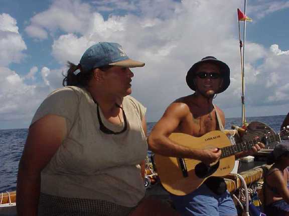
Pomai and Kahua – Kanikapila
Last night Mike cooked fish (not fresh, unfortunately but a gift from Kamahele's freezer chest) taro, rice, fruits and a mix of spices, which he will not reveal. We wash clothes--Hokule`a's rigging is festooned with T-shirts, pareos, whatever. We read. We talk to our families via single side band phone patches and we talk to various school classes by satellite phone. We fish--but at this speed there is little chance of catching anything--and we plot ways to scoop up the schools of squid we have encountered almost every night. We take photographs and write in our journals. And that's just our recreational activities--activities that we actually have no time for when the wind is blasting.
When we are sailing hard there's much more effort extended in the basic chores of carefully steering the canoe, navigating, pumping the bilges, trimming sails and taking in and letting out the sails in squalls and all the other normal tasks associated with crossing 2400 miles of open ocean to find land.
Are we bored by the constant empty horizon, the repetitive path, and the--as it sometimes seems--slow moving passage of time? Hardly. There is always something to do, and we are always doing it with good friends.
All day yesterday was basically windless. We made perhaps a knot an hour maximum through the water. Sunset brought cooler air and a slight breeze allowing us to sail towards the N at about 4 knots. Today with the wind increasing we are steering Haka Ko`olau--one house E of N at about 5 knots.
Feb. 12
Sailing at sunrise
Tava and Shantell steering
Feb. 13, 2000 Sunrise
Dawn reveals a dark slate gray ocean, confused swells, white caps and a complex sky-veined and roped with clouds of all descriptions.
Nainoa goes over navigation with his students Kahua, Shantell, and Ka'iu, Sunday Morning, February 13. After a hard night of dodging many squalls, the navigators discuss their position. Because the night sky was almost totally clouded over,they had no opportunity to observe the stars, so they must estimate where they are by dead reckoning--averaging various headings, speeds, and deviations from their course.
It's as if mother nature had dug deep into her laundry bin to wash and hang out to dry every variety of cloud she owns. The canoe sails Naleo/Haka Ko'olau (one & two houses east of north) at 5 knots in a 10 to 15 knot wind from La Ko'olau (one house north of east). This morning the navigators estimate we are 40 miles to the west of our reference course at 7 degrees 16 minutes south lattitude.
We continue to deviate west of our ideal course due to the winds which are blowing from the north of east , forcing us to steer off to the west. "At some point we know we will have to make back the distance we have lost" says Shantell Ching, " but we want to continue moving north as efficiently as possible and to do that we are willing to deviate a little from our course line". During the day yesterday we went 43 miles and during the evening, in spite of many harassing squalls, we made good 37 additional miles toward Hawai'i.
Sunset
The dense clouds that have been following us now receeded far astern behind the gently swaying running lights of Kama Hele. Overhead, the sky dome is clear where the half moon now presents itself above our masts at sunset. The wind is cool. The crew don t-shirts and jackets as they go on watch. Tava, leaning against the aft safety rail says, "... going to be a nice night."
At 6 p.m., our navigators conclude we are at 6 22' S latitude and 58 miles west of our course line. Having sailed 54 miles since sunrise, we are now about 1880 miles from Hawai'i. Among the celestial clues we use to steer our course are: Mars, setting in Komohana (west); Jupiter and Saturn setting in La Ho'olua (1 house north of west); and Venus rising in 'Aina Malanai (2 houses south of east).
Tonight the navigators will pay particular attention to observing two pairs of stars: Murzim (a star near Sirius or A'a) and Alhena (in Gemini); and Saiph and Betelgeuse in Orion. During his painstaking observations of the stars in the Bishop Museum Planetarium, Nainoa discovered a variety of star pairs that appear to set simultaneously when the observer is at a very specific latitude. He calls this phenomenon "synchronous setting." Mirzim and Alhena, our first pair - and Saiph and Betelgeuse, the other pair both set simultaneously at only 6 S.
"We will be looking carefully at both star pairs tonight," Shantell says, "because we think we are about 6 S and so if they do set simultaneously, it will help confirm our dead reckoning position." In fact, the navigators have been mentally plotting their position through dead reckoning ever since departing Tikehau without a solid celestial observation as a reality check.
"Ideally, you only navigate by dead reckoning for about 360 miles when making a passage from Tahiti to Hawai'i," says Nainoa, "but because we have had so much bad weather we've been dead reckoning for about 750 miles and that's not comfortable. So I'm looking forward to getting some good celestial clues by looking at the star pairs and also observing Kochab or Holopuni."
During the morning navigator's meeting shortly after sunrise on Valentine's Day, the navigators report our position as 5 27' S, 68 miles west of our reference course line.
"We observed the two star pairs setting at the same time last night," Shantell says, "so we are pretty confident of our latitude. We are also pleased that our latitude estimates by dead reckoning are very close to what the stars indicate which give us additional confidence about our position."
Feb. 14, 2000; 9 days out of Tahiti, Road to the Wind
Nainoa Thompson: "Mau taught me to call clouds that look like this "the road to the wind." Imagine at the far horizon there is a factory producing the clouds and, like smoke from a haystack, they follow the wind. This road indicates the wind is coming from the horizon. and because the road is straight, the wind is steady. If you see the road curve--it means that the wind direction will change and the way it curves will tell you the new direction. It is interesting to me that meteorologists call this kind of phenomenon "cloud streets', pretty close to Mau's term "Road of the Wind."
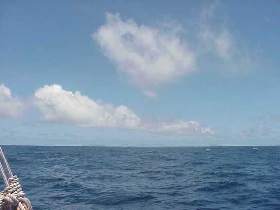
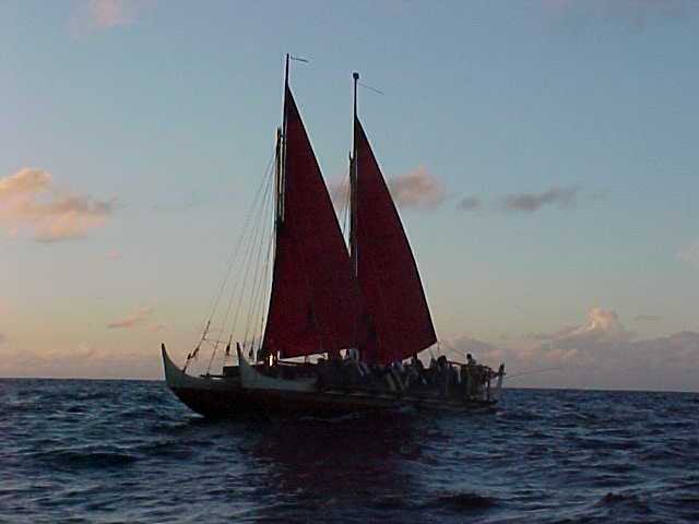
Hokule'a Sailing in 10 knots of wind under clear skies
Feb. 15, 2000; 10 days out of Tahiti, Light Winds and Fair Weather Ahead
Nainoa's view of the sea at sunrise, and what he sees in the shape of the clouds:
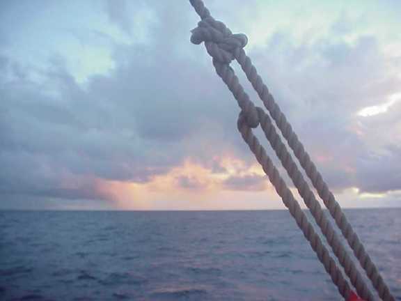
"The sky where the sun is rising is very clear--I don't see any smoke (which is caused by strong winds stirring salt into the atmosphere)--so I think the winds will be relatively light today.
"Ahead of us, I see two squalls, but there are no squalls beyond them so we should have good weather once we pass through them."
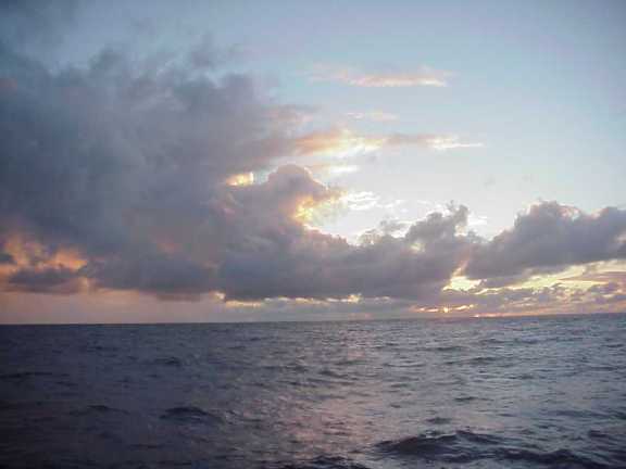
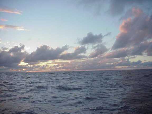
Feb. 15: first catch – a small aku
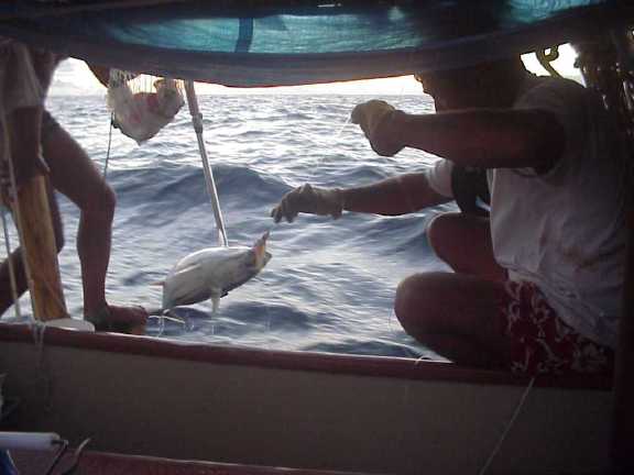
Hokule'a fisherman Bruce Blankenfeld pulls in a small aku
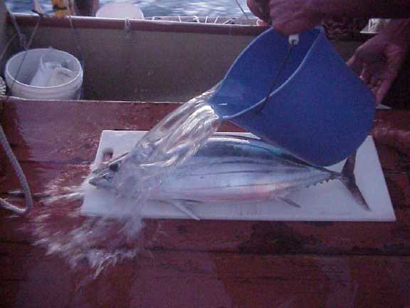
Feb. 16; 12 days since departure
Yesterday at sunset Tava mans the steering sweep. Chad stands next to him carefully assessing Hokule'a's speed. Together they hunt for the most efficient angle to the wind. We are once again steering the canoe around the clock, seeking to head as close as possible into the wind that keeps shouldering us west of our desired course line. The wind blows from Noio Ko'olau, 3 houses north of east (NE by E). We would much prefer a wind from Hikina or east, or better yet south of east, so that we may move back toward our ideal reference course. At sunrise on February 15th we were 60 miles west of our course line. At sunrise today we are 76.5 miles west of it.
As night falls, the glow of the screen of a computer perched atop Hokule'a's radio box indicates a big change aboard the canoe.
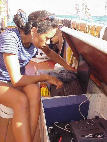
Kau‘i typing email
On all four previous legs of the voyage to Rapa Nui the computer has been aboard the escort boat. On this leg, to make it easier for us to carry out various educational programs, we have moved it aboard. Yesterday the demand was so heavy that the screen remained lit from 8 am to 8 pm. Chad wrote and sent off a feature article for the Honolulu Advertiser, Bruce sent a complex memo concerning the logistics of the upcoming 25th anniversary celebration, we processed and sent out photos as well as a daily report and an internet article. The system works well as long as we have clear skys and light seas. In heavy weather we will have to cut back on our transmission.
At about 8pm mid-level clouds slide over us, eventually erasing the stars from 3/4 of the sky. "it's a good sign," says Nainoa, " because the clouds are moving from due east so its possible we will see the wind shift back east but its hard to tell when."
During the rest of the evening, however, we continue to try to steer into a stubborn wind that flows from a direction a few house further north than we would like-and we often hear the familiar command "single up" from Nainoa-signifying that we remove the bridles from the main and mizzen so they are held in trim by only a single line-called a bronco-really to be brailed in quickly should a threatening squall pass over us. It is a command that we have heard countless times in the last eleven days of changeable weather and squalls.
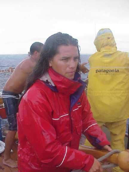
Ka'iulani Steering in a Light Rain Squall. Apprentice navigators Ka'iulani and Kahualaulani stand longer and more frequent watches than the rest of the crew--six hours on and six off.
At sunrise today, February 16th, with the decks sheened by yet another rain squall, we learn that our efforts at the steering sweep have paid off. The navigators report we are 76.5 miles west of the reference course today so we have only "lost" a mile and a half since sunset. "We are 723 miles from Tikehau and 1,667 from Hawai'i ," Shantell reports. Factoring in information provided by their dead reckoning estimates and an early morning observation of Holopuni ( Kochab) they estimate our latitude to be 2 degrees 58 minutes south.
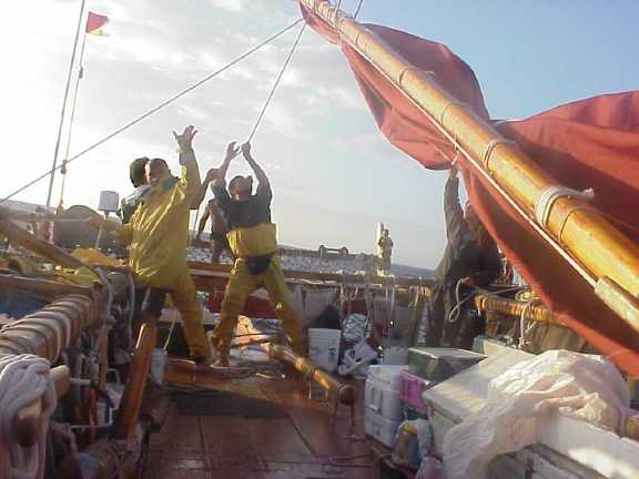
Winds are brisker: Lowering the rig to put on smaller salls
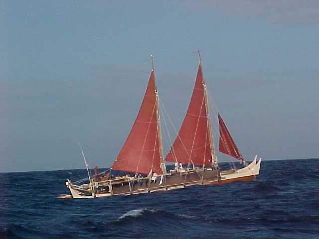
Feb. 17: Hokulea's sailing in stronger wind, choppier seas.
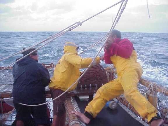
Pomai, Tava, and Nainoa adjusts the sheet lines as after a squall sweeps across the desk of the canoe.
February 17, 2000--A New Sail Plan
Dawn today found the crew in their slickers, as usual, after encountering a rain squall. The wind has accelerated to 15-20 knots from the ENE ('Aina Ko'olau). The canoe dances over swells with short wave lengths as the wind stirs whitecaps.
"Last night after we decided to let the canoe run free, the sky cleared and the wind began to accelerate," says Nainoa. "This morning we are making good time--rocketing home--and the canoe feels so good, so smooth and confident."
Just before sunset yesterday Nainoa called a meeting with senior crew and navigators and later, after dinner, with the entire crew to discuss a new sail plan. For the last three days we have been struggling to sail the canoe hard into a wind that blows from the ENE and in spite of our best efforts, we find ourselves being forced to the west of our ideal course line. On February 13th we were 35 miles west. During the next four days the numbers mounted 58 , 60, 75 and 110 miles. To make up the distance would require us to continually pinch into the wind, or perhaps even begin to tack. During last night's meeting Nainoa described a way out of this dilemma.
"We are west of our course line and getting more so every day. That is not the result of bad steering on our part, everyone of you has done an awesome job of holding a course. It's the northerly wind component that is driving us west. The canoe wants to sail free and we have been driving her hard to get back to our course line. We're not going to do that anymore. What we are going to so is target South Point rather than a point in the ocean 250 miles to the east of the Big Island. That will be difficult and it will require discipline from all of us--but it's a new challenge. It's exciting.
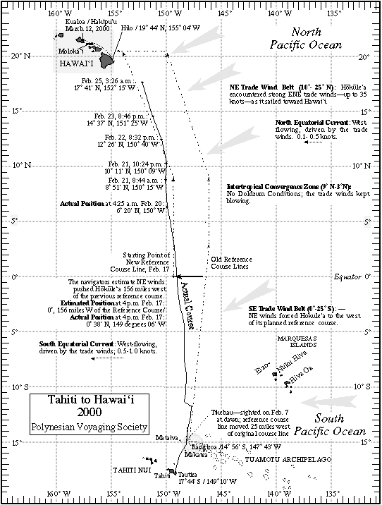
As Hokule‘a crossed the equator, the course line was shifted to the west
Ever since the first voyage in 1976, Nainoa went on to explain, the reference course has allowed for a large 'cushion' of error by targeting a point in the ocean 275 miles east of the Big Island at the mid-latitude of Hawai'i (20.5 N) where the canoe would finally turn west down wind to find landfall. During the last 25 years, the ability of Hokule'a's navigators to use a combination of dead reckoning and celestial clues to find their way over long ocean passages has improved to the point where such an ample cushion might not be needed. Taking that into consideration along with the fact that Hokule'a's present heading seems destined, it projected forward to bring her directly to the the island of Hawai'i--Nainoa decided to let the canoe find the most efficient way home by following a route that the winds allow.
"When we sailed to Rapa Nui, Nainoa pointed out, "we thought that the canoe was our instrument which we would use to reach land but we found our that in reality we were the instrument for the canoe to reach landfall. It's something that is difficult to explain. It's the mana of this canoe. When Max said that he saw land ahead on the day we found Rapa Nui I was a little bit in shock and denial at first. We had been sailing in squalls even worse than we have experienced on this voyage. I stayed back at the navigator's platform. I didn't believe it. Bruce had to come back and tug me to go forward--"There it is--it's there he told me.'"
"I'm not saying that we had nothing to do with finding Rapa Nui--far from it. We trained hard for 2 and a half years for that voyage and we chose a crew of intense, dedicated professionals to make that voyage and we worked every inch of the way. Now I want to do the same thing on this voyage.
This new sail plan will require more precision than any other previous voyage home from Tahiti and so Nainoa has asked Bruce and Chad to assume a more active role in the navigation as assistants to him as they did on the voyage to Rapa Nui.
"Shantell and the apprentice navigators will continue to plot our position and we will continue with our daily meetings, "Nainoa explained duringe the crew meeting, " but now Bruce, Chad and I will meet every day to come up with our own positions. We will not tell the student navigators where we think we are and the learning process will continue because education is still an extremely important goal of this voyage. So far the student navigation team has done extremely well. There is no reason to expect that won't continue. But the precision that is needed in this new sail plan-without the cushion-requires that the senior navigators, with me as principal navigator, step forward and take a more active role.
"I'm excited," Nainoa told us all at the end of the meeting. " We have a new challenge. It will test us all and it will give Hokule'a the freed om she needs to find her way home. Which seems to me to be especially fitting on this voyage which marks her 25th anniversary."
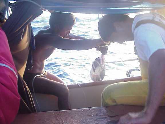
Nainoa and Bruce pulls in another small aku just after sunrise on Feb. 17.
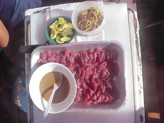
Ono! Fresh raw fish for breakfast!
Feb. 18, 2000; 13 days since departure; Crossing the equator into the North Pacific; new reference course
At 4 p.m yesterday, by Nainoa's reckoning, we crossed the equator after a day of sailing under mostly clear skies.
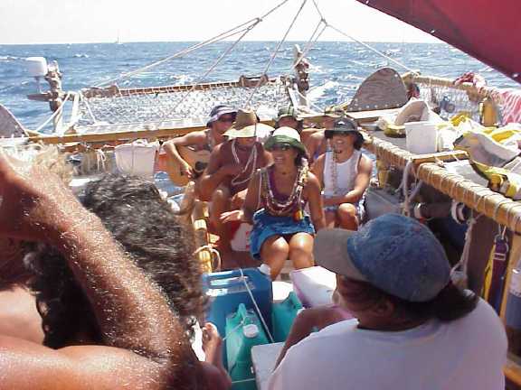
Dr. Tim Sing's newly formed halau. The novice crew (crossing the equator for the first time) entertains the veterans.
At sunset,we pass under a line of tattered clouds--dark bellied and full of wind. We ease the main and mizzen sheets and changed down to a smaller jib. All around us the sea is dark and cold-looking but we are buoyed by the canoe's increase in speed.
After dinner, looking east, Bruce says "the sky is clearing" and sure enough in a few hours the clouds dissipate. The moon shines through--a few days from full and now rising to starboard (she was on the port side and setting at sunset when we began the voyage).
"What's the speed Chad?" Nainoa asks. Chad crawls up on the navigator's platform with a spotlight to track bubbles of foam passing along Hokule'a's port hull. He counts the seconds, converts time to speed, and announces "five knots." We trim our sails and change to a larger jib and increase speed to six knots.
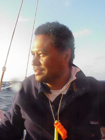
Chad
We watch the stars rise to starboard. Breaking the horizon, they now rise straight up rather than arching--a sign that we are on the equator, "We are close to the Northern waters, " Nainoa says. "I feel it. This canoe is going to go."
Nainoa , Bruce and Chad have now adjusted our reference course to match the existing wind and sea conditions. At 4 p.m. yesterday, as we crossed the equator, Nainoa began our new course line at 0 degrees latitude and 156 miles to the west of our previous course line (which had already been adjusted 25 miles west to depart Tikihau instead of Rangiroa). The new line heads Akau (north) until we reach end 9 degrees north latitude (the end of the intertropical convergence zone), then heads Haka Ko'olau(1 house west of north) to a point 20 degrees, 30 minutes N latitude and sixty miles east of Kumukahi and 100 miles east of South Point.
Yesterday's mild evening did not last. In a pattern that has repeated itself for the past 3 or 4 days,a squall factory to the east of us opened for business--churning together remnants of clouds, cold dense air and stored energy to send dark swirls of wind and rain down the horizon toward us. The two evening watches endured rain and gusting winds--brailing up the sails many times to let the squalls pass.
Today at noon the sky dome is filled with sun and brisk 15 knot winds. We steer north at 6 knots, following a new and challenging path toward home.
Feb. 20, 2000; 15 days since departure--aita pea pea
At dawn this morning (Feb. 20, Sunday), we caught a large a‘u (needle-nosed sailfish) and another aku.
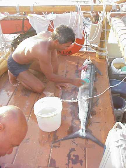
Nainoa cutting up the a‘u
Even though we are sharing all our catches with the Kama Hele crew, we now have too much fish so Mike, Tava and Snake begin fashioning a fish drying rack outboard of the port and starboard navigator's platforms.
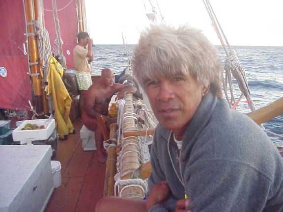
Snake Ah Hee
We continue to sail north at about six knot under clear skies. The winds are ENE at 25 knots, gusting to 30, with lots of white caps and froth on the top of the waves.
Just before sunrise yesterday in a pattern now becoming familiar we caught fish, two fish actually, an aku and an ono, about 20 pounds each.
Bruce slices the ono open cleanly, removing the liver and the heart. Tava cuts up the heart, adds lime juice, and offers it around. Suddenly, I have something to accomplish elsewhere on the canoe, which forces me to miss the opportunity to try this delicacy.
Like clockwork, only a little early yesterday evening, rows of cumulus clouds assemble on the horizon, pink at the tips and dark underneath.
The northeast swell has abated, to be replaced by swells from the east, with gentle faces, widely separated. The canoe's motion is smoother now; she no longer has to push through swells at the bow.
Last night Nainoa saw the North Star ahead of us--a certain sign we have crossed the equator. Most of us cannot see the star through the low scrim of clouds on the horizon.
Last night turned out to be calm, with no bothersome squalls. A highlight yesterday was the crossing-the-line ceremony presented a day late by Ming's halau of newly minted shellbacks--Kahualaulani, Joey, Kona, Kau'i, and Ka'iulani.
During such ceremonies, the novices have to entertain an audience of more experienced sailors. Ming composed two hilarious songs that accomplished that purpose.
Feb. 20, 2000; 15 days out of Tahiti, weather forecasting
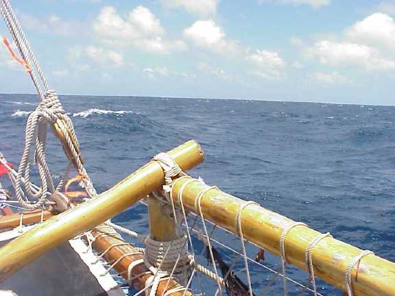
Nainoa Thompson: "On the horizon you see what we call zone-based trade wind cumulus clouds. There is little vertical development, meaning no high clouds, and no squalls are visible. These clouds suggest to me a stable weather pattern. The wind is clean and predictable, blowing 20-25 knots. I judge the wind speed by the feel of the wind against my body, also by the fact there are a lot of white caps and wind streaks along the ocean surface, also the size of the swells which are about ten feet high. (On feb 20 the wind blew from the NE, forcing us to steer too far to the west; since then the wind has shifted more easterly allowing us to head north.)
Normal trade wind clouds and sea state on February 20, 2000.
Feb. 20, 2000 p.m.; 15 days since departure--Sailing on the Edge
"He ho'okele wa'a no ka la 'ino" / "A canoe steersman for a stormy night." Said of a courageous person.
During the afternoon yesterday (Feb. 19) the wind piped up to from 20 to 25 knots and began to shift ENE. The swells became steep, faceted, and dark as the sun sank lower. The sound of the wind increased in pitch and volume; we were pleased with the increase in the canoe's speed but concerned about its course which was even more west than we wanted.
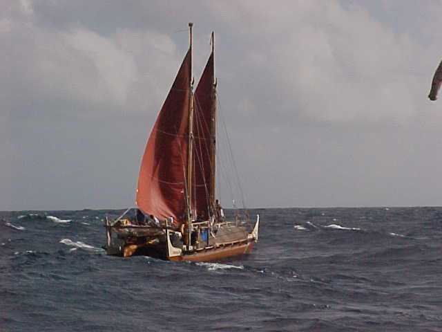
Feb 19-Hokule'a sailing in 25 knots winds, 8-foot swells; the winds have picked up after Hokule'a entered the northern hemisphere.
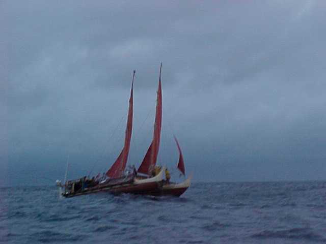
Sailing through a squall
Later just about sunset Nainoa briefs the crew: "Okay, you guys, we are in an interesting situation. We can't keep losing ground to the west, so we are going to have to steer close to the wind. But we can't lose speed because we are in the Intertropical Convergence Zone (ITCZ). We don't know when the doldrums might reassert themselves here, so we want to get out of here as fast as possible. We may have to tack to make up for the ground we have lost to the west, but I don't want to tack in the ITCZ--not until we get to 10 degrees North. It will be a lot of work but if we do it right, we should be in Hawaiian waters in a little more than a week.
Later last night (Feb. 19) after dodging some squalls and enduring a few others, the clouds dissipated and we saw the north star ahead already high in the sky, about five degrees according to the navigators (indicating the canoe was at five degrees N latitude). The wind increased; the sea pumped up, and we put the steering paddle in the water to hold the canoe right on the edge of the wind.
This time the dance between helmsman and paddle is not delicate. The paddle kciks and bucks as we try to control it.
"With the back sail hauled in tight and a small jib, the canoe is not well balanced," Nainoa explains. "The canoe turns into the wind, so your job is to let her do that until she is about to come into irons, then put in the paddle and steer downwind, but not too much.
Nainoa calls these conditions sailing on the edge. To do it properly a helmsman must be attuned to a number of signs: Is the windward rigging taut or slightly loose? Is the canoe heeling to leeward or running flat? Are the sails straining with pressure or relaxed? What does the wind sound like? Are the sails luffing slightly?
Nainoa explains how to put the clues together to sail on the edge: sailing close to the wind without stalling requires a delicate touch and sensitivity to the natural environment, he tells us . To go into the wind the sails are strapped down tight to make them efficient airfoils. We have 800 feet of canvas up there so the wind pressure on them is intense. If you turn downwind the canoe presents more canvas to the wind and she speed up. That feels good to an inexperienced helmsman. We're going fast--but we're going in the wrong direction. We're heading too far west.
You know you are too far off the wind when the wind sound increases, the canoe accelerates, and the pressure in the sails causes her to heel over onto her leeward hull. Also look at the windward rigging--it will be as taut as piano wire. So put the paddle up and bring her into the wind until you are still going fast, but the canoe is no longer heeling--she feels flat in the water, and the windward shrouds are a little loose. Hold it right there. If you steer up too high into the wind, you notice the speed drop off and the sails begin to luff. That's already too late, put the paddle down and steer off.
The trick is to avoid zigzagging. Going up to far, over-correcting, then going down too far. The goal is to maintain a steady course--on the edge.
To make this as easy as possible, Nainoa and the other senior crew balance the canoe, distributing the weight fore and aft. Take in the back sail and the canoe will want to turn into the wind by herself--creating what sailors call a weather helm. Loosen the back sail and the canoe will want to turn downwind, a condition known as lee helm. Move weight forward and the canoe turns into the wind; move weight back and the canoe turns off the wind. It's a delicate balancing act; when we get it right, the balance allows us to tie down the steering paddle and give Hokule'a the freedom to steer herself for a time.
The balance is so delicate, that when a crew member leaves her puka forward and walks aft to take a bath, the canoe may come a few degrees off the wind.
This refined tuning of the crew and canoe on the edge of the wind is necessary because the wind conditions are so unusual. The NE trades usually found in the northern hemisphere, have crossed over into the south.
In one sense this is good because instead of encountering fickle winds or no winds, in the ITCZ, we have strong winds from the NE or NNE. it looks like Hokule'a will set a speed record for the ITCZ, says Nainoa. And that's good . But instead of getting SE trades south of the equator, we got wind from the NE and that has forced us way west of our ideal course line.
In the last few days, Nainoa has been considering alternate strategies for finding landfall--taking into consideration what the wind may be when we past the ITCZ and reach ten degrees north. At about noon today (Jan. 20), he says "The wind are now NE to NNE at 25 knots and we're steering at northwest--we're not even aiming at the Hawaiian Island chain. We can make Hawaiian landfall if we can maintain Nas Leo Ho'olua (two houses west of north, or NNW), but now we're steering three houses west (NW by W)."
So due to the unfavorable winds we have lost the cushion that our earlier sail plan called for. Our original course line intersected the mid-latitude of Hawaii (20.5 degrees N) 275 miles to the east. Now it is possible that we may be forced so far west that we may intercept the Hawaiian Islands in the middle of the chain or even sail past them.
"I could tack east now," says Nainoa, "but I'm going to wait until I get through the ITCZ and we're at ten degrees north and then decide. We have to be ready to take advantage of a wind shift. If the wind shifts slightly east or south of east we may be able to go straight on. If it shifts to the north we will tack to the east to make up the distance we've lost to the west."
In the meantime, we sail on, forcing Hokule'a to perform at her peak in whatever conditions nature provides.
"If we arrive at twenty degrees north latitude, the center of the Hawaiian chain, and have not seen the Islands, what then?" Nainoa asks. "Are the islands to the east or west? With our origina; sail plan and the cushion it provided we would know they had to be to the west. Without that cushion we can't be sure. But I know what we'll do. We'll turn east, against the wind, and tack in a search pattern."
Nainoa pauses for a moment, then says--"I guess in ancient times if you were west of the Islands and turned down wind you were dead. I still ask myself how did our ancestors ever colonize such a vast ocean area? Twenty-five years ago I had no intelligent way to answer the question now I have a lot more information about how they might have done it, but I still don't have the answer."
Feb. 21, 2000 a.m.; 16 days since departure--Will the wind shift to the East?
On Feb. 20 (Sunday) we sail into the evening with gusty fairweather cumulus clouds. By sunset the wind has abated to about 15-20 knots, and the sea state is a little more tranquil than it was this morning.
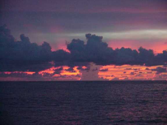
Sunset
The wind is coming around to the east, says Nainoa, and sure enough when the clouds ahead part to reveal the North Star, it's on the port side of the canoe. We are steering Haka Ko'olau (N by E), Shantell Ching, says, and that is good. Maybe we can start to gain back some of our easting.
With this news, the mood aboard the canoe lightens considerably. Later Shantell and Ka'iulani meet at the bow to measure the altitude of the North Star and returns with their estimate: "We are at 6.5 degrees N--390 miles north of the equator, and 700 miles from Ka Lae, the southernmost land of Hawai'i. A little while later, the moon rises off our starboard beam, an orange disk behind the clouds and bathes the canoe in silver as it climbs higher. Overhead a long strand of clouds drifts across the Dog--the constellation of Canis Major--obscuring his tail, his hind quarter, and his shiny nose (the star Sirius) then passing on to the west, blocking out Orion, then Taurus, then the Pleiades.
It is amazing how pleasant this evening is, particularly in comparison to those of the last four or five days. The canoe glides forward gracefully. The constellations whell overhead. A boobie brid passes lazily over the canoe, intrigued perhaps by the wash of wind over our sails.
During the evening the wind continues to blow almost from due east.
With the steering paddle tied up, Hokule'a leans into the wind and heads haka Ko'olau, one house east of north. She continues on that heading throughout the night. "We're doing good now," Bruce says. "If we keep this heading, we can begin to make up our easting and the danger of sailing to the west of the Hawaiian islands will no longer be a problem."
Looking out over the swells to starboard into the slanting rays of the rising sun, the navigators see that the dominant swell continues from the northeast while the minor swell builds from the east. The presence of the eastern swell defines our hope for the near future--if that swell becomes dominant it will signal the coming on of an easterly wind--just what we need to sail home without tacking.
The following story is now appearing in Hana Hou Magazine (the Hawaiian Airlines in-flight magazine, whose current issue is dedicated to the last 25 years of voyaging and the voyage to Rapa Nui). As we begin to exit the doldurms the place where the story unfolds, it seems appropriate to place it here:
The Doldrums and Na'au March 15, 1980
After training for three years with Will Kyselka and Mau Piailug, Nainoa boarded Hokule'a as the first Hawaiian navigator in centuries to set out for Tahiti. In spite of all his preparation, he struggled with deep anxieties about the voyage. He felt responsible for the safety of his crew. He felt the weight of constant public scrutiny - of television cameras and news interviews. Mau had lived with the sea and the stars all his life, how could he expect to emulate even a part of his genius? And in the midst of a renaissance of pride among Polynesians, his success - or failure - took on new dimensions.
I was afraid every day that I was in Hilo waiting to go. I constantly rehearsed everything that could go wrong - instead of focusing on how to make it work. I felt responsible for the crew's safety and also for the whole public arena, for doing well.
The day we finally left the Hilo breakwater stands out powerfully in my mind, because all of a sudden I felt much better. Now I focused on making the journey, not worrying about it. But I was still worried about staying awake. Mau never sleeps at sea. He can stay up all night, for weeks on end. I thought, "how in the world am I going to do that?" Not sleeping was part of Mau's magic, not part of mine.
Mau told me that the mind doesn't need much rest, but the physical body does. So when the navigator is on the canoe, the crew does the physical work. "When you are tired," he said, "you close your eyes." He told me that even though his eyes were closed, he is always awake in his heart. And when I sailed with him, I saw that was true. Preparing for the voyage, I tried to figure out how Mau stayed awake. I forced myself to stay up for a day or so but then I collapsed. I couldn't do it. So when we left Hilo I felt like I was voyaging both into an unknown ocean and into unknown regions of my own potential.
It was ten thirty at night. Tumor was rising, Maui's fishhook. I thought, "it's pretty late and I had better get some rest or I will be a basket case tomorrow."
I lay down and closed my eyes. I thought, "how stupid you are. You are not prepared to go to sleep. You cannot sleep." So I got up and from then on I slept only two to three hours a day. When I became so exhausted that I couldn't think, I lay down. I slept until I dreamed. Then I got up. I slept maybe ten or fifteen minutes at a time and that was enough. My mind was refreshed. I learned to do that for a month. It was a whole new reality.
As the voyage progressed and Hokule'a neared the equator, Nainoa worried about what would happen when the canoe entered the doldrums where hot air ascends from a three hundred mile wide belt of ocean. Here the constant northeast trades winds die off to be replaced by long periods of calm, followed by severe buffeting squalls, then windless days once more. It's a navigator's nightmare. Which way is the current taking me? How fast? From what direction did the wind blow in that last squall? In what direction did it push us? How far? Where am I?
I dreaded the doldrums. I had no confidence that I could get through it. I thought that I could only accurately navigate if I had visual celestial clues, and that when I got into the doldrums there would be a hundred percent cloud cover. I would be blind. And that's what happened.
When we arrived in the doldrums, the sky went black. It was solid rain. The wind was strong - about 25 knots - and it was switching around. We were moving fast. That's the worst thing that can happen - you are going fast and you don't know where you're going. I couldn't tell the steersmen where to steer. I was very, very tense. I knew that I had to avoid fatigue - I couldn't allow myself to get physically tense. But I couldn't help it. I just couldn't stop myself.
I was so exhausted that I backed up against the rail to rest. Then something strange happened. When I gave up fighting to find a clue in the sky and I settled down, then, all of a sudden, a warmth came over me. All of a sudden, I knew where the moon was. But I couldn't see the moon - it was so black.
The feeling of warmth and the image of the moon gave me a strong sense of confidence. I knew where to go. I directed the canoe on a new course and then - just for a moment - there was a hole in the clouds and the light of the moon shone through - just where I expected it to be. I can't explain it, but that was one of the most precious moments in all my sailing experience. I realized there was a deep connection between something in my abilities and my senses that goes beyond the analytical, beyond seeing with my eyes. It was something very deep inside. And now I seek out those experiences. I can't always do it. I have to be in the right frame of mind. I can't conjure up those experiences consciously. But they are coming more often now. It just happens. I don't want to analyze it too much. I just want to make it happen more often.
Before that happened, I tended to rely totally on math and science because it was so much easier to explain things that way. I didn't know how to trust my instincts. My instincts were not trained enough to be trusted. Now I know that there are certain levels of navigation that are realms of the spirit. Hawaiians call it na'au - knowing through your instincts, your feelings, rather than your mind, your intellect.
Feb. 22 a.m.; 17 days since departure--A gift
A favorable wind from the east blew all day (Feb. 21) and throughout the evening. Hokule'a continued to sail due north.
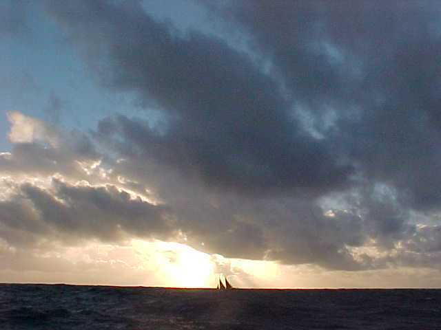
As a result, the student navigators--Shantell, Kahualaulani, Ka'iulani--estimate we got back on our new reference course at sunset.
At 9 degrees N, the reference course heads Haka Hoo'lua (N by W) to intersect 20.5 degrees N latitude at a point 60 miles east of cape Kumukahi, the easternmost point of the Big Island of Hawai'i.
At this intersection, the canoe will turn west to sail into the Big Island. Shantell Ching estimates we reached 9 degrees N at 2 p.m yesterday. The student navigators decided to continue N ('Akau) for another 12 hours to give the canoe some more easting in case the wind became fickle again. "If the wind continues in this direction, we are in good shape, says Nainoa."
Some difficulties still remain because for the first nine days of the voyage (starting on Feb. 5) Nainoa suffered from the flu and the canoe was beset by squally weather: "I'm a little worried about the dead reckoning because my illness and the squally weather could have made my navigation less accurate. But not too worried, because we have been conservative in our estimates, and with this wind we won't end up west of Hawai'i. But I agree, let's keep going north for another twelve hours to be sure we stay east. I want you guys to know that I am smiling inside. You are doing very well; your estimated position and mine are not far off.
During the night the wind shifted north about one and a half houses, and at 9 a.m. this morning, Hokule'a was sailing haka ho'olua (N by W) at six knots, directly on course for Hawai'i. Yesterday the crew caught a 130-150 lb. ahi.
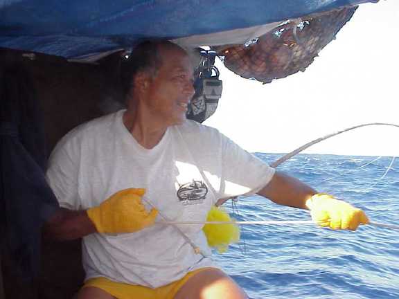
Mike Tongg pullng in something big
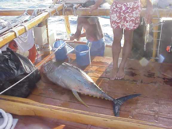
130 lb. ahi
Feb. 23, 2000 p.m.; 18 days since departure--Heavy Weather
Early afternoon, Feb. 22, the female 'aumakua rides the port manu aft; her perch rocks from side to side, then rockets upward high above the horizon and drops back accompanied by a geyser of spray as the port catwalk meets the heavy roller passing under Hokule'a.
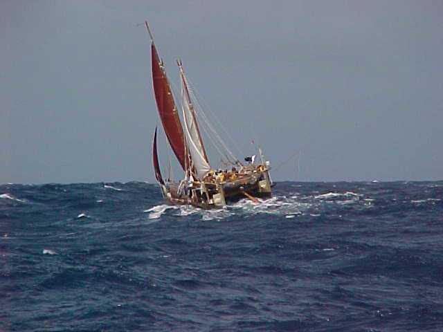
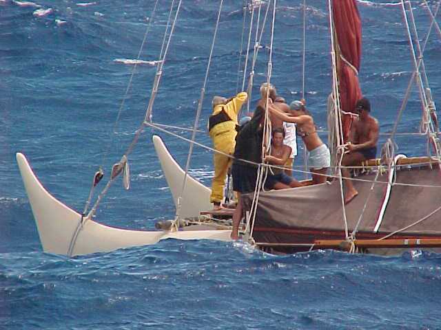
The winds have been so strong, the canoe had to heave to in ten-foot seas to tighten the rigging.
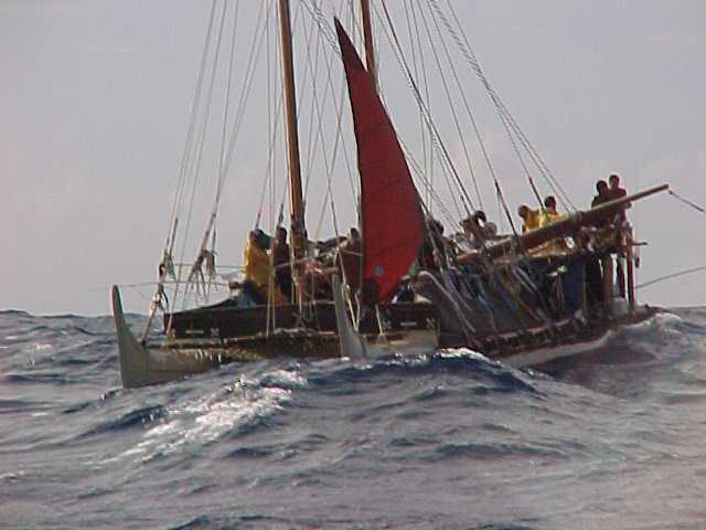
Dropping the rig to put on smaller sails
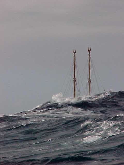
Hidden behind a large swell
The view of our world expands from our perch high on the back of a swell: we look out over a vast conveyor belt of water rolling toward the Southwest. To starboard we see white caps, froth, and wind streaks scarring the faces of the swells as they move ponderously toward us. Then we drop down into a trough and the world contracts within a fold of ocean--a view that now features a washed out blue sky overhead and clouds fields of cumulus topped by wind-whipped mid-level stratus--probably the outflow of a thunderstorm to the east of us. Occasionally Hokule'a takes a swell hard on the bough and sifts whitewater aboard, or endures the indignity of a breaking wave slapping her hindquarters. But mostly she maintains her composure, slicing through the swells, riding over them, heading Haka Ho'olua, one house west of north, straight toward our rendezvous with the Big Island.
During the evening watches all hands are dressed in their Patatgonias against the chilly wind and occassional tendrils of spray that curl over our deck. The North Star appears about 12 degrees above the horizon to the right of our mast, as we travel at about 6 knots. At about 10 pm., a series of squalls march across our path out of the east and we trim in our sails. The relatively heavy seas Hokule'a has traveled on this voyage to Rapa Nui has exacted its toll on the sails and rigging. With the moon providng enough light to see, we drop with mizzen mast and lash it down, rigging a storm sail in its place...
[Since this report was filed the winds have dropped down from 30-35 knots to 25 knots and forecasted to be in the 20-25 knot range as the canoe approaches Hawai'i--a welcome respite for the wind-lashed voyagers].
Feb. 24, 2000 p.m.; 19 days since departure
All day and into night yesterday, the wind continued hard out of the east. During the night we steered north under heavy clouds which prevented the navigators from obtaining an accurate latitude fix using the southern stars which are lower to the horizon and hence give more accurate measurements using the traditional technique of measuring the altitudes by hand. At sunset last night, Shantell, Kahualaulani and Ka'iulani estimated we were at 13 degrees 52 minutes north and 73 miles east of the reference line. After an uncomfortable evening in which the winds abated slightly, we find ourselves today sailing one house west of north (N by W), at about 5-6 knots under altostratus clouds moving from the southeast. Weather conditions are improving. Winds are about 20 knots and the seas are calming down, but the deck is cold and wet, and those not on watch are in their compartments trying to stay warm and dry.
Feb. 25, 2000; 20 days since departure--Approaching the Search Area
At sunrise this morning, the winds and seas are noticeable calmer than yesterday, as we proceed along our course line to our rendezvous with 20.5 degrees N, possibly as early as tomorrow when we will turn west.
"This is the exciting part of any voyage," Nainoa says, "landfall is imminent. We all now have to be very alert."
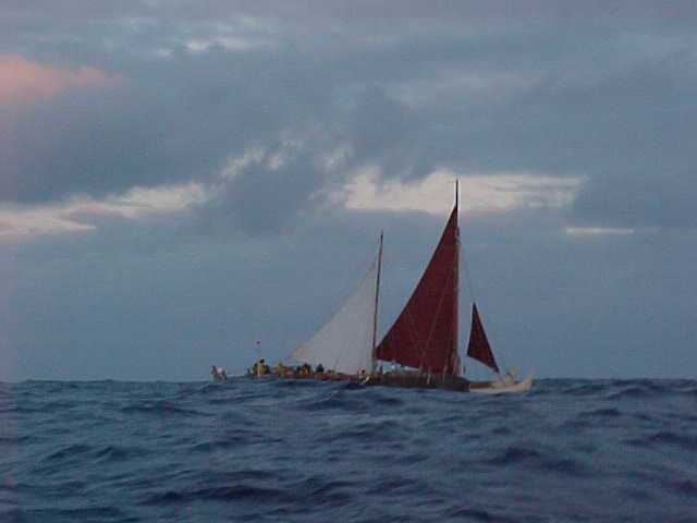
Sailing in calmer seas
Yesterday was the first warm day in several of days: how great it is to be warm and dry! Chad Baybayan and I sleep in the No. 2 aft puka (compartment) and over the last two nights, our sleeping pads have been seemingly awash with seawater, which comes through growing holes in the canvas half-tents. We sleep fully clothed in our foul weather gear. In the warmth of the morning on Feb. 24, Thursday, we commiserate: "I'll tell you what," says Chad, "they're having canoe races in my puka, and I don't want to disturb them, so I'm sleeping top-side tonight."
The winds have abated since they reached near gale force on Wednesday, and the canoe now rides smoothly, although the swells are still formidable. At a sunset crew meeting last night, Nainoa tells us we are now entering the search area for the Hawaiian Islands. "We are in a really good place to begin to search for the Hawaiian Islands. Tomorrow (Feb. 25), will be the first day that we might see land. It's unlikely, but it's possible, so you should all be alert."
At sunset on Feb. 24, Shantell's estimates our position tob 16 degrees 7 minute north, 31 miles east of our course line. Later, the navigators on board took the altitude of Hokupa'a, the North Star, and came up with latitude estimates from 16 to 17 degrees. Later in the evening Nainoa and the others measure the altitude of Miaplacidus in the south, a star crossing the meridian very low to the horizon, hence providing a more accurate latitude estimate than Hokupa'a.
"I got a latitude of 17 degrees 30 minutes N from Miaplacidus," says Ka'iulani Murphy. "Now that we are approaching the search area, it is important for all of us to get accurate latitude fixes," Nainoa tells the students. "You must always assume the worse--that the skies will be cloudy tomorrow night and we will be forced to dead reckon from tonight's measurements. So you want to get the best position possible now."
"We could make Hawaiian landfall very soon, because South Point is only 18 degrees 55 minutes N, only 85 miles north from our current latitude, based on measuring Miaplacidus. But we are probably too far east to see it," says Nainoa.
Our plan is to follow our reference course to 20.5 degrees N and then turn west to search for land. Now that we are within the search area of Hawai'i, extremely accurate steering in imperative, so the sweep is put in the water and a navigator is stationed nearby to make sure the person steering stays on course.
We steer 'Akau, North, and with the current and wind pushing us westward, we make Haka Ho'olua (N by W). We steer mainly by Hokupa'a, the North Star, but when smudges of clouds cover the star, we use the pointers at the front end of the Na Hiku, the Big Dipper, or other stars, to stay on course.
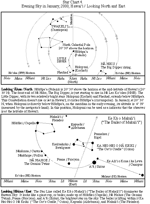
During the beginning of the 6-10 watch, the sky is mostly clear. Our companions--Hanaiakamalama, the Southern Cross; the False Cross; Canis Major; and other constellations in the southern sky--have now slipped behind us noticeably to arc lower across the sky. Na Hiku rises high off our starboard bow--her handle--rotating out of the sea as our watch goes on, its pointers aiming at Hokupa'a, our constant steering guide. Tava is at the sweep much of the time--the trusted steersman wrestling with the weather helm. The canoe tries to turn into the wind and bucks against the swells, coming from the starboard side. With Tava's skillful managment of the sweep, Hokupa'a remains steady just to the starboard side of the mast.
Feb. 26, 2000; 20 days since departure--Looking for Land
A few hours before sunset yesterday (Feb. 26), Nainoa, Kahualaulani, and Shantell were on the port side of the canoe scanning the horizon ahead. "I'm looking for edges," Nainoa says, "sharp lines that cannot be clouds. Also the clouds are always transluscent, but an island is opaque. For a while I was watching a dark area on the horizon but all the masses were moving. If the island is there, I can't see it."
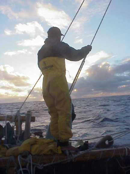
Nainoa looking for land at sunrise
Yesterday morning we passed through a series of gentle rain squalls which closed off the world around us and washed the decks clean of salt. By noon we were sailing in brisk easterly winds, heading Haka Ho'olua (N by W) and making Na Leo Ho'olua (NNW). The skies had cleared and the horizon was peppered with low level fairweather cumulus clouds.
At 2 a.m. this morning (Feb. 26), Chad, Kahualaulani, Shantell Ka'iulani, and Nainoa gathered aft to make a final observation of the altitude of Ka Mole Honua, Acrux, the bottom star in the Southern Cross. The verdict was seven degree above the horizon, which means the canoe was at 20 degrees N latitude. "That's it," says Nainoa, "Let's turn downwind and sail west."
After pulling down the jib, we turn Hokule'a to the west so that the wind is behind us now, and the canoe races down the face of low, easy swells. Running downwind with the sea behind us is tricky because the canoe may dive into the swell in front of it. So port and starboard sweeps as well as the center sweep are manned.
Bruce, Mike and Snake run the big genoa jib up the forestay on the starboard manu--to enfold the power of the following wind. Now Nanamua and Nanahope (Castor and Pollux) are setting in front of us. Hokupa'a, The North Star is to our right and the Southern Cross to our left. The moon goes through a ragged belly of cumulus clouds.
Behind us the ruby and emerald lights of Kama Hele mirror our own port and starboard running lights, which have been turned on for the first time in three weeks. We are now in shipping lanes between Hawai'i and the West Coast and need to keep our lights on so that passing ships can see us.
It takes three crew members to steer the canoe downwind--Bruce mans the center sweep, Kahualaulani is on the port sweep and Snake is on the starboard sweep. To turn to port, Snake puts his paddle in the water; to go to starboard, Kahualaulani puts his sweep down while Snake brings his up. Swells rise up behind us, crest, and race beneath the canoe, causing her to turn upwind then down. The to and fro motion is dampened by the synchronized movement of the two men manning the side sweeps.
A little after 2:30 a.m., we see Hokule'a high in the sky, and it is less than an hour from passing through the zenith, directly overhead--a certain sign that we are in Hawaiian waters.
At dawn, as the sun breaks the horizon behind us, Kahualaulani, Nainoa, Shantell, Chad, and Kau'i scan the horizon to port for a sign of land, but by 8:30 a.m., they see nothing. But we are all convinced that land is near. In the meantime, the sun warms Hokule'a's deck, Pomaikalani prepares breakfast, and we all enjoy the canoe's easy motion as we race toward home.
Feb. 26--Sunrise
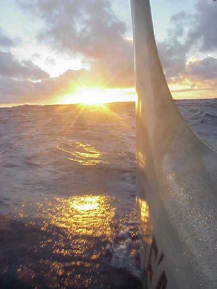
With 2400 miles of ocean behind us, the familiar ancestral seapath between Tahiti and Hawai'i, we sail toward a dark cloud mass ahead. With the wind over our starboard quarter, we feel only a hint of breeze from astern. The sun makes most of us drowsy, except for the navigators who keep a silent vigil ahead. At about 10 a.m., Nainoa tells us that he has seen strong indications of land in the clouds. But then a series of gentle rain squalls move in from the east, pass over the canoe and obscure our view ahead.
All day we continue on at about 4 knots toward the cloud mass which remains stationary off our bows. We strain for a sighting of land. What Nainoa calls edges--the sharp borders of island against sky--seem to appear, only to fade in the swirl of clouds. Illusions of land. Our eyes quickly tire and our imaginations take over. Chad, Bruce, and Nainoa have seen something that remains illusive to the rest of us.
Three crew members are constantly manning the three sweeps, and fatigue sets in.
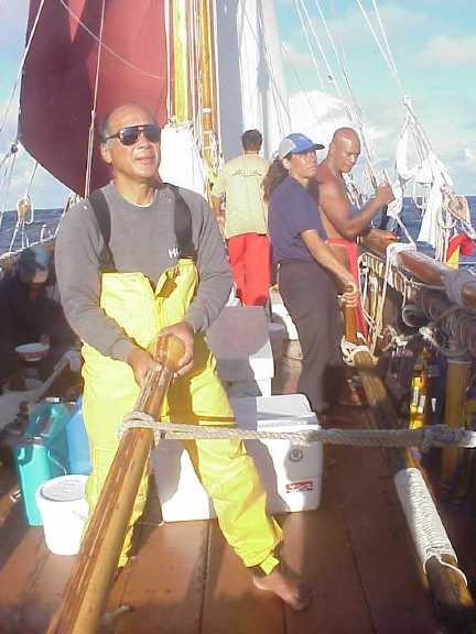
Mike, Kau'i, and Tava manning the sweeps to keep the canoe on its downwind course toward Hawai'i.
"It will be a long day," Nainoa tells us. "There is still a long way to go, even if Hawai'i is dead ahead of us. So get rest." Except for the crew on watch the deck is mostly empty--the crew member not on watch lie on their bunks and drift into a light sleep. Darkness seeps under the cloud bases and slowly blankets the sky dome from the east, revealing pin pricks of light, the brightest of stars.
Having watched the western horizon all day, Nainoa is now certain land lies ahead and he thinks he knows precisely what land it is. For the entire day, Nainoa has watched squalls pass over us and he noticed a pattern. "The squalls to the north and south of us seem to continue over the horizon," he explains, "but those moving in front of us seemed to impact something and stall there. They sat there like fog or dark mist inside the cloud. That makes me think there is land in front of us."
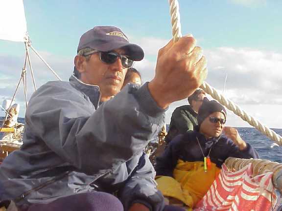
Nainoa, Chad and crew looking for land
There is also the matter of the wind, which the steersperson noticed fluking a little, and shifting to the ESE and we cannot keep the sails full without changing course slightly to starboard. The wind shift is a slight annoyance to them, but to Nainoa, it is another sign of land. "The trade winds cannot rise over 7000 feet," he explains. "When they encounter Mauna Kea, they split at Laupahoehoe to flow around the volcano (over 13,000 feet high). One branch blows southwest down the Puna coast, and the other flows northwest along Hamakua. When our winds, which are originally from the east veer to the ESE, it is an indication we are to the north of Hilo."
As the sky darkened and the sun descended, Nainoa watched even more closely for a land sign he had observed on other voyages--light, colors, and a black band on the horizon. "Off to the left I saw a brightness on the horzion and looking to the right it went dark, until farther right, off the starboard bow, it became light again, like an opening on the horizon there. As the sun went down I saw colors in the opening which I think is the sunlight refracting in the atmosphere. Where it is dark there is land breaking the rays of the sunset. The opening to the right is, I think, the 'Alenuihaha Channel."
To explain better our exact position, Nainoa places his two open palms in front of his body and joins them to form a "V", one pointing to the opening on the left, and the other to the opening on the right. "You can roughly triangulate our position like this," he says. "My left hand points to the opening on the south, my right hand to the opening on the north, where my two hands join is where we are. I think that we are to the NE of Hilo, maybe 20-25 miles away and heading toward the 'Alenuihaha Channel. I could be wrong, but that's what I think."
So we go on a starboard tack and begin to parallel a line that still exists only in Nainoa's mind--the Hamakua Coast, if it is there, is lost in the dark mist to port. "Waipi'o to Pololu is a rocky, dangerous coast with few lights," Nainoa explains, "so it would be a mistake to approach too closely." Now almost all of us are aware that something large lies to port, as a result of Nainoa's explanation, but also by a kind of latent instinct. We cannot see the towering volcano, but we can feel something. What is it? The darkness, certainly, but also a kind of vibration, a warning, maybe a pressure of some sort. The feeling draws us to the port rail, where we all stand peering into the darkness.
Under a slight lifting of clouds we see first a break, then a few minutes later, twinkling lights. First to appear is the sparkle of Hilo off the beam. Then the loom of the lighthouse at Cape Kumukahi sweeping the horizon off our port quarter. Then pin pricks of light sprinkled along the coastline ahead of us and the brighter node of the small town of Honoka'a. The lights reveal a landscape that uncannily match the one that only a few moments before Nainoa had described. There are exclamations from the crew, and a muted clapping, followed by embraces among us all. Speaking for all of us, Nainoa says simply, "We're home." Almost simultaneously, the wind picks up, and Hokule'a accelerates into the darkness, and instead of steering by the stars, we now have the lights of Hilo and Honoka'a, as we head for the north side of Maui.
So the first light of morning finds us coasting toward Hana amidst the sparkle of sun on muted blue swells. While the electric lights last night conveyed an intellectual understanding that we had arrived in Hawai'i, it is the sloping emerald land of Hana that provides the gut feeling of arrival. We are indeed home.
We meet at a crew perhaps for the last time, on Hokule'a's aft deck. We join hands. Pomai provides the gift of a pule, uniting us in thanksgiving for our safe arrival. At one point she says: "Thank you lord for giving us the strength and wisdom to follow the path of our ancestors home, and please give us the wisdom to continue to aloha each other, to learn from each other, and to appreciate what you have created for us in these special islands, which we are lucky and privileged to call home."
At the close of the meeting Nainoa speaks: "Hokule'a is coming home to celebrate her 25th anniversary. We celebrate the rebirth of our Polynesian values. In my youth, Hawaiian spirituality was not widely recognized. Now look at us--what a change. When we voyaged to Rapa Nui, the mana of this canoe was clear. We did not really guide her there, she guided us. Over the last 25 years, as we learned through experience, she also learned. Hokule'a's mana comes from a union of so many of us with her, and the care we have given to her and the care she has given to us. I know in my heart that she can feel Tava's hand on her steering sweep. She knows that it is him.
"On this voyage, I chose to step away from the kind of rigid mental preparation that has charactereized all of my other voyages. I went more on my instincts and a deep trust of the canoe. She sailed herself through the doldrums on our fastest passage ever, and she would have brought us home even faster, if we had not tried to force her to the east. Her mana sleeps when she is tied up at the pier, but it awakens, when the crew comes aboard with a vision and a challenge they have accepted and lets go the mooring lines.
"We are bringing her home now to a celebration that will honor her and recognize the mana she has given to us all."
As the meeting closes, we begin preparing the canoe for port.There's much to do this morning. cleaning up the clutter of personal gear in our pukas, washing down Hokule'a's decks, striking the storm sail, putting up the mizzen spar, resetting the tan-bark mizzen sail, and breaking out anchors and deck lines in preparation for port.
The wind freshens from behind us and Hokule'a sets a course for Moloka'i, surfing the swells at 8 knots.
Feb. 27, 2000; 22 days since departure--Home
Eia Hawai'i, he moku, he kanaka
He kanaka Hawai'i, e-
He kanaka Hawai'i
He kama na Kahiki
He pua ali'i mai Kapa'ahu
Mai Moa'ulanuiakea Kanaloa
He mo'opuna na Kahiko, laua o Kapulanakehau
Na papa i hanau
Na ke kamawahine a Kukalani'ehu, laua me Kahakauakoko
Na pulapula 'aina i paekahi
I nonoho like i ka Hikina, Komohana
Pae like ka moku i lalani
I hui aku, hui mai me Holani[Behold Hawai'i, an island, a man,
A man is Hawai'i
A man is Hawai'i
A child of Kahiki
A royal bud from Kapa'ahu
From Moa'ulanuiakea Kanaloa
A descendant of Kahiko and Kapulanakehau
Born of Papa,
The daughter of Kukalani'ehu and Kahakauakoko
Sprouts of land in a line
Placed alike to the East, to the West
Arranged evenly in a line
Joined to, joined from Holani...From an ancient chant by Kamahualele, priest of the chief Mo'ikeha, celebrating arrival in Hawai'i after a voyage from Tahiti.]
The base of the volcano emerges from a long strand of cloud and mist. It is dark green where the early rays of the sun are interrupted by clouds, and emerald where the sun shines through. There are a number of vents in the volcano's skirt, a few of them now islands and peninsulas smoothed by the ocean and eons of rain. The sea is calm. The wind from the east. The land is Maui, more specifically, Hana, birthplace of Ka'ahumanu, Kamehameha's favorite wife, and once the ahupua'a of Pi'ilani, whose heiau stands clear on a large splash of lava rimmed by ivory surf.
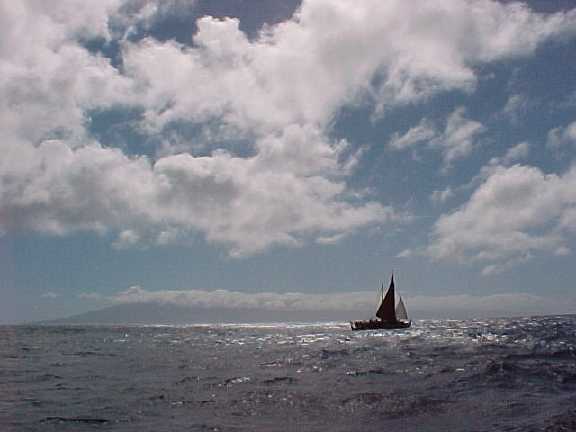
Off Maui
Our view from the sea would have been familiar to 'Umi, the great ali'i who unified the Big Island and led her warriors here to battle with his foes--the chiefs of Maui. Today we share 'Umi's visual perspective as Hokule'a coasts along Maui's eastern shore. The 2-6 watch is on deck steering in a quartering sea. Pomai is preparing breakfast for the crew perhaps for the last time, and the rest of us--quiet and pensive--watch the ancient coastline slip across our western horizon.
We're finally in home waters after a passage of 22 days.
February 27, 2000 / Kaunakakai, Moloka'i
From Cat Fuller: On a beautiful Moloka`i Sunday, word of Hokule`a's arrival was passed from person to person along with smiles and greetings. At Take's, the Friendly Market and the Chevron station, the question was, "When?" and the answer, "Between six and seven tonight." Preparations were already in progress, but there were signs to be painted, flowers to be gathered and strung into leis as well as a welcome home meal to prepare. Anxious eyes that had spent the last twenty-two days scanning the internet now turned to the ancient task of scouting the horizon for the shape of a sail among the ferocious wind swells. With each succeeding internet report, the actual position of the canoe moved into familiar waters, and closer to home and loved ones.
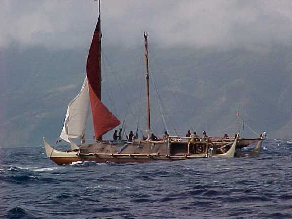
Hokule‘a Sailing off south Moloka‘i
At 4:15 in the afternoon, Myrna Ah Hee, wife of crew member Snake Ah Hee, was visiting Donna Paoa at home, when something made her look out at the horizon. There, distant off the Kawela shoreline was Hokule`a's sail. As word spreads, Myrna's excitement is contagious. Soon there are cars and trucks full of family and supporters cruising the coastline to see for themselves. In true Moloka`i style, the reports come house-to-house down the coastline, "They dropped the front sail"..."they dropped the jib"..."now they're riding the waves bare-masted..."
At Kaunakakai, the crowd begins to swell. In the raging winds, it is obvious that even without sails, Hokule`a has made the last few miles of this eight and a half month journey in record time.
It's as if she feels that home is near and it's time to return. A half mile out of the Kaunakakai pier, she turns and waits; a small snag has occurred, as the barge is still docked. Soon, the tug hauls it out of sight, and Hokule`a, along with her escort boat Kama Hele, triumphantly turn down the channel, towards the waiting crowd. As the last of the sun's rays light the sky, the two vessels slip in easily to the dock, where eager hands catch docking lines and secure them, finally, to Hawaiian soil.
Family members wait anxiously, yet with the kind of patience that comes from voyaging experience, for their loved ones. Judy Mick is there to surprise her son Kahualaulani. Judy says,"I don't fly...what does it take to get me on a plane?" Her son's arrival. The crew is formally greeted by both ancient and modern traditions. John Ka'imikaua's Halau performs, followed by an enchanting group of young girls. Their performance is in contrast to the immigrations and customs officials who also appear at the dock to administer their official duties. Finally, the crew is released and they eagerly come ashore to the things they have missed over the last twenty-two days: family, friends, beer and ice cream. A journey of twenty-two days, a journey of eight-and-a-half months and a journey of twenty-five years all end on this night. Yet, as crew members gather to compare stories, the predominant question is "When do we sail again?"
From Likeke Sawyer: Aloha--Well, the Hokule'a arrived about 6:00 pm Sunday evening. It was a beautiful event. We had Uncle John Kaimikaua and his Molokai men's halau there to greet the canoe with some chants and some hulas, and also another women's halau there to greet them. To add to all of this there was a beautiful sunset in the background. We had a little paina for them with some killer grinds. Aloha Nui.