
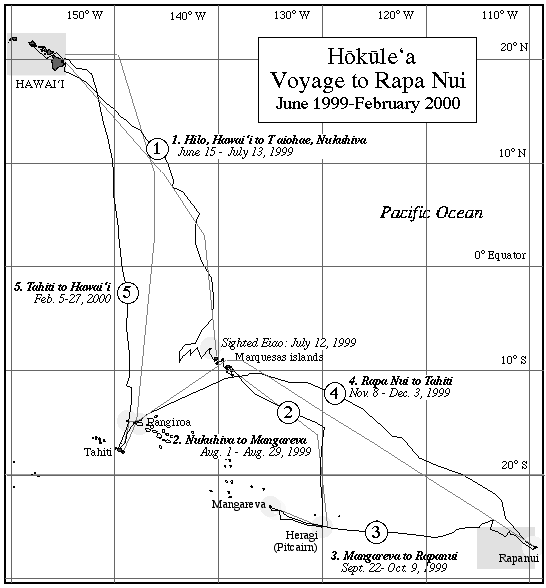
Voyage to Rapanui
Journal, Rapanui to Tahiti
November 9-December 3, 1999
Navigator: Bruce Blankenfeld; Captain: Wally Froiseth
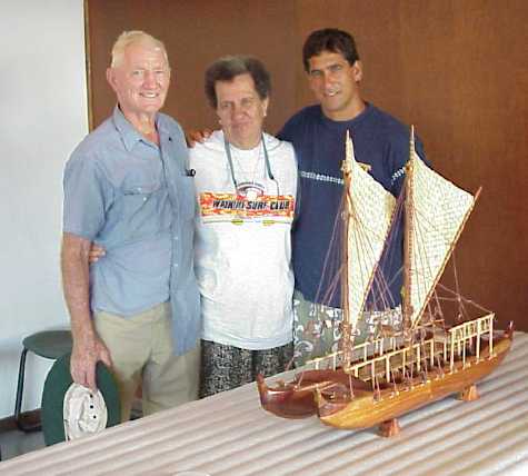
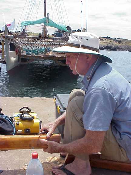
Wally, on the left, with his wife Moku and navigator Bruce Blankenfeld. The canoe model is a gift for the Rapanui Museum.
Hokule'a Crew: Na'alehu Anthony (O'ahu); Bob Bee (O'ahu); Blane Chong (O'ahu); Dennis Chun (Kaua'i); Terry Hee (O'ahu); Nalani Kaneakua (Kaua'i); Kawika Crivello (Moloka'i); Kealoha Hoe (O'ahu); Kimo Lyman (O'ahu); Kawai Warren (Kaua'i); Kamaki Worthington (O'ahu)
Kama Hele (Escort Vessel) Crew: Captain Alex Jakubenko (O'ahu); Elsa Jakubenko (O'ahu); Alicia Akuna-Ika (Rapa Nui); Tim Gilliom (Maui); Attwood Makanani (Kaua'i); Jacky Tetuanui (Tahiti); Nalani Wilson (O'ahu)
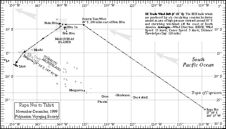
Hokule'a will sail from Rapa Nui to a point at 9° S (the mid-latitude of the Marquesas) and 200 miles E of Fatu Hiva; from there the navigators will turn west to intersect the islands on its long north-south axis, between 8° S and 10.5° S. After sighting one of the Marquesas islands, the canoe will head for Rangiroa in the Tuamotu Archipelago, then on to Tahiti. The strategy is designed to avoid the dangerous reefs and atolls of the Tuamotu by staying north of them. Navigator: Bruce Blankenfeld; Captain: Wally Froiseth.
November 7 / Na'alehu Anthony
Today we received confirmation that the earliest that we could leave is Tuesday , Nov 9. Weather permitting we want to leave in the afternoon after a departure ceremony. We are finishing manifesting equipment and starting to load fishing gear and cooking utensils. We have one last thank you dinner tonight. We want to make sure those who hosted us on Rapa Nui knows how much we appreciate all of their hospitality and kindness. They have really opened their home to us as if we were all long lost family members.
The wind is still out of the north and the swells are supposed to come up in the next few days. If the swells do rise, it will be hard to get out of the harbor at Hanga Piko. The harbor is very similar to the one at Hale-o-Lono in Moloka'i in that in big surf, the harbor is inexcessible either way.
Na‘alehu Anthony
November 10
Hokule'a departed Rapa Nui for Tahiti on the afternoon of Nov. 9; it is targeting the Marquesas Islands to avoid the dangerous reefs and atolls of the Tuamotu Archipelago. After sighting the Marquesas, the canoe will continue on without stopping to Rangiroa, then Tahiti. Estimated time of voyage: 22 days. As of sunrise on Nov. 10, the canoe was averaging 2 knots on a Noio Ho'olua (NW by W) heading. Winds were from Nalani Ko'olau (NE by N) at 8-10 knots. SW swell, 8-10 ft. 40 percent cloud cover. No white caps. Crew and Canoe are both well.
Reflections on Leaving Rapa Nui / watch captain Kimo Lyman
It was with a mixture of emotions as we left ten days ago--sadness departing from good friends made in a short time, excitment about the open sea, wonder at whether we'd even clear the channel. But the surf laid down and after a beautiful blessing by Francisco Nahoe of Rapa Nui of both vessels and crew, we were on our way. Laden down to her lines with last minute donations of bananas, sweet potato, bananas, cabbage, pineapple, and more bananas, Hokule'a cleared Hanga Piko harbor on Tuesday afternoon, November 9.
Rapa Nui, Isla de Pascua, Easter Island, is a land of rugged beauty with a treacherous coastline, lots of offshore rocks, pounding surf and only two white sand beaches; Anakena, where Hoku was officially welcomed and Ovahe. The people are handsome, fit and enjoy a healthy diet with mostly locally produced vegetables and fresh fish.
Contrary to what a lot of us crew bringing Hokule'a back home were led to believe, there were lots of green, good sized eucalyptus stands, plenty of pasture land and much diversified agriculture on Rapa Nui. We were fortunate to stay with Ines Teave at her family farm, mauka of the main town of Hanga Roa, where it was cool and quiet. After working on the canoe preparing for our leg, inventorying, stocking, and training, we'd head for the farm and dinner. Helping pull weeds in the pineapple patch was good for our host and us, knowing that there would be no soil for the next three or four weeks. Relaxing around the firplace in the evening (with one watch aboard Hoku) discussing the wonders and mysteries of the ancient culture topped off our days.
Rapa Nui, a Glimpse at Hawaii's past / Blane Chong
The health problems of Native Hawaiians have been well documented. Our ethnic group is afflicted with some of the nation's highest rates of heart disease, diabetes, certain cancers, obesity and all of the obesity-related diseases. There is also documentation to show the excellent health Hawaiians enjoyed pre-western contact. Early explorers described Hawaiians as being lean and muscular and close to seven feet tall. They were also described as having a tremendous capacity for work. This is supported by the remnants of lo'i (taro fields), fishponds and heiaus. All of this changed as the Native Hawaiian lifestyle became assimilated into the western way of life.
The people of Rapa Nui have not yet lost their traditional way of life. Upon arriving in Rapa Nui, I was surprised by the similarities between Hawai'i and Rapa Nui. The landscape reminded me of a rural outer island, not unlike Moloka'i or Lana'i. There is one main street through town, about three blocks long. Most people walk or ride horses through town. There are no stoplights, buildings are all single story. Many people farm their land, grow sweet potato, pineapple, taro and various other greens. Cattle and horses roam freely. All livestock are branded and not limited by fences.
In my personal observations and interviews with local Rapa Nuians and the medical director at the local hospital, I found the Rapa Nui people to be in good health. They are all physically active, beginning with the children. On a field trip down to the harbor where Hokule'a was anchored, the children walked from their school, approximately one to two miles away. There are no fast food chains, the local resturants make everthing fresh. The Rapa Nuians still speak their native language, along with Spanish.
I did not see any obese locals, most were on the lean side. Some ills of modern society have taken hold there, including alcohol excess, marijuana use and tobacco smoking. In general, the Rapa Nui people have maintained good health with their active lifestyle, traditional plant based diet and retention of their culture through their native language. Hopefully, we can learn from Rapa Nui and get back to good health with increased physical activity, a traditional plant based diet and maintainence of our culture.
November 11
A night of swift sailing at 6-7 knots, with 15-25 knots winds out of Na Leo Ko'olau (NNE). By 3 a.m., the winds began to slacken. The canoe was still doing 6 knots at sunrise, but by 1 p.m. HST today, the winds had died down. The canoe was sailing along at two knots. Last night and today, high cirrus clouds, covering 80-90 percent of the sky. The canoe traveled about 150 miles in the last 24 hours on a Manu Ho'olua heading (NW). Mellows seas, with a NE swell (3-4 ft.), a SW swell (3-5 ft.) and a N swell (1-3 ft.) At sunrise, the crew caught a 40 lb. ahi, and shared the catch with the crew of the escort boat Kama Hele.
November 12 (Sat Phone call from Na'alehu Anthony)
Sunrise : Light, variable winds. The crew has its biggest sails up, but the canoe is mainly bobbing, doing at best, one knot on a Noio Ho'olua (NW by W) heading, down from two knots last night and yesterday. (Winds should pick up as the canoe gets north, away from the high pressure ridge sitting over Rapa Nui.) Squalls on the horizon (cumulus congestus); high clouds (cirrus, mares' tails). Seas are smooth and glassy, with 3-4 ft. NE swell and 4-5 ft. SW swell continuing. Hokule'a has made about 60 miles in the last 24-hours.
Estimated latitude about 25 degrees S, based on altitude of Caph (in Cassiopeia) last night at 6 degrees above the horizon as it transited the meridian. (Actual latitude about 24.40 degrees S.) Bird sightings: shearwater, white-tailed tropic bird. Debris: styrofoam block the size of a 48-quart cooler, attached to a long-line for fishing; both covered with barnacles.
November 13 (Sat Phone call from Na'alehu Anthony)
Almost no wind this morning. The canoe is doing half a knot to one knot, down from one knot yesterday, in glassy seas. The strategy now is to head north, away from an area of high pressure and light winds that reaches up to about 20 degrees S, and to find the 20-knot easterly trade winds blowing north of the 20 degrees S. Heading as of last night: Haka Ho'olua (N by W). High clouds (cirrus) and cumulus along the horizons. Eighty-five percent cloud cover, but enough holes in the clouds to pick up stars to steer by at night.
Navigator Blankenfeld estimates the canoe has made about 60 miles in the last 24-hours, 270 miles since departing Rapa Nui. Estimated latitude about 24 degrees S. The Kama Hele crew caught a 25 lb. aku last night.
November 15
Morning Report (Information from SOEST tracking map at 5 a.m., and latest weather map of the Pacific): Hokule'a is heading NW-NW by W, averaging 4 knots in 15 knot ESE trade winds winds. Rainy. Latitude: 20 degrees 01 minutes S, 115 degrees 05 minutes W. After 5.5 days the canoe is 484 miles from Rapa Nui; 1578 miles to reach its first target: Nuku Hiva in the Marquesas Islands.
November 16
Morning Report (Information from SOEST tracking map at 5 a.m., and latest weather map of the Pacific; navigator's report e-mailed from Kama Hele): Hokule'a is on a heading of Noio Ho'olua (NW by W) at 4 knots in 8-12 knots winds from the ESE. It has traveled 91 miles in the last 24 hrs.
Current estimated position: 20 degrees 30' S and 64 miles E of the reference course; it has traveled an estimated 590 miles in the six and a half days since leaving Rapa Nui. Actual Position and Miles traveled: 20 degrees 13'S, 116 degrees 24' W, 607 miles traveled since departure. Two crew members down with the 24 hr. flu, but otherwise the crew is in good spirits--in good humor and positive.
November 17
Morning Report (No report sent in today; Information from SOEST tracking map at 8:19 a.m. HST and latest weather map): Hokule'a is on a heading of La Ho'olua (W by N) at 4 knots, up from 1 knot two hours earlier (6:09 a.m.); wind field around the canoe looks like light easterly winds at under 10 knots. The lights winds experienced a couple of days ago seem to have moved north with the canoe. Progress has been slow the last two days: the canoe has made only 67 miles since yesterday morning. Actual Position and Miles traveled:19 degrees 50'S, 117 degrees 29' W, 674 miles traveled since departure.
November 18
Morning Report (e-mailed from Kama Hele): Hokule'a is on a heading of 'Aina Ho'olua (WNW) at 5 knots, averaging about 4.5 knots over the last 24 hours; the winds are 8-12 knots from Hikina (east), with intermittent squalls. Winds to the north are stronger: 15-20 knots. The crew is trying to get north to find these stronger winds.
Estimated latitude at sunrise, 11/18: 18 degrees 38' S. Actual Position at 5:46 a.m. HST: 19 degrees 19' S; 118 degrees 52'W. From report for 11/17, received today: Due to light and variable winds, the crew has put up the largest and lightest sails to catch as much wind as possible. Everyone is in good health; the crew cleaned and disinfected the canoe yesterday.
Last fish caught: sail fish on 11/16; a koa'e kea (white-tailed tropic bird is following the canoe and escort boat.
Estimated latitude yesterday at sunrise (11/17): 19 degrees, 26' minutes S, based on measurements of stars in Cassiopeia transiting the meridian (Caph at 11.5 degrees; Navi at 10, Segin at 6.5, Ruchbah at 10.5. 56 miles east of the reference course. Actual Position at 8:19 a.m. on 11/17:19 degrees 50'S, 117 degrees 29' W. Steering by the Moon (rising in the afternoon, setting at night); the sun; the planets--Jupiter, Mars, Saturn, and Venus; and the stars--Canopus, Sirius, Sheratan, Albebaran, Rigel. Steering by a SSW swell at 4-6 ft.
November 18 Long Line Fishing
We spotted a long line fishing rig which we assume was laid by the only ship we have seen in these waters--a 150-200 foot longline vessel. There were about 12 lines laid with 50-100 hooks per rig. A boat of that size would have laid much more gear, yet being that there were only a dozen laid, the longliner was perhaps testing the waters. The rig that we pulled up was freshly baited with frozen sanma, a Japanese mackerel, and the hooks were also from Japan.
Steve Gates, a long line fisherman on a 78-foot boat out of Honolulu explains the technique (Honolulu Advertiser, July 15, 1998, C1+): "While we target one fish like ahi [yellow fin tuna], half our catch ends up being by-catch [fish not targeted]. But the by-catch like tombo [ahi], marlin, and opah carries us: it's all salelable." Joan Clarke of the Honolulu Advertiser writes, "When he goes ahi fishing, Gates is usually away from home for 14 to 21 days; when he targets swordfish, he's out for 45 to 50 days, traveling up to 2,000 miles away from Hawai'i....When he's out at sea, Gates lays as much as 40 miles of line threaded with hundreds of hooks [1400 hooks]. For ahi, the lines go out early in the morning with sanma--pipe mackerel--as bait. The lines sag, reaching depths of 150-200 fathoms (a fathom is 6 feet), where the ahi run. The lines are pulled up in the evening. Swordfish, on the other hand are caught near[er] the surface, so the lines are set at 25-30 fathoms, with squid used for bait. And since swordfish are nocturnal, the lines are set in the evening."
Gates says, "We might get three hours of sleep a day in short naps. Lines get tangled, sharks and whales might eat the catch on the line. Swordfish might die and float to the surface and then the albatrosses attack and destroy them."
Some fisheries managers want longline fishing regulated because there has been a decline in the stocks of tuna, swordfish and sharks worldwide. Long line fishing is already illegal in Hawaiian waters out to 75 miles. Ocean waters beyond 200 nautical mile from land (the limit of each country's economic zone) cannot be regulated except by international treaties.
Life at Sea / Kimo Lyman
Life at sea teaches one many values that can easily be a metaphor for life ashore. Caring for one's resources, because that's all you have got, respect for the environment and eachother, how to maintain and protect your "little island" are a few that come to mind. Hardship is offset with fellowship. Together we work to raise and lower the sail, steer and trim, clean and care for the canoe and in doing so we experience harmony and strive for balance. Simple things have great value, sunrises and sunsets, a delicious meal, a fresh breeze, shade in the midday, a rain squall rinse. Courtesy, respect, cooperation become second nature. Pleasantries are common and magnified, faults overlooked or gently corrected. Living in close quarters with a dozen other individuals can be either, (a) trying and difficult or (b) easy and enjoyable. Why choose (a)? Life at sea teaches aloha as a lifestyle. Our hope is to bring what we learn ashore.
Conversation is large aboard. We've got recollections of voyages past and expectations of voyaging's future, wonderful history and geography lessons, astronomy discussions, environmental and world health, navigation technique, rightous gossip of antics ashore and personal "from home" stories, all liberally closed with huge helpings of laughter. And we've got an on board contest now starting it's second week, guess Lopaka Bee's middle name, one clue so far, it begins with the letter "M". Still there's plenty of quiet time to reflect on one's direction in life or marvel at the wonders of nature.
Talking story around the galley
I've been going to sea since I was sixteen when my brother got me a berth on a sailboat back to San Francisco. On every voyage I've learned something new and the lessons continue. This time one word stands out, support. Without the support and love of each of our family members back home, we couldn't be here. I'd like to personally thank my wife for insisting I "go again" and my kids for putting up with my absence. And we, as a crew, thank all the people of Hawaii for their interest, love, and support as we sail our ambassador, Hokule'a, into the next century.
November 19, 1999 Morning Report / 9.5 days since departure (e-mailed from Kama Hele): Hokule'a is on a heading of Manu Ho'olua (NW) at 5 knots, and averaging about 5 knots over the last 24 hours; the winds are 10-12 knots from 'Aina Malanai (ESE). Estimated latitude at sunrise, 11/19: 17 degrees 42' S, 23 miles east of the reference course. Actual Position at 7:00 a.m. HST: 18 degrees 26' S; 120 degrees 43'W. Now that Hokule'a is back near its course line, the navigator intends to stay within 60 miles of it while trying to get north to stronger winds. The sky is filled with clouds--cumulus congestus, altostratus, and cirrus. Dominant swell: 3-4 ft. from the east.
Rapa Nui to Tahiti / the Crew for Hokule'a and Kama Hele, introduced by watch captain Kimo Lyman
[Kimo, from Mokulei'a, O'ahu, works for the fire department in Waialua. He is a veteran of many sails on Hokule'a, starting in 1976, when he was the instrument navigator from Tahiti to Hawai'i. He was on board Hokule'a from Tahiti to Hawai'i in 1980, Aotearoa to Samoa in 1986, Cook Islands to Hawai'i in 1992 (co navigator, without instruments); and on board Hawai'iloa from Hawai'i to Tahiti, and Tahiti to the Marquesas to Hawai'i in 1995. One of the most skillful and knowledgeable sailors on board the canoes, he has been voyaging since he was sixteen. He is also a skillful writer and a great person to swap stories with.]
Perhaps the best way to begin an article about sailing aboard Hokule'a would be to start as we do our voyage, by giving thanks and praises to the most high. The spiritual realm of life and the wonders of our existence and in this universe are very evident out at sea and daily, both collectively and individually, we affirm our faith. Mahalo Ke Akua!
There are thirteen of us sailing on this leg as one 'ohana. Let me introduce our crew: Wallace Froiseth, co-captain, is a living treasure and a hero of mine since small kid time. At eighty years young, this surfing, sailing, and diving legend is amazingly comfortable and agile aboard, as well as being a work horse, whether changing sails, splicing lines, steering or even washing dishes. He influences all of us very positively with his quiet, up beat manner and wonderful stories of Hawai'i's past. A master woodworker, he has built many of the parts of Hokule'a, including our main steering sweep (16 feet long) and the new booms. It's an inspiration and a privilege to sail with Uncle Wally.
Bruce Blankenfeld, co-captain and navigator, is the epitome of a great skipper, knowledgeable, intelligent, and prudent, Bruce knows that safety at sea is utmost. His caring and compassionate manner for his crew and his commitment to the goals of the PVS are what create such a good leader.
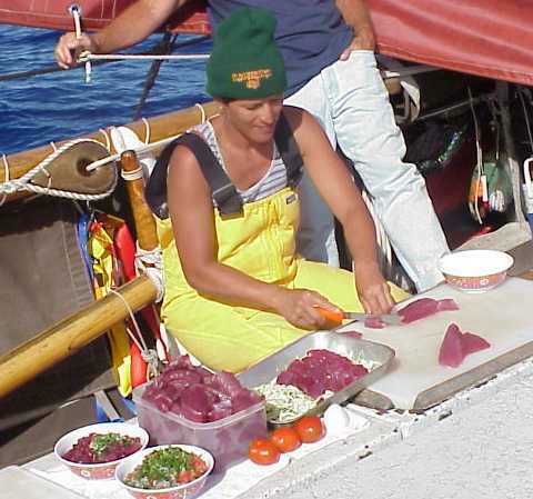
Voted most likely to be captain if we didn't already have, is Nalani Kaneakua, our cook, although "cook" is too weak of a word. Gourmet chef is much closer to the mark as indeed, she's a professtional back home on Kauai. To see her clean and fillet and slice a fish is truly amazing and her creations from the galley are unbelievalbe, from ahi came poisson cru, poke, sashimi and breaded fillets as well as strips to dry; from an aku, fried bone and belly, sashimi and ono dried aku; from a sailfish, marinated steaks and more dried fish, throw in a chocolate banana pie, vegetarian chili, fritata, huevos rancheros with homemade tortillas and eggs benedict a la canoe and you have an inkling of Nalani's talent, all from a modest two burner propane stove.
Much of her success is directly attributed to the hard work of many back home but particularily Lita Blankenfeld and Mary Fern who planned, shopped and packed for the entire voyage. Awesome!
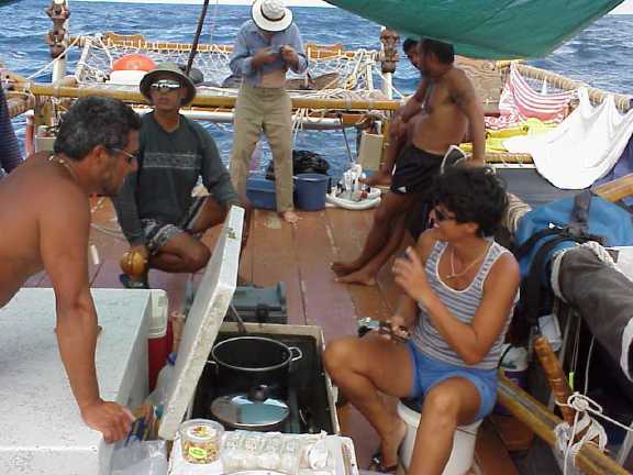
Kimo goes over the menu with Terry, Bob, and Nalani
Closely coordinating the stores and knowing where to find them is another monumental task, but for Terry Hee, quarter master, watch captain and most camera shy person you'll ever meet, the job seems easy. Terry has been aboard for the entire duration since May, having taken a leave of absence from his job (without pay) and his contributions, love for Hoku, and dedication to this voyage, as well as many in the past, are as deep as the sea we're crossing. And if you want the real scoop, Terry's the man.
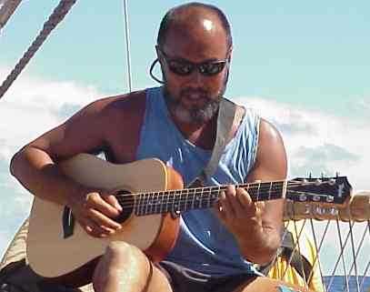
Dennis "Kaho'i" Chun, watch captain from Kauai sailed on the first leg from Hilo to the Marquesas and has been on many past trips. Quick with a smile and laugh, he is an extremely talented musician who makes all aboard both nostalgic and happy with his skillful guitar licks, beautiful voice and vast repertoire. It's always a pleasure sailing with Dennis.
Bob Bee is a veteran of Hawaiiloa's trip to Alaska in 1995, as well as sailing her inter-island in the Tahiti group that year. "Lopaka", Bruce and Terry all work together on the waterfront in Honolulu and his knowledge of shipping and ocean related ventures fit right in and make for interesting stories. Trouble is, he's so humble and soft-spoken one has to pry them out of him. Bob was a year ahead of me in high school and I remember his athleticism as a gifted football, basketball, and high jumping star.
Bob Bee, with Blane
Kawika Crivello, Kawai Warren, Na'alehu Anthony and Blane Chong are all on their first blue water crossing. Well prepared, due to the PVS's solid training program, all have proven themselves as good shipmates. Extremely helpful, eager and quick to learn, and easy to get along with, these gentlemen epitomize what one seeks at sea.
Kawika is a volunteer Hawaiian immersion teacher, whose job is with the Public Works of Moloka'i, as his friendly personality exhibits. Paddler, diver, surfer, he is comfy out at sea and has a lot of inter-island seatime aboard Hokule'a.
Kawai, hailing from Kauai, works as a firefighter in Waimea where he says helping people is the best part of his job. He carries that philosophy here as well and is always looking out to kokua whether on watch or off.

Na'alehu, at 24 is our youngest crew member, but probably the most energetic. Dubbed "Gadget" due to the myraid of tools, devices and equipment he is responsible for, if he is not communicating on the radio, filming, or documenting then he's fixing something. Preparing to graduate soon from the UH with a Hawaiian Studies degree, Na'alehu has been a busy man as he is the trip's documentor and radioman. He is also held in high esteem as the one who has obtained the CD player from Kenwood, installed it. Lots of inprovements have been made on Hoku since her initial sail in 1976 and listening to Iz, Amy, Gabby, and Carlos on a moonlit eve is certainly one of them.
On all long legs Hokule'a carries a doctor, basic prudent seamanahip. Dr. Blane Chong of O'ahu is a genuine asset on this trip keeping everyone healthy and fit. Doc's a paddler with Hui Nalu Canoe Club and is a specimen of fitness himself even though it took him a couple of days to get his sea legs. A common malady.
Kamaki Worthington, address Pacific Ocean, is our apprentice navigator. With roots in Rarotonga, relations in Tahiti and New Zealand, Kamaki is truly a Polynesian citizen. He is learning his art well and a lot of sea miles on various vessels as well as his Coast Guard Captain's license. He was a large help when Hoku was in drydock for an extensive re-fit, headed up by Jay Dowsett. Together with hundreds of volunteers from all over and Jay's expert advice and hard work, Hokule'a is a beautiful, dry and fast canoe, capable of worldwide travel.

Our last crew member, like Terry, has been with the voyage from day one but not always aboard Hoku. Kealoha Hoe, from Hakipu'u, O'ahu was on the Kama Hele, our escort vessel,on legs one and three and on the canoe for leg two from Nuku Hiva to Mangareva. He rejoined Hoku in Rapa Nui as a late entry and we are all grateful and blessed to have him. Combined with a boisterous laugh, kolohe eye and quick wit are a tangible sence of spirit and love of God. Kealoha's daily pule, usually before our evening meal is all encompassing, thankful for all blessings, mindful of our loved ones ashore and straight from the heart. Our kahu is aboard.

We couldn't be here if not for the Kama Hele and her crew. Alex and Elsa Jakubenko with their crew have been watching our for Hoku's safety, towing her in and out of harbors and carrying extra goods and crew for thousands of miles.

Now aboard in addition to Alex and Elsa are their son-in-law Jacky Tetuanui from Mo'orea, Alicia Akuna from Rapa Nui, and three crew members who sailed aboard Hokule'a on previous legs. Nalani Wilson, from Ka'a'awa, O'ahu, was on leg two, through the Marquesas islands to Mangareva, and is now heading the computer aboard to send log reports, digital images, and other information via short wave e-mail. Tim Gilliom, from Maui, was also on the second leg of the journey aboard Hokule'a, and like Attwood Makanani, from Kaua'i, who traveled on the first leg from Hilo to the Marquesas, both have been volunteering their services on the Kama Hele prior to and after their time aboard Hoku. We aboard the canoe are more comfortable and grateful because of their sacrafice and vigilance.
November 20
Morning Report (from Bruce Blankenfeld and Kamaki Worthington), 10.5 days since departure: Looks like Hokule'a has finally sailed far enough north to find stronger tradewinds yesterday.The canoe is sailing at six knots this morning on a heading of Manu Ho'olua (NW), in steady 10-15 knot winds from La Ko'olau (E by N). Navigators estimate the canoe has averaged about 7 knots over the last 24 hours and made 164 miles. Progress toward the Marquesas will be rapid, as the wind field develops into 10-20 knot trades. The crew can see the effects of stronger easterly winds in the swells, as the easterly swell has increased from 3-4 feet to 4-6 feet. The NW heading of the canoe is the best point of sail for the canoe, to reach maximum speed, as the crew strives to make up days spent bobbing along in light, variable winds farther south. Cumulus and altocumulus (fair weather clouds) at 80 percent this morning; 30 percent cloud-cover last night, with good visibility for navigation. Steering by Canopus, Alpheratz, Sirius, Sharatan, Aldebaran, and Rigel as well as the four bright planets--Jupiter, Mars, Staurn, Venus; also the waxing moon.
Estimated latitude at sunrise, 11/20: 15 degrees 43' S, 39 miles east of the reference course. Actual Position at 6:00 a.m. HST: 16 degrees 39' S; 122 degrees 17'W. Fishing: caught an aku; sealife: white tailed tropic birds...birds of the open ocean that nest in the cliffs of the Marquesas islands.
November 21
Morning Report (from Bruce Blankenfeld and Kamaki Worthington), 11.5 days since departure: Hokule'a is over halfway to the Marquesas (2000 miles from Rapa Nui) sailing at six knots on a heading of Manu Ho'olua (NW), in steady 10-15 knot winds from Noio Malanai (SE by E). Navigators estimate the canoe has averaged about 6 knots over the last 24 hours and made 154 miles. The easterly swell is holding at 6 feet, suggesting good trade winds will continue. 60 percent cloud cover: cumulus, stratus, cirrus, with cumulus clouds diminishing since yesterday.
Bright moon (hua, or egg-shaped, 13 days old, two days from full) has begun to brighten the night sky, so that only the brightest stars and planets are visible. Estimated latitude at sunrise, 11/21: 14 degrees 16' S, 33 miles east of the reference course. Actual Position at 6:00 a.m. HST: 15 degrees 13' S; 124 degrees 19'W. Fishing: lost a mahimahi; sealife: a'a (boobies) and koa'e 'ula (red-tailed tropic birds...birds of the open ocean that nest in the cliffs of the Marquesas islands).
November 22
Morning Report (from Bruce Blankenfeld and Kamaki Worthington), 12.5 days since departure: Hokule'a is 3/5 of the distance to the Marquesas, about 840 miles away this morning, sailing at 5.5 knots on a heading of Manu Ho'olua (NW), in steady 10-15 knot winds from Hikina (E). Navigators estimate the canoe has averaged about 5.5 knots over the last 24 hours and made 139 miles. The easterly swell is holding at 6 feet, suggesting good trade winds will continue. 50 percent cloud cover, mainly cumulus (fair weather clouds). Nearly full moon (akua, "god", 14 days old, one day from full) lights the night sky.
Estimated latitude at sunrise, 11/22: 12 degrees 07' S; based on measurements of stars in Cassiopeia crossing the meridian (Caph at 18.5 degrees, Navi at 16.5 degrees, Ruchbah at 17 degrees); 50 miles east of the reference course. Actual Position at 6:00 a.m. HST: 13 degrees 13' S; 124 degrees 19'W.
Fishing: no strikes, but Kama Hele passed over a 7 lb. aku (skipjack tuna); sealife: malolo (flying fish), 'iwa (frigate bird; "makohe" in Rapa Nui), manu o Ku (a land based bird, but the canoe was still miles from the Marquesas yesterday). The canoe's holds have been very dry, not taking on any water, due to the downwind sailing (no waves crashing over the bow) and the excellent dry dock work in 1997. Dennis Chun continues to play his guitar and this, along with good conversations, are keeping spirits high.
November 23
Morning Report (from Bruce Blankenfeld and Kamaki Worthington), 13.5 days since departure: Hokule'a is sailing at about 5.5 knots on a heading of 'Aina Ho'olua (WNW), in 10-20 knot winds from Hikina (E)/La Ko'olau (E by N). Navigators estimate the canoe has averaged about 5.1 knots over the last 24 hours and made 123 miles. The easterly swells ('Aina malanai/ESE and Manu Malanai/SE) have diminished to at 3-5 feet, suggesting lighter winds to the east as the canoe moves north. 50 percent cloud cover, mainly cumulus, stratus, stratocumulus; 100 percent cloud cover last night made steering and latitude calculations difficult.
Full moon (Hoku, 15 days old). Estimated latitude at sunrise, 11/23: 10 degrees 54' S; based on measurements of stars in Cassiopeia crossing the meridian (latitude was recalculated on 11/22); 46 miles east of the reference course. Actual Position at 6:00 a.m. HST: 12 degrees 51' S; 127 degrees 50'W. Fishing: no strikes; sealife: malolo (flying fish); crew says they are going "mo' lolo" (more crazy) everyday.
November 24
Morning Report (from Bruce Blankenfeld and Kamaki Worthington), 14.5 days since departure: Winds have lightened to 5-12 knots, variable from Hikina (E) to Noio Malanai (SE by S). Hokule'a is sailing at about 4.5 knots on a heading of Noio Ho'olua (NW by W). Navigators estimate the canoe has averaged about 4.5 knots over the last 24 hours and made 110 miles. The easterly swells has three components: Manu Ko'olau (NE) at 3-5 feet, Hikina (E) at 2-3 feet, and Manu Malanai (SE) at 3-5 feet. 100 percent cloud cover (70 percent cumulus, 100 percent stratus, 60 percent cirrus) last night again made steering and latitude calculations difficult. Round moon, waning (Mahealani, 16 days old). Estimated latitude at sunrise, 11/24: 10 degrees 41' S; based on measurement of Caph; wanted to use Shaula in the southern sky but couldn't get a fix; 14 miles east of the reference course. Hokule'a will turn west to look for the Marquesas when it reaches 9.5 degrees S. Actual Position at 6:00 a.m. HST: 11 degrees 58' S; 129 degrees 50'W. Fishing: no strikes. Crew: everyone in good health and spirits.
November 25, Thanksgiving Day
Morning Report (from Bruce Blankenfeld and Kamaki Worthington), 15.5 days since departure: Winds have strengthened to 10-20 knots from Noio Ko'olau (NE by E). Hokule'a is sailing at about 7 knots on a heading of La/'Aina Ho'olua (W by N/WNW). Navigators estimate the canoe has averaged about 6 knots over the last 24 hours and made 137 miles. The easterly swell is from Manu Ko'olau (NE) at 3-5 feet and building. 100 percent cloud cover (70 percent cumulus congestus and cumulonimbus, 100 percent stratocumulus, 70 percent cirrostratus). Squall bands. Round moon, waning (Kulua, 17 days old).
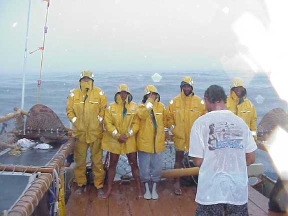
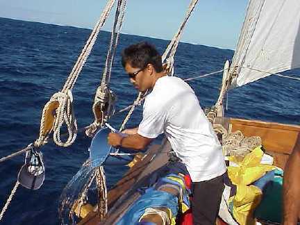
Squall at sea
Estimated latitude at sunrise, 11/25: 9 degrees 33' S; 11 miles east of the reference course. Hokule'a will turn west soon to look for the Marquesas, which lies about 500 miles to the east (3-5 days sailing). Southernmost island: Fatu Hiva, at 10 degrees 28' S; northernmost island: Eiao at 8 degrees S and Hatutu at 7 degrees 55' S. Actual Position at 6:00 a.m. HST: 11 degrees 02' S; 131 degrees 38'W. Fishing: no strikes. Birds: 'Iwa (Frigate bird), Ua'u Kani (Shearwater). Crew: Nalani Kaneakua and crew are preparing an afternoon Thanksgiving Feast.
November 26
Morning Report (from Bruce Blankenfeld and Kamaki Worthington), 16.5 days since departure: Many birds sighted: Manu o Ku (white terns), Noio (noddy terns), Koa'e Kea (white-tailed tropic birds), Koa'e 'Ula (red-tailed tropic birds). The navigators believe islands are close and are on the lookout. Hokule'a is sailing at about 6 knots on a heading of 'Aina Ho'olua (WNW) and will continue on this heading until an island is sighted. Winds are 10-15 knots out of Noio Ko'olau (NE by E). Navigators estimate the canoe has averaged about 5 knots over the last 24 hours and made 128 miles. Sea state has gotten confused, with 3-5 foot swells from Manu Ko'olau (NE), Hikina (E), and 'Akau (N). 50 percent cloud cover, cumulus and stratus. Moon waning (La'aukukahi, 18 days old).
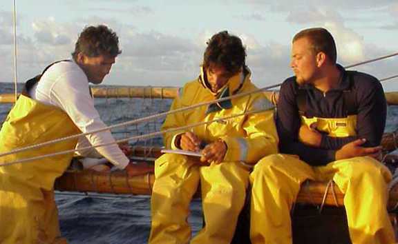
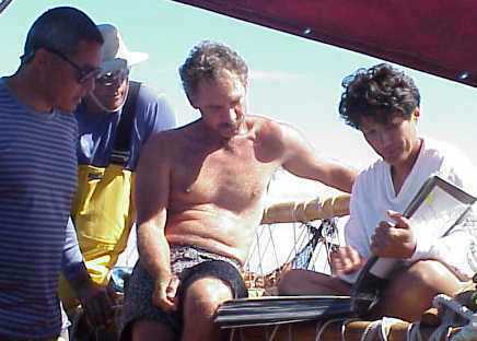
Kamaki going over navigation data, with Bruce and Na‘alehu looking on
Estimated latitude at sunrise, based on a measurement of Caph at 20 degrees transiting the meridian last night: 09 degrees 06' S; 68 miles east of Fatu Hiva. Fatu Hiva (10 degrees 28' S, 138 degrees 50' W) is the closest island to the canoe, the southeasternmost island of the Marquesas. Actual Position of Hokule'a at 6:00 a.m. HST: 10 degrees 50' S; 133 degrees 48'W, or about 300 miles east of Fatu Hiva--about two sailing days from this morning. Fishing: no strikes.
November 27
Morning Report (from Bruce Blankenfeld and Kamaki Worthington), 17.5 days since departure: Hokule'a is sailing at 6.5 knots on a heading of 'Aina Ho'olua (WNW) and plans to continue on this heading until an island is sighted. According to their dead reckoning, the navigators believe they should have reached the Marquesas yesterday. As of this morning, however, they are still about 180 miles east of Fatu Hiva. Last night they met to discuss their estimates and have decided to stay on their current heading. On this heading, they should see land-based sea birds heading for the Marquesas at sunset today and make landfall in the Marquesas by tomorrow afternoon, perhaps Hiva Oa. Winds are 10-15 knots out of Hikina (E).
Navigators estimate the canoe has averaged about 5 knots over the last 24 hours and made 132 miles. Sea state is still confused, with 3-5 foot swells from Manu Ko'olau (NE), Hikina (E), and 'Akau (N). 50 percent cloud cover, mainly cumulus (fair weather clouds). Moon waning (La'aukulua, 19 days old). Estimated latitude at sunrise: 09 degrees 22' S, based on measurements of Caph (21 degrees), Navi (19.5 degrees), and Ruchbah (20 degrees), transiting the meridian; also the latitude pairs of Vega and Shaula, parellel to the horizon at 4.5 degrees as they set at evening twilight; and a triplet of stars rising around 9 p.m.--Capella (4 degrees), Betelguese (6 degrees), and Canopus (8 degrees). Actual Position of Hokule'a at 6:00 a.m. HST: 10 degrees 11' S; 135 degrees 56'W, or about 180 miles east of Fatu Hiva (10 degrees 28' S, 138 degrees 50' W), the closest island to the canoe and the southeasternmost island of the Marquesas. Fishing: no strikes.
November 28 Landfall, Fatu Hiva
Morning Report (from Bruce Blankenfeld and Kamaki Worthington), 18.5 days since departure: Navigator Blankenfeld sighted an island this morning at sunrise--Fatu Hiva in the Marquesas. Hokule'a is heading for the island to identify it and then the navigators will reset their course for Rangiroa in the Tuamotu Archipelago and Tahiti. Actual Position of Hokule'a at 6:00 a.m. HST: 10 degrees 30' S; 138 degrees 23'W; Fatu Hiva: 10 degrees 28' S, 138 degrees 50' W.
The crew was feeling down last night, thinking that perhaps they had passed the Marquesas, which would have made finding Rangiroa much more difficult. Now that land has been sighted, spirits are up. The next priority is to get to Tahiti to make the December 5 flight to Honolulu, as some crew members need to get back to jobs and family. The sail to the Marquesas from Rapa Nui took 4-5 days longer than anticipated due to light winds early on. Now the crew has six days to make about 800 miles. If the winds are light, the canoe will be towed by the escort boat Kama Hele to maintain a speed of six knots. Fishing: 10 lb. sailfish. Sealife: Land-based seabrids (Manu o Ku and Noio) sighted throughout the day yesterday.
November 29
Morning Report (from Bruce Blankenfeld and Kamaki Worthington), 19.5 days since departure: After sighting Fatu Hiva in the Marquesas Islands yesterday at sunrise, Hokule'a is heading for Tahiti via Rangiroa in the Tuamotu Archipelago. It is on a heading of 'Aina Kona (WSW), under tow by the escort boat Kama Hele at 6 knots because of light winds (5-10 knots, variable direction, but mainly east); it is still being guided without instruments, with the navigators directing the escort boat.
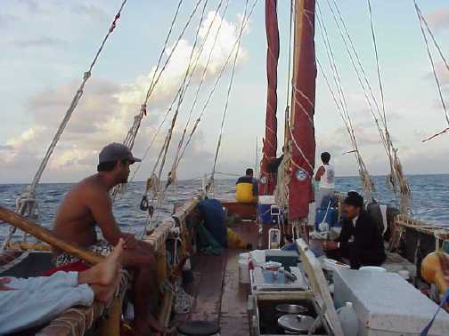
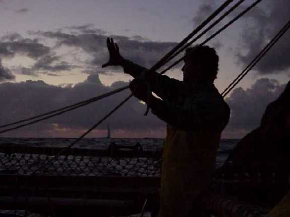
Under tow, with sails furled
The canoe will sail again if and when the winds pick up. The priority is to get to Tahiti to make the December 5 flight to Honolulu, as some members of the all volunteer crew need to get back to jobs and family. The sail to the Marquesas from Rapa Nui took 4-5 days longer than anticipated due to light winds early on. Now the crew has five days to make about 650 miles.
Estimated Position: 11 degrees 24' S, 3 miles S of the reference course, which now runs from Fatu Hiva to Rangiroa. Actual Position of Hokule'a at 6:00 a.m. HST: 11 degrees 15' S; 140 degrees 30'W.
November 30
Morning Report (from Bruce Blankenfeld and Kamaki Worthington), 20.5 days since departure: Hokule'a continues heading 'Aina Kona (WSW) for Tahiti via Rangiroa in the Tuamotu Archipelago, sailing at 6-7 knots. Winds at 15-20 knots from Hikina (E)/La Malanai (E by S). Navigating by the stars and swells. The canoe is about 500 miles out and should be in Pape'ete in 3-4 days. Fish and birds abound: 2 ahi (yellow fin tuna) caught yesterday, and 2 more this morning.
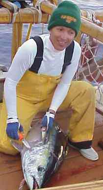
Nalani with ‘ahi
Estimated Position: 12 degrees 29' S, 12 miles N of the reference course, which now runs from Fatu Hiva to Rangiroa. Actual Position of Hokule'a at 6:00 a.m. HST: 12 degrees 10' S; 142 degrees 32'W.
December 1
Morning Report (from Bruce Blankenfeld and Kamaki Worthington), 21.5 days since departure: Winds have dropped again, so Hokule'a was under tow as of yesterday, at 7.5 knots. Heading is still 'Aina Kona. Navigating by the stars and swells. The canoe is about 360 miles out of Pape'ete, Tahiti, and should arrive there in 2-3 days. Estimated Position at sunrise, 12/1: 13 degrees 31' S, 22 miles N of the reference course, which now runs from the south end of Fatu Hiva to the NW corner of Rangiroa. Actual Position of Hokule'a at 6:00 a.m. HST: 13 degrees 17' S; 144 degrees 44'W.
December 2
Morning Report (from Bruce Blankenfeld and Kamaki Worthington), 22.5 days since departure: Hokule'a passed Ahe and Manihi atolls last night and are approaching Rangiroa in the Tuamotu Archipelago. Winds are 10-15 knots from the southeast. The canoe is still under tow, at 6.5 knots, heading Noio Kona, toward the slot between Rangiroa and Tikehau The canoe is a little over 200 miles from Tahiti. Landfall signs: land-based seabirds and refraction of wave patterns from atolls. Swells from the south are choppy. Estimated Position at sunrise, 12/2: 14 degrees 44' S, 14 miles N of the reference course, which now runs from Fatu Hiva to Rangiroa. Actual Position of Hokule'a at 6:00 a.m. HST: 14 degrees 29' S; 146 degrees 57'W.
December 3
Morning Report (from Bruce Blankenfeld and Kamaki Worthington), 23.5 days since departure: Hokule'a sighted Tahiti dead ahead at sunrise this morning--a shadow on the horizon. Winds are extremely light, 3 knots from Hikina (E); seas calm, skies clear andsunny, with fair weather clouds. The canoe is still under tow at 7 knots, heading Na Leo Kona (SSW) and should arrive in Pape'ete, Tahiti, late this afternoon. A delegation from Hale'iwa, O'ahu, where crew member Kimo Lyman works with the community on voyaging projects, has traveled to Tahiti to greet Hokule'a. Estimated Latitude at sunrise: 17 degrees 15' S. Actual Position of Hokule'a at 6:00 a.m. HST: 16 degrees 31' S; 148 degrees 46'W.
December 4 Arrival in Tahiti
Morning Report: Hokule'a arrived in Tahiti at 7:23 yesterday evening.Leg 4 of the voyages was completed. The voyage from Rapa Nui took 24 days; the crew covered 2901 nautical miles, averaging 5 knots. Pape'ete: 17 degrees 32' S; 149 degrees 34'W.
The Voyage Home: Hokule'a will resupply, change crews, and depart from Tahiti for Hawai'i at the end of December, 1999 or early January, 2000, pending weather.